CityMAP
Project Website
Project Information
![]() The Texas Department of Transportation (TxDOT) is seeking your participation regarding major interstate corridors within Dallas' Central Business District (CBD). TxDOT is conducting an assessment of the major urban interstate corridors immediately surrounding and entering the urban core. The assessment will be delivered as the Dallas City Center Master Assessment Process (Dallas CityMAP).
The Texas Department of Transportation (TxDOT) is seeking your participation regarding major interstate corridors within Dallas' Central Business District (CBD). TxDOT is conducting an assessment of the major urban interstate corridors immediately surrounding and entering the urban core. The assessment will be delivered as the Dallas City Center Master Assessment Process (Dallas CityMAP).
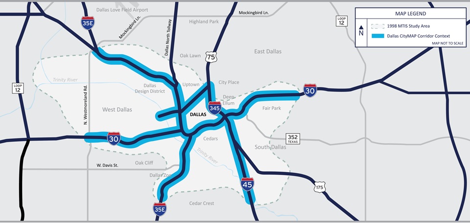
In 1998 TxDOT conducted a study titled the Trinity Parkway Corridor Major Transportation Investment Study otherwise referred to as the MTIS.
Many of the goals and objectives of the original MTIS have been accomplished, but over the last 17 years much has changed in Dallas. In order to respond to these changes and maximize the opportunities associated with major transportation improvements, TxDOT is engaging the MTIS stakeholder groups to identify new stakeholders, evaluate the MTIS and identify other transportation needs integrated with community projects and short, medium and long-range plans based on the following broad objectives.
- Improve Regional Mobility and Safety
- Include Multi-modal Solutions
- Reconnect Urban Form
- Connect Neighborhoods
- Enhance Economic Development
- Establish Pedestrian Connections
- Provide Greenspace
- Incorporate Sustainability
- Create Sense of Place
- Promote Quality of Life
- Make Policy Recommendations
- Deliver Implementation Guidance
Frequently Asked Questions
Why develop a CityMAP?
Thorough consensus building guides future development, economics and policy promoting a safe, livable and sustainable urban multimodal infrastructure system.
What is the purpose of the CityMAP?
Provides various integrated development scenarios, feasibility, financing and policy guidance for short, medium and long-term benefit to the respective corridors and regional transportation in the context of value capture and project viability.
How will the CityMAP be used?
Deliver key information in developing multi-modal improvements and coordinate associated development connectivity and funding priorities. Identify potential for value capture scenarios, public-private partnerships and helps guide future transportation, urban design, environmental planning and policy decisions by elected officials and other decision makers responsible for the corridors.