Virtual Public Hearing for I-30 East Corridor
To view the Final Environmental Assessment, click HERE
To view the Public Hearing Summary, including responses to comments, click HERE
To view the Finding of No Significant Impact document, click HERE
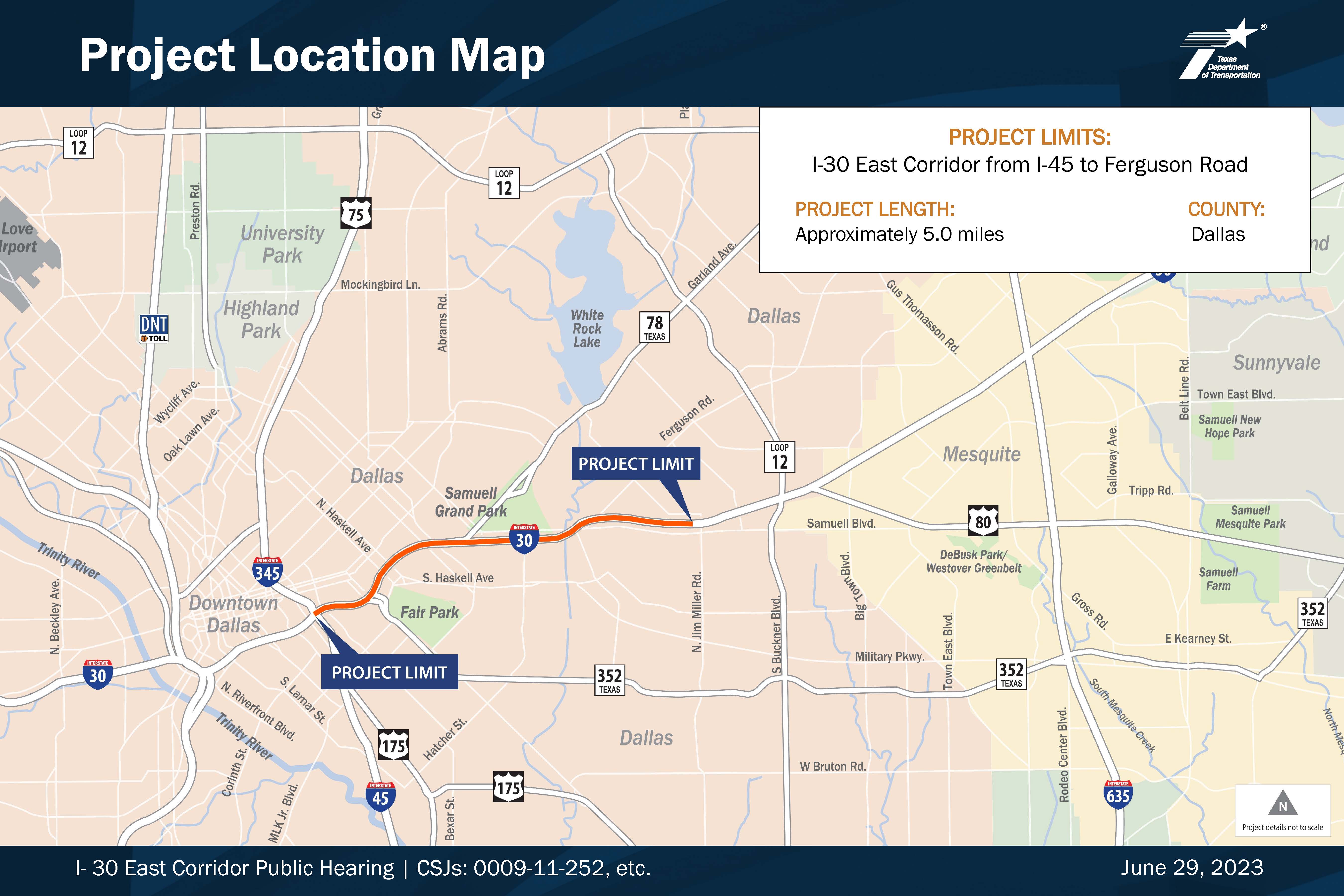
From I-45 to Ferguson Road
Dallas County
CSJs 0009-11-252 and 0009-11-251
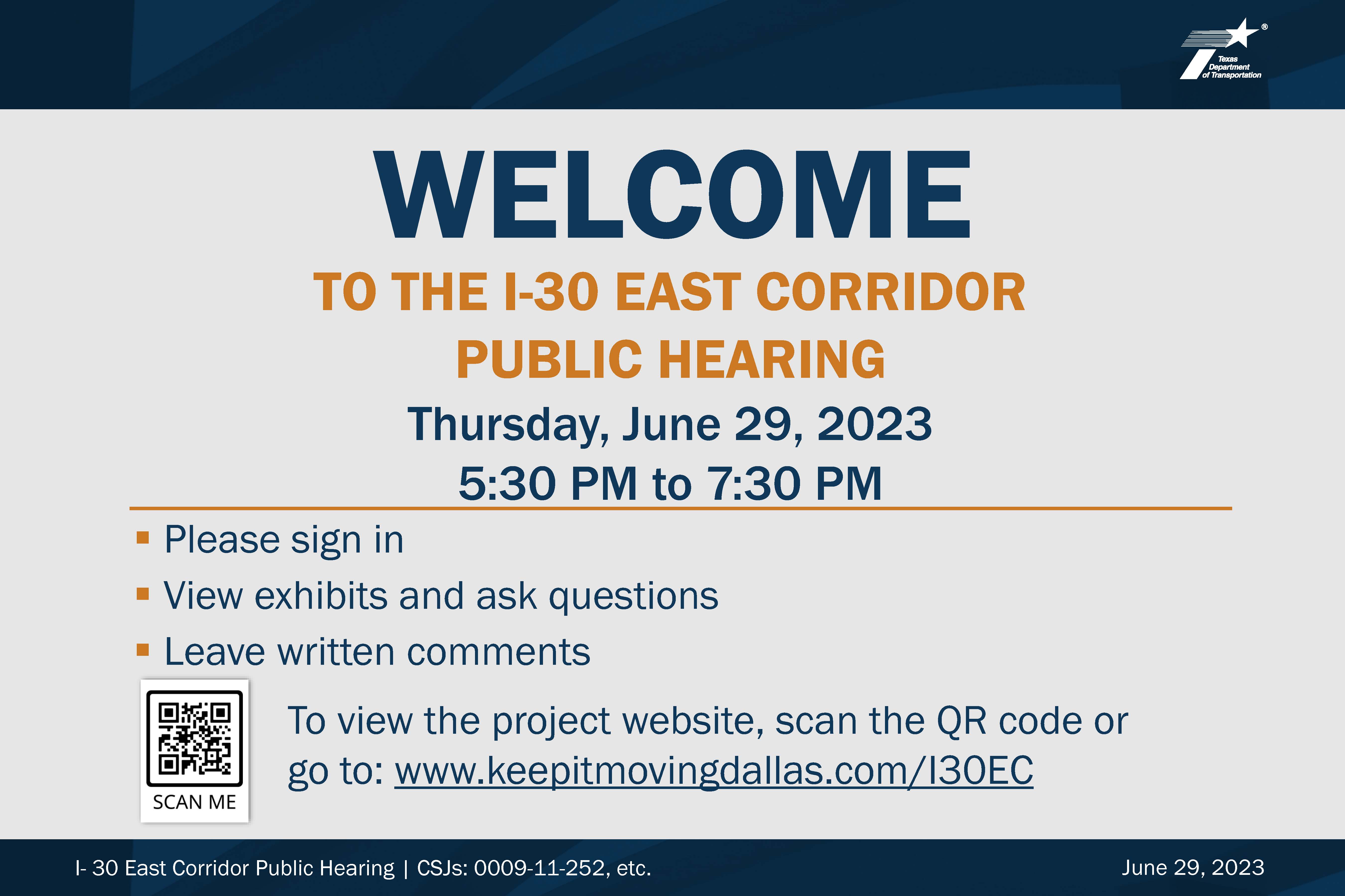
Thursday, June 29, 2023
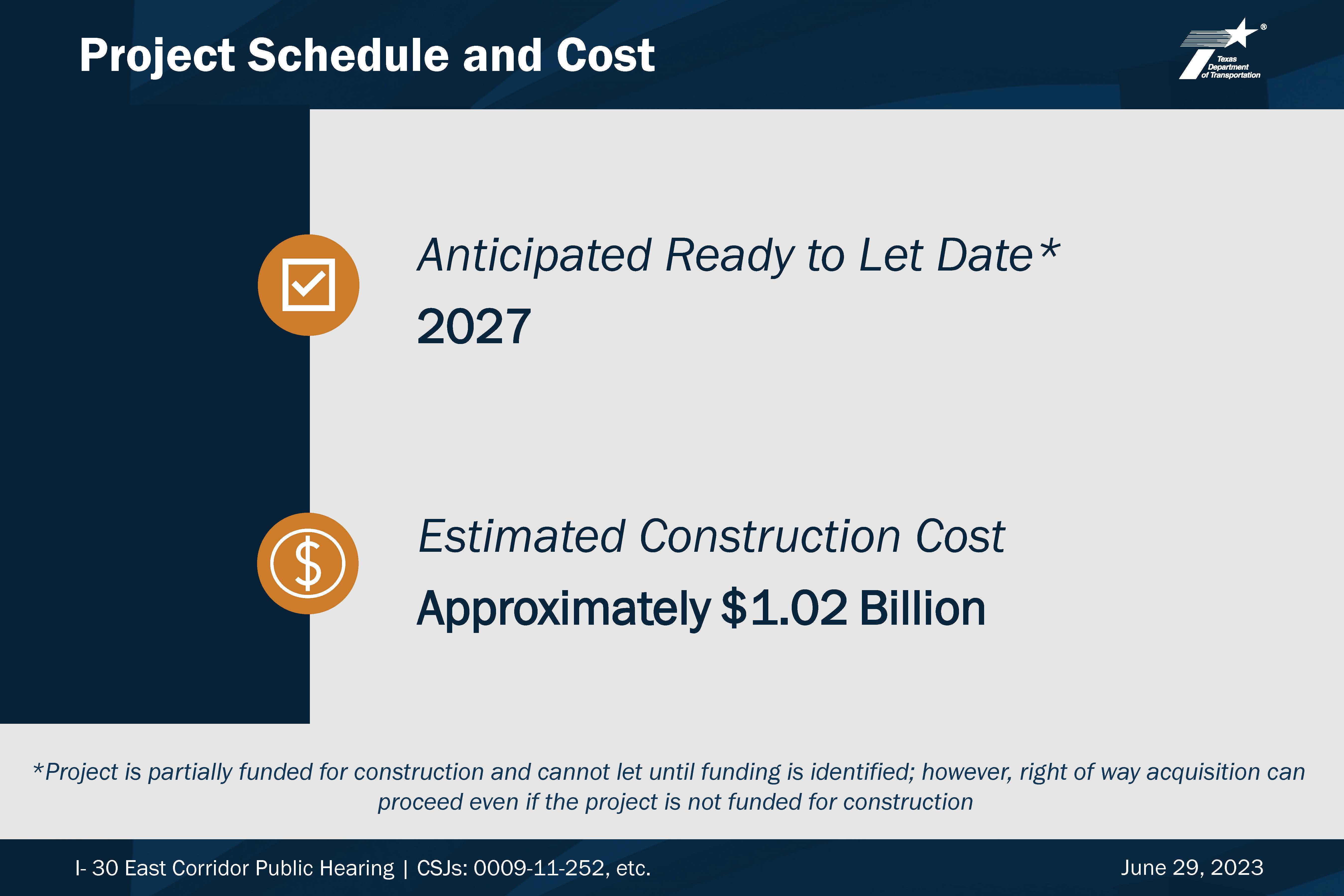
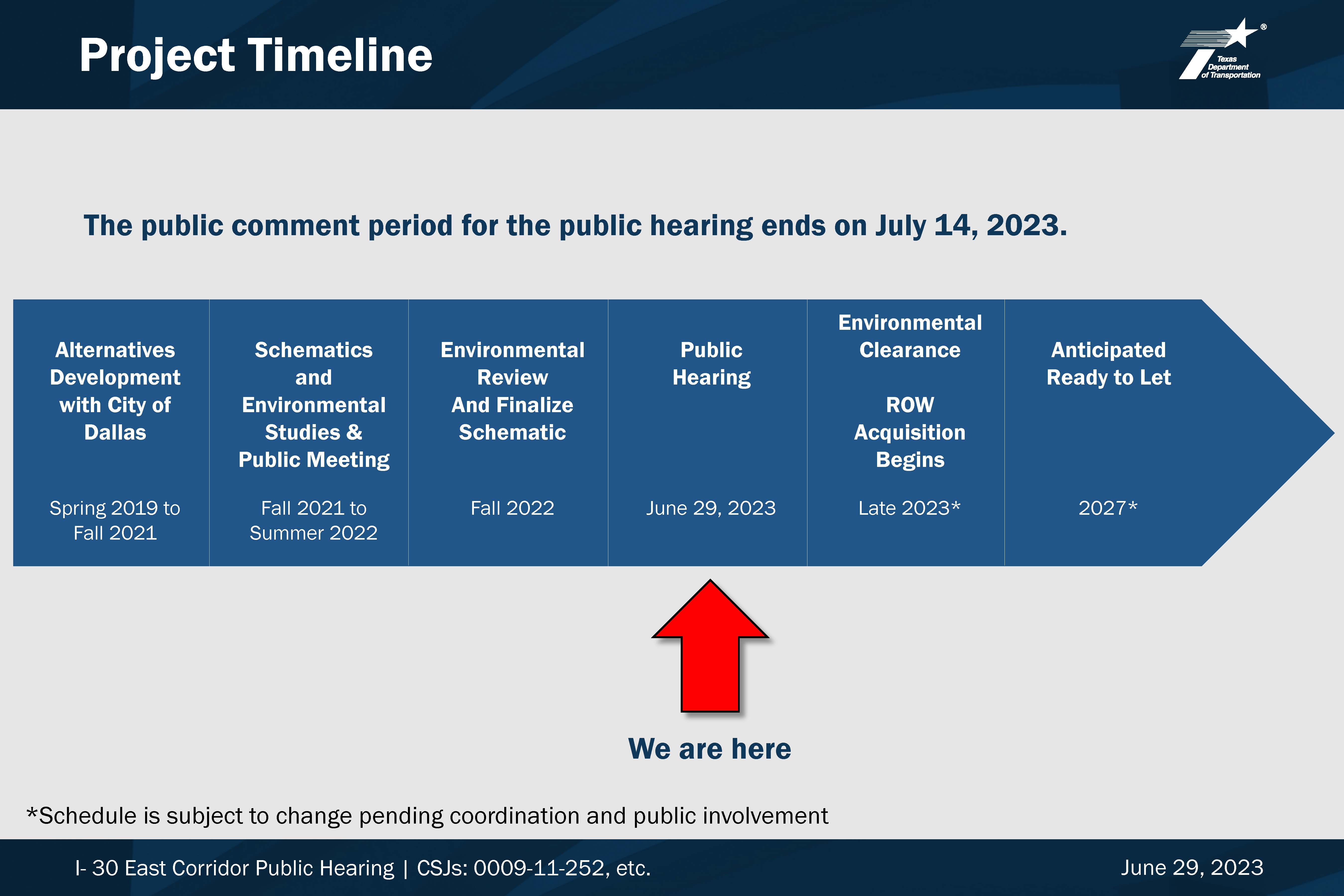
The virtual hearing begins on Thursday, June 29, 2023 at 5:30 PM and will remain available online through the comment period deadline of July 14, 2023. During this time, please view the project materials and other information provided on this site to learn about the project and provide your comments.

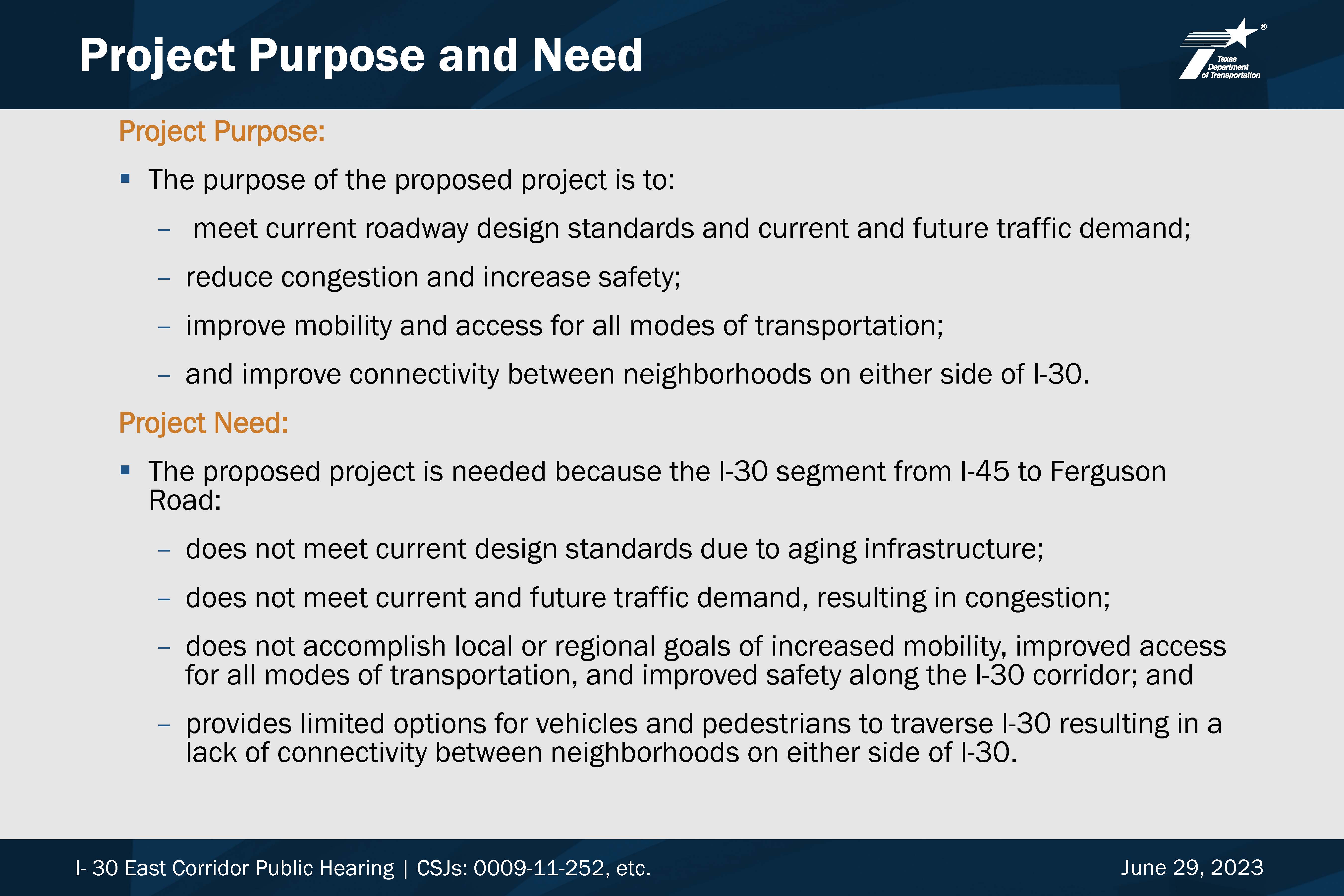
PROJECT DESCRIPTION
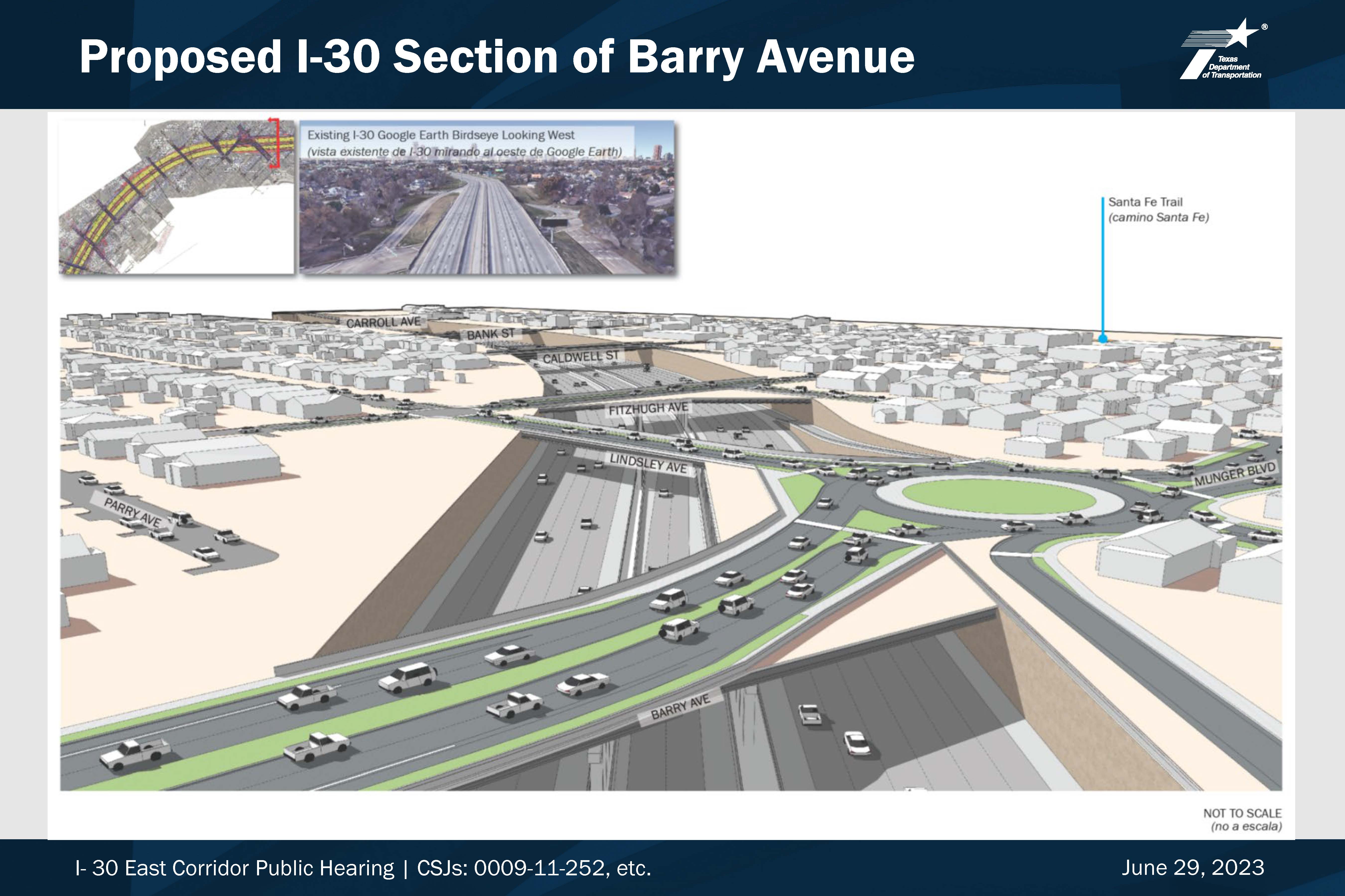
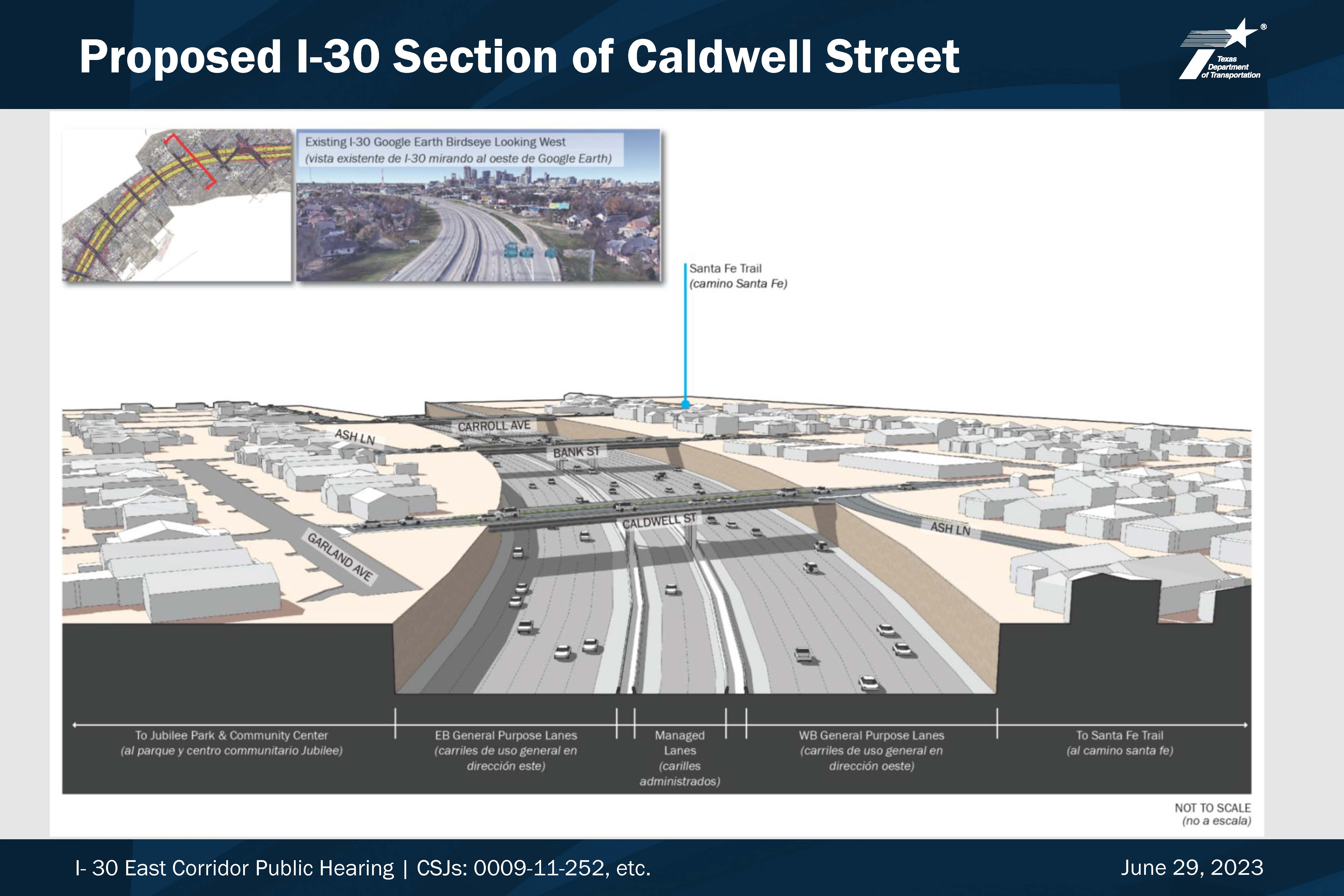
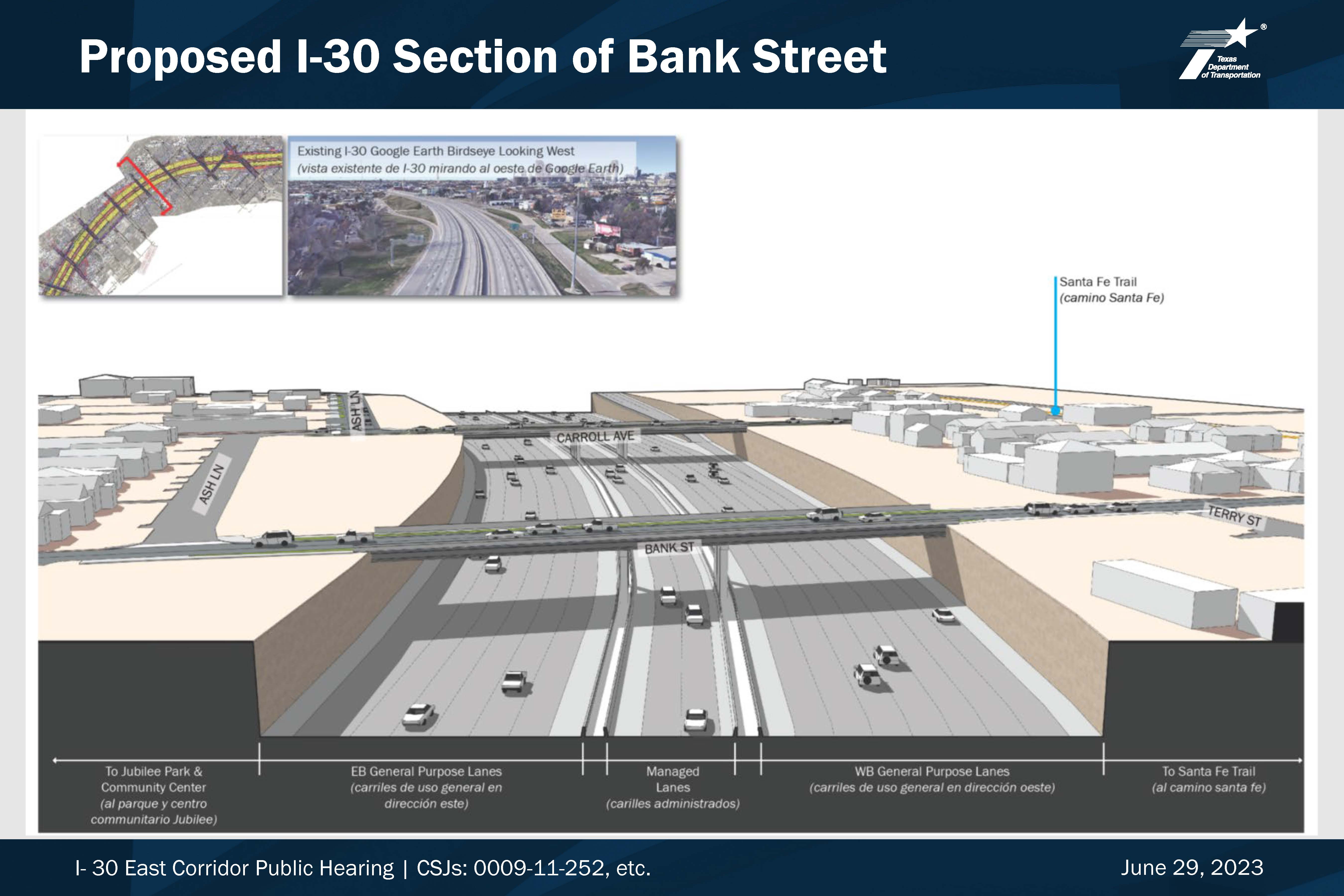
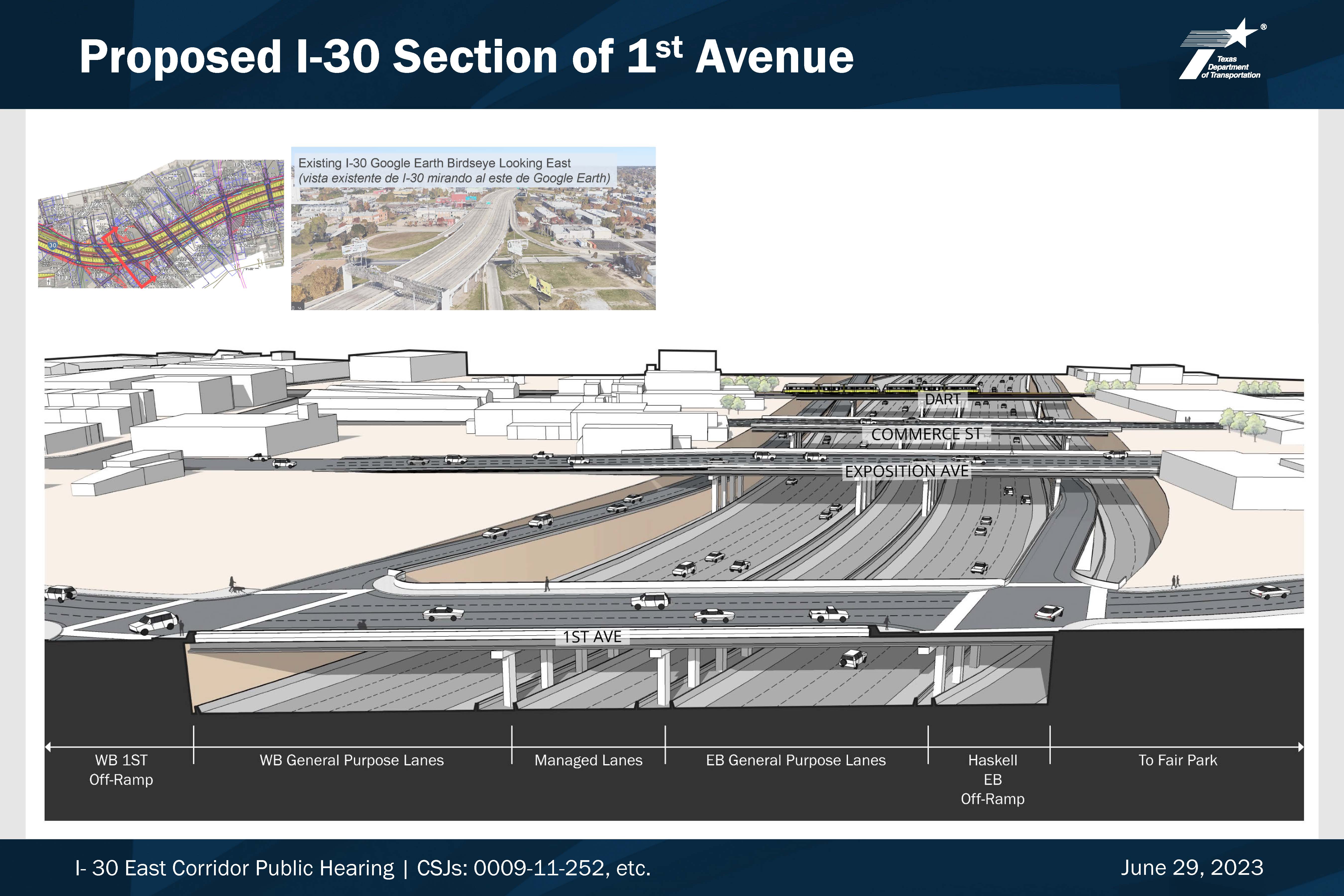
The proposed project would widen I-30 from I-45 to Ferguson Road from eight mainlanes (four in each direction) to ten mainlanes (five in each direction) and add two reversible managed lanes in the center median. The total distance is approximately five miles. The proposed mainlanes would be depressed to a lower elevation than the proposed frontage roads. Access ramps throughout the project corridor would be reconstructed. The project would construct new cross street bridges across the depressed mainlanes as part of the reconstruction. A DART bridge and adjacent pedestrian bridge would also be constructed. Sidewalks would be constructed or reconstructed on both sides of all street crossings at I-30, and a shared use path would be constructed alongside the outer frontage road lanes in most cases. The typical right of way width would vary from approximately 300 feet to 500 feet.
You may click on any of the project exhibits below to view them at full size
PRESENTATIONS
Presentation in English
Presentation in Spanish
Script in English
Script in Spanish
TxDOT EXHIBITS
You may click on any of the project exhibits below to view them at full size
ENVIRONMENTAL
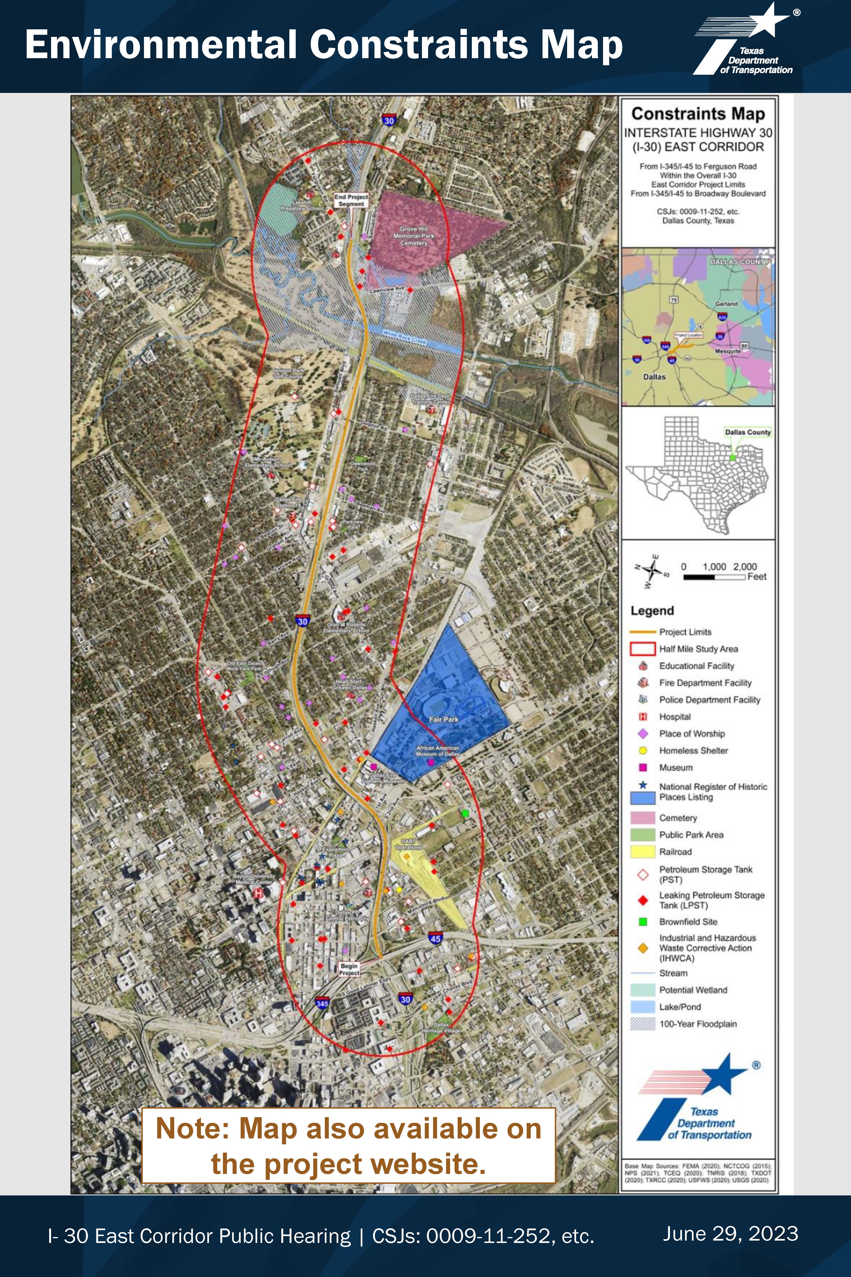
HISTORICAL RESOURCES
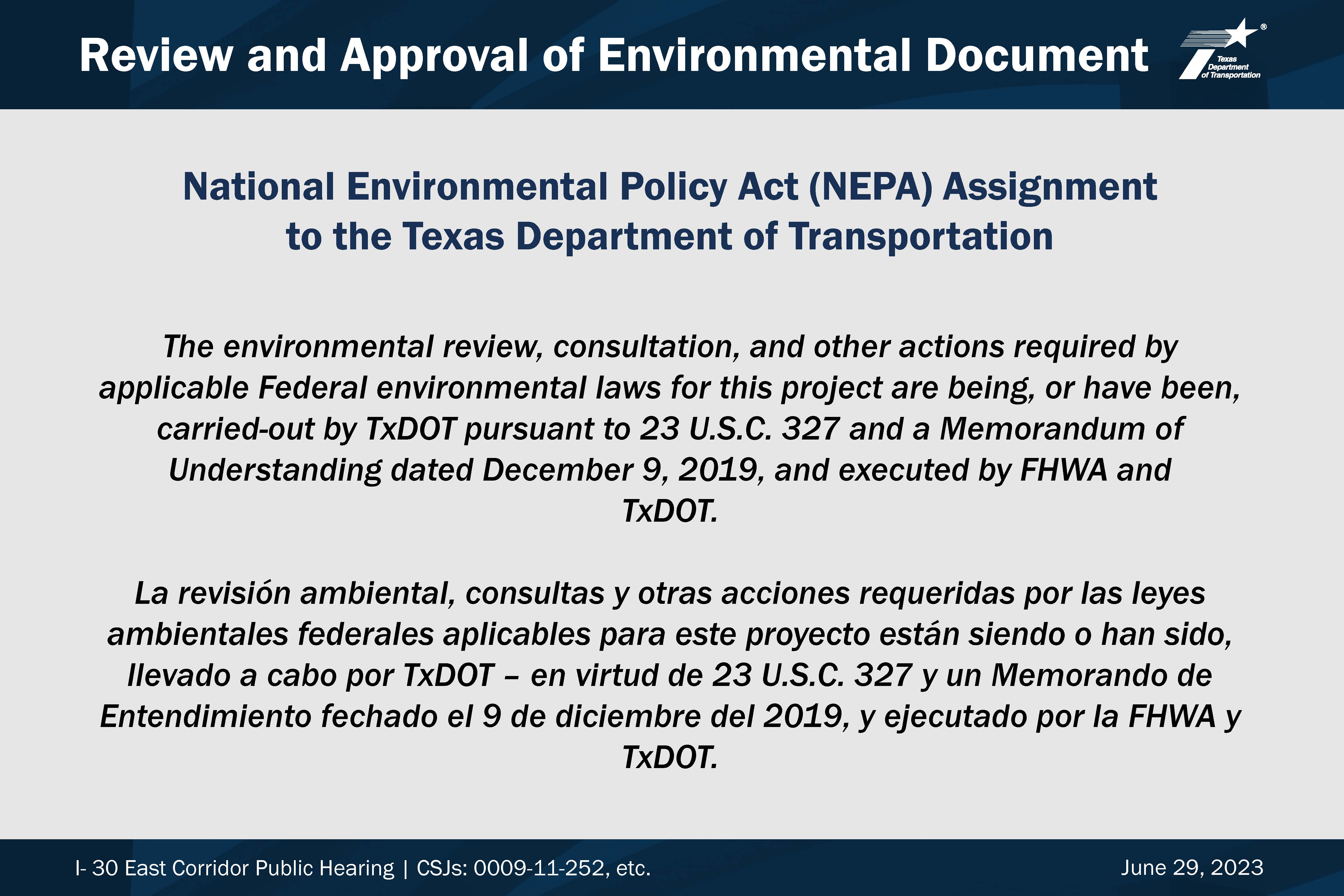
TxDOT conducted a historic resource survey of properties that fall within the I-30 East Corridor Area of Potential Effect. This is a step in the National Environmental Policy Act (NEPA) process, as well as under Section 106 of the National Historic Preservation Act. See the survey reports below for additional information about this project. Learn more about how TxDOT reviews project effects to historic properties in the Connecting People to the Past brochure
Historic Resources Report & Appendix A: Project Information and ROW Information
Appendix B: Tabular Inventory of Surveyed Properties
Appendix C: Survey Forms
Appendix D: Maps and Figures
Appendix E: Area Photos
Appendix F: Consulting Party Comments
Appendix G: Approved Historic Survey Research Design Tables
SCHEMATIC
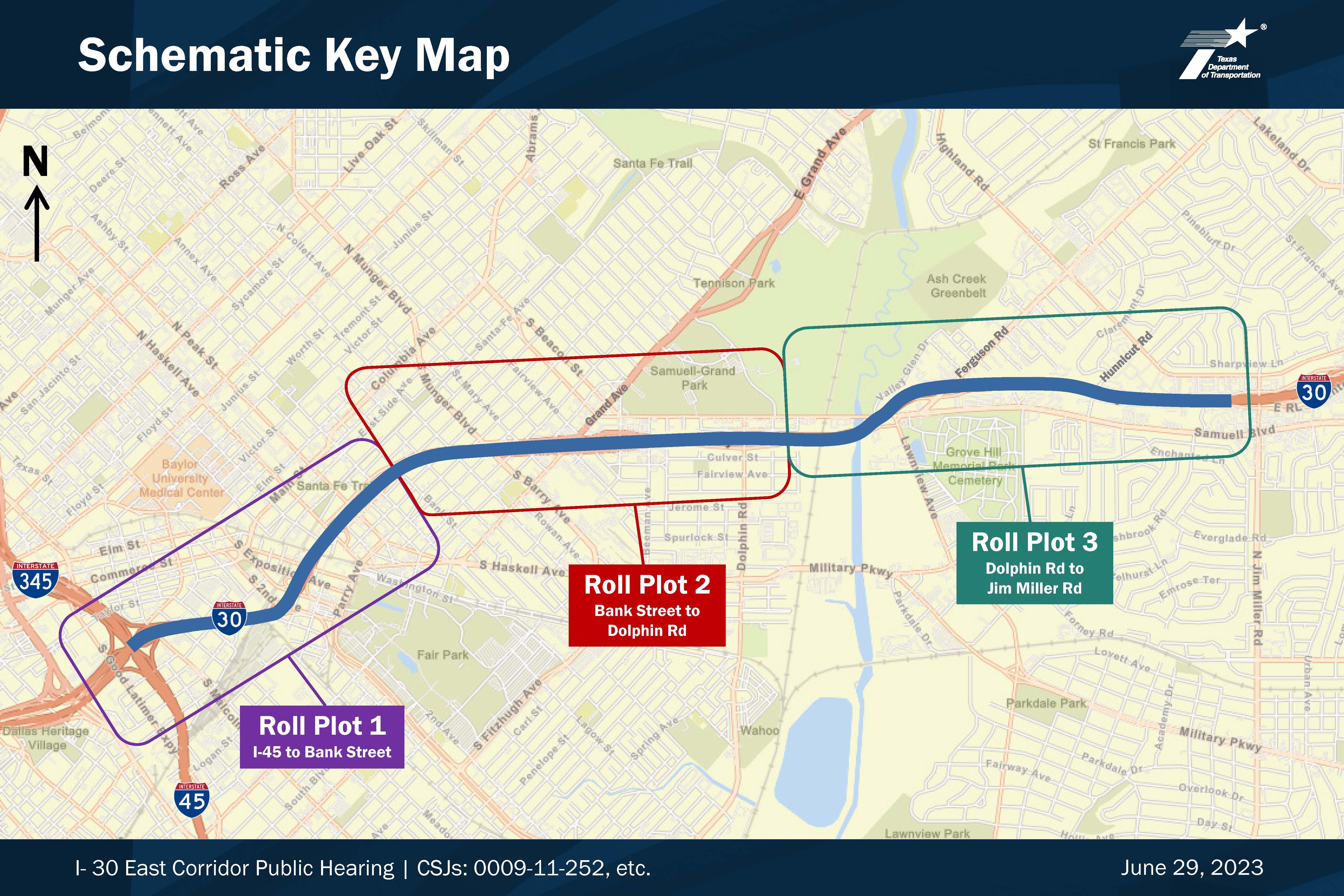
Roll 1 Existing Roadway
Roll 1 Proposed Roadway
Roll 2 Existing Roadway
Roll 2 Proposed Roadway
Roll 3 Existing Roadway
Roll 3 Proposed Roadway
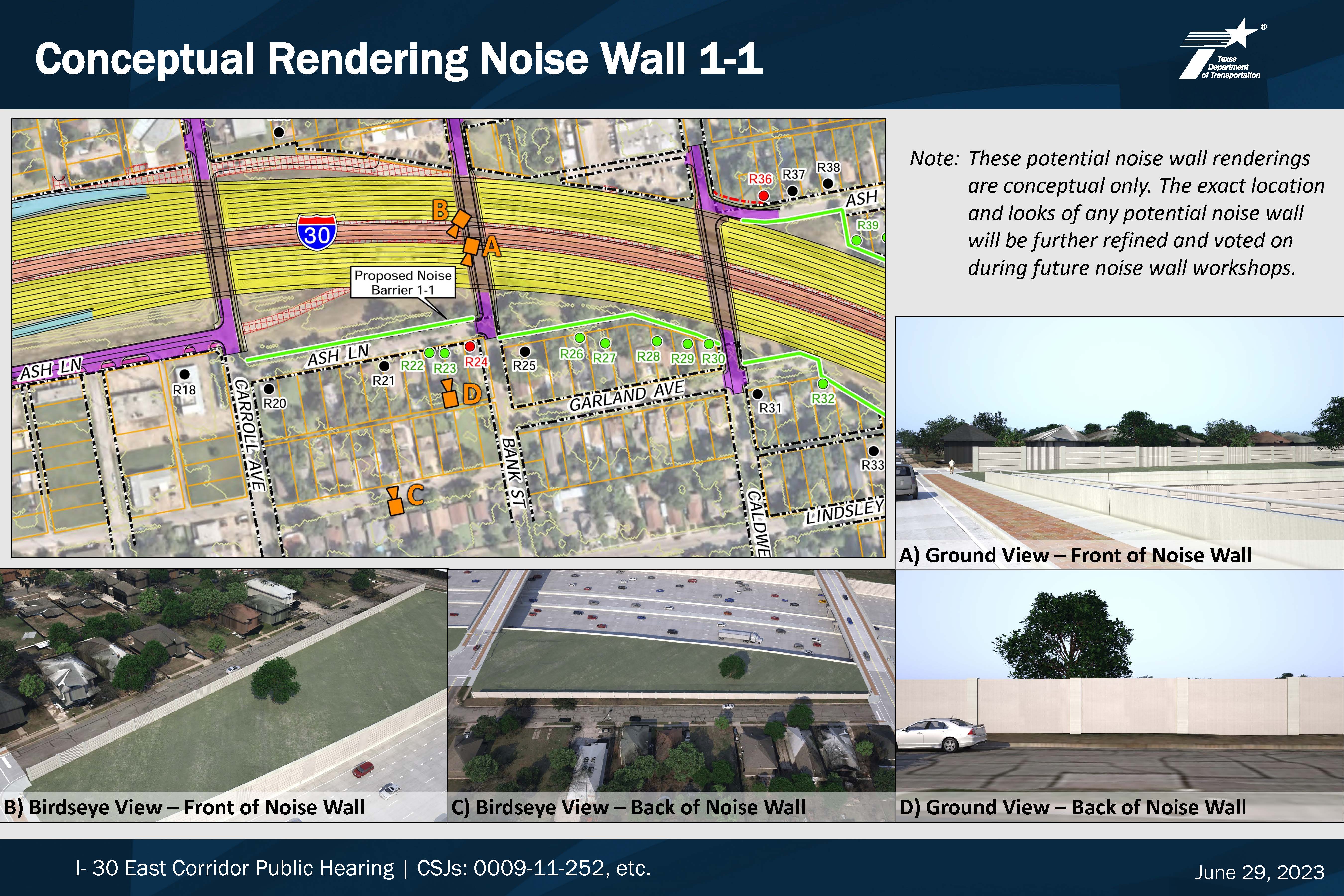
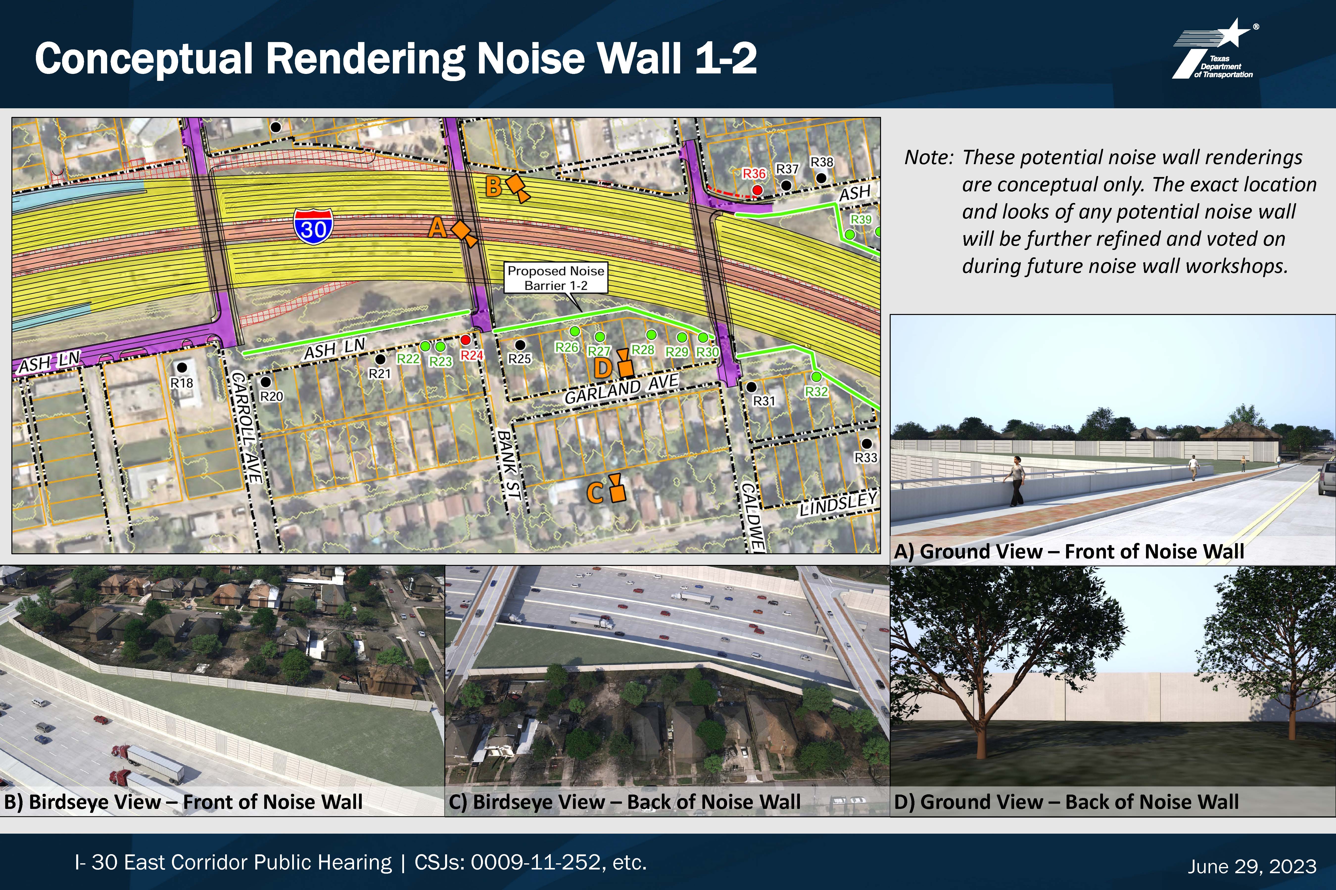
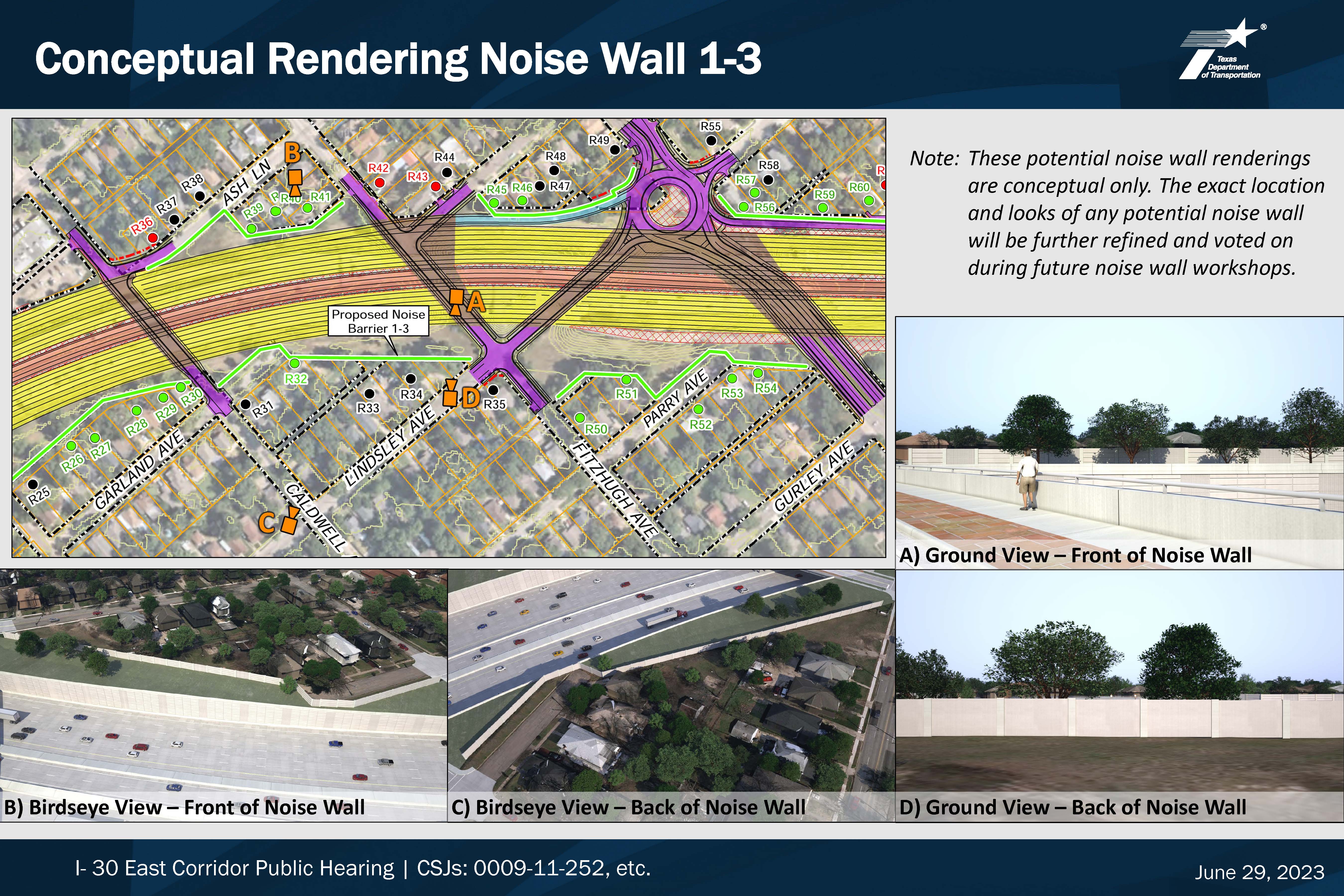
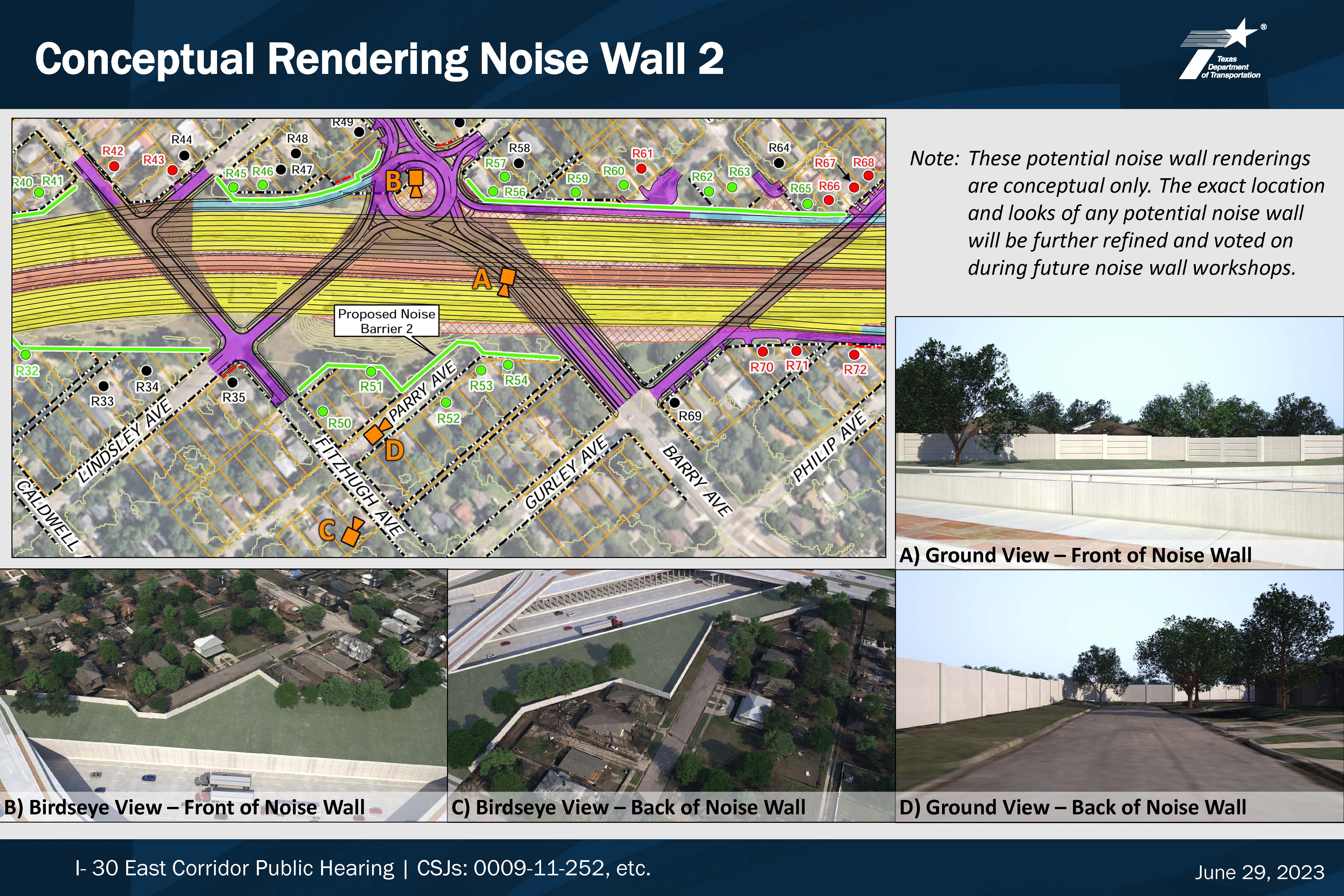
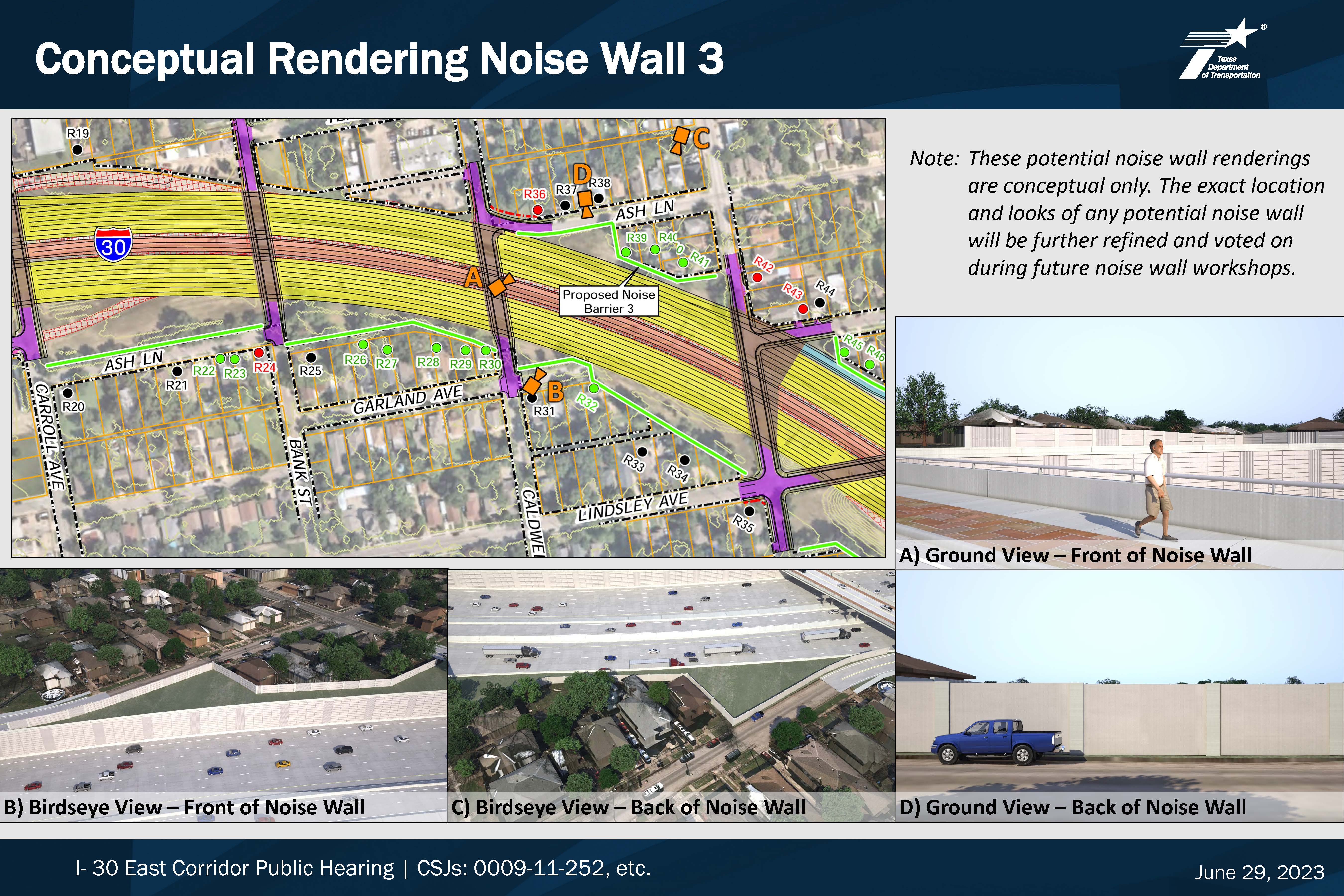
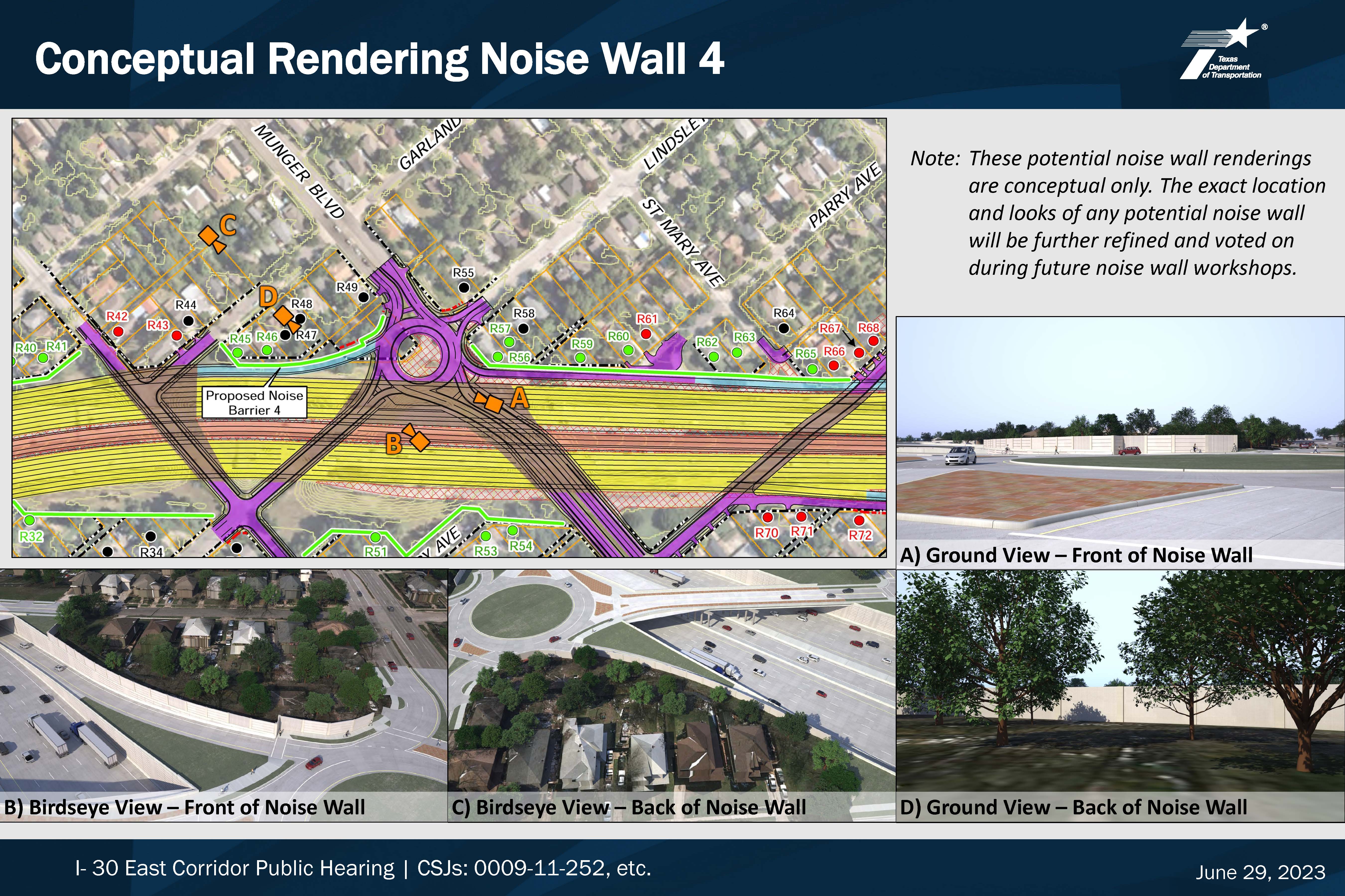
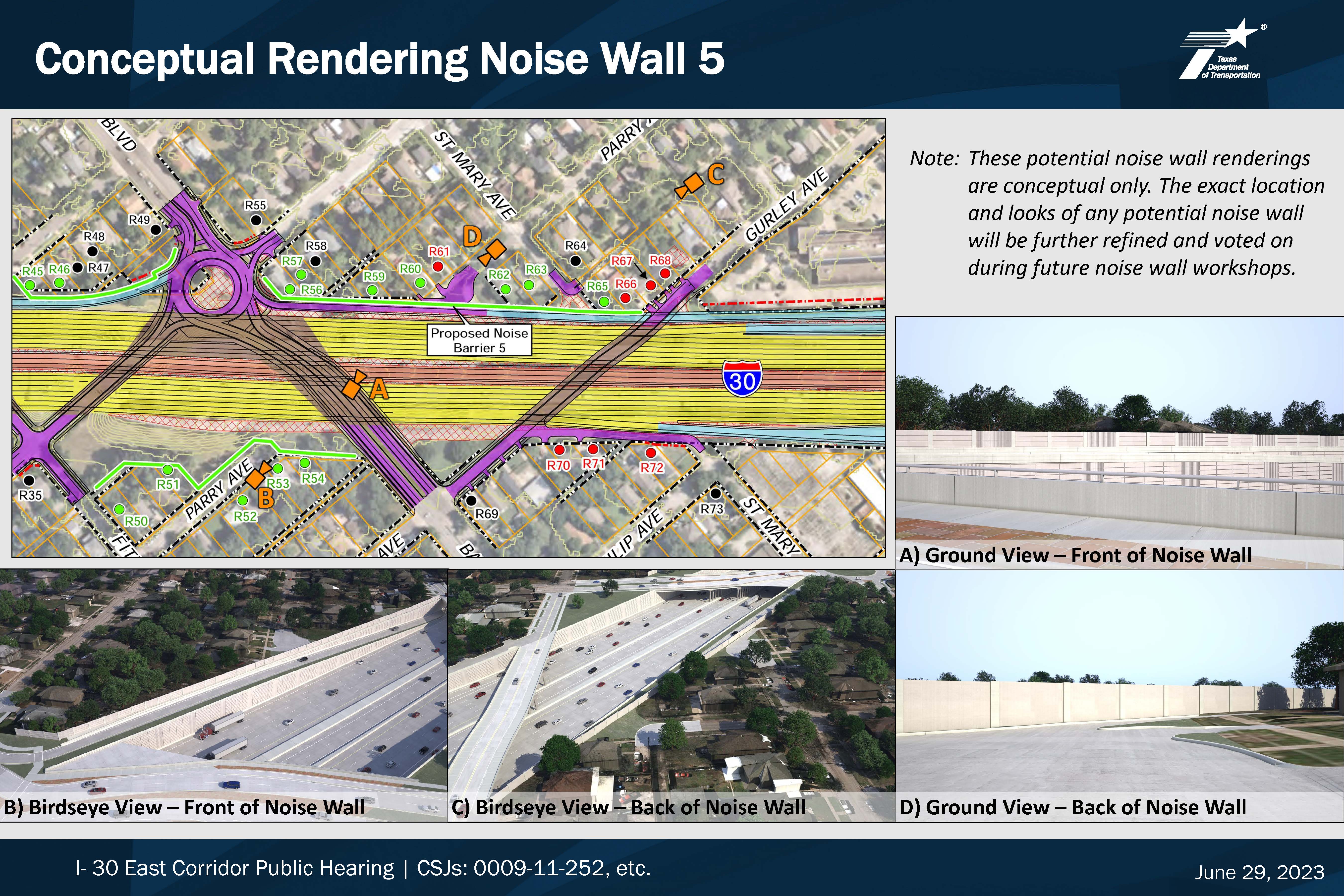
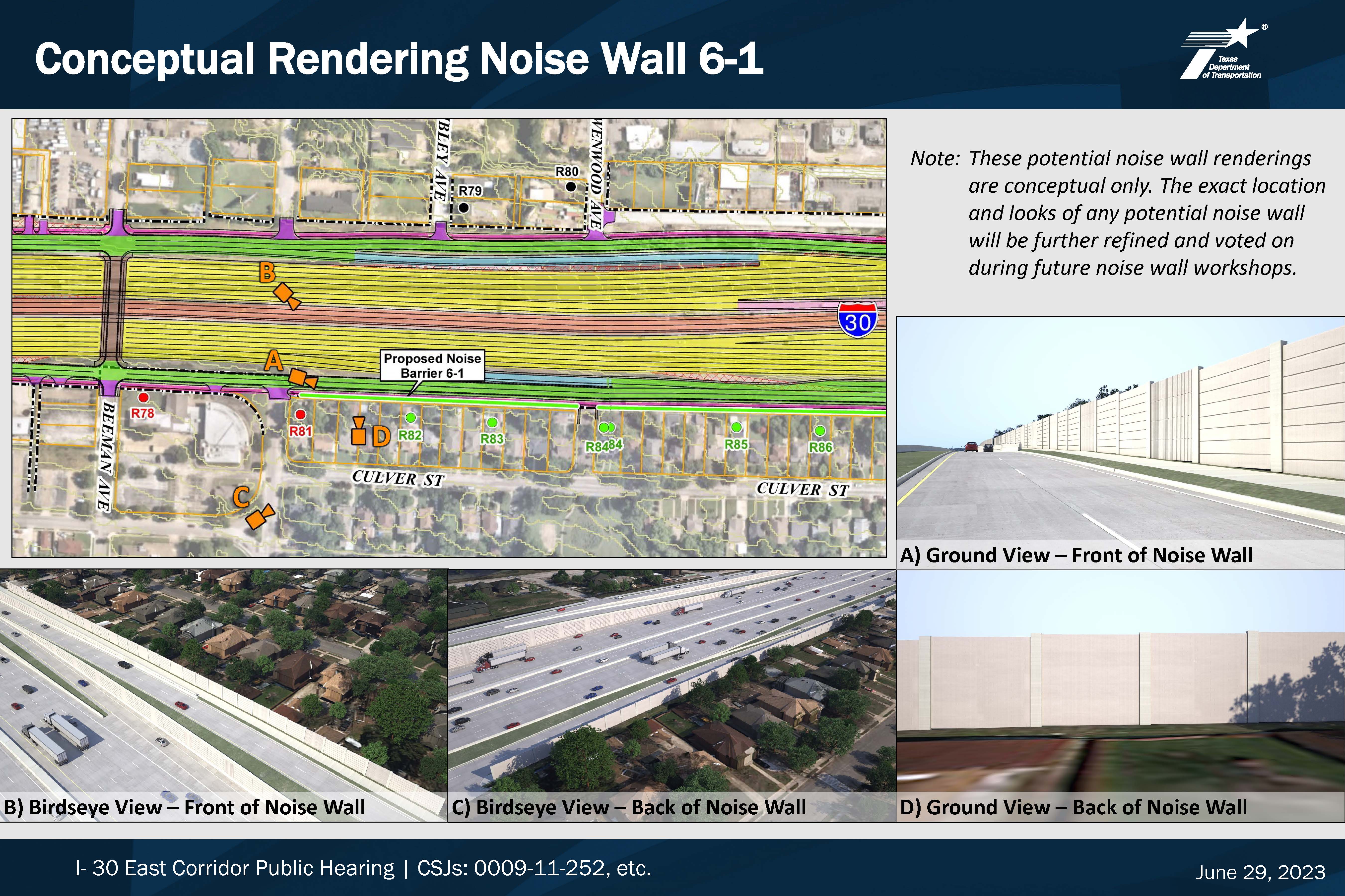
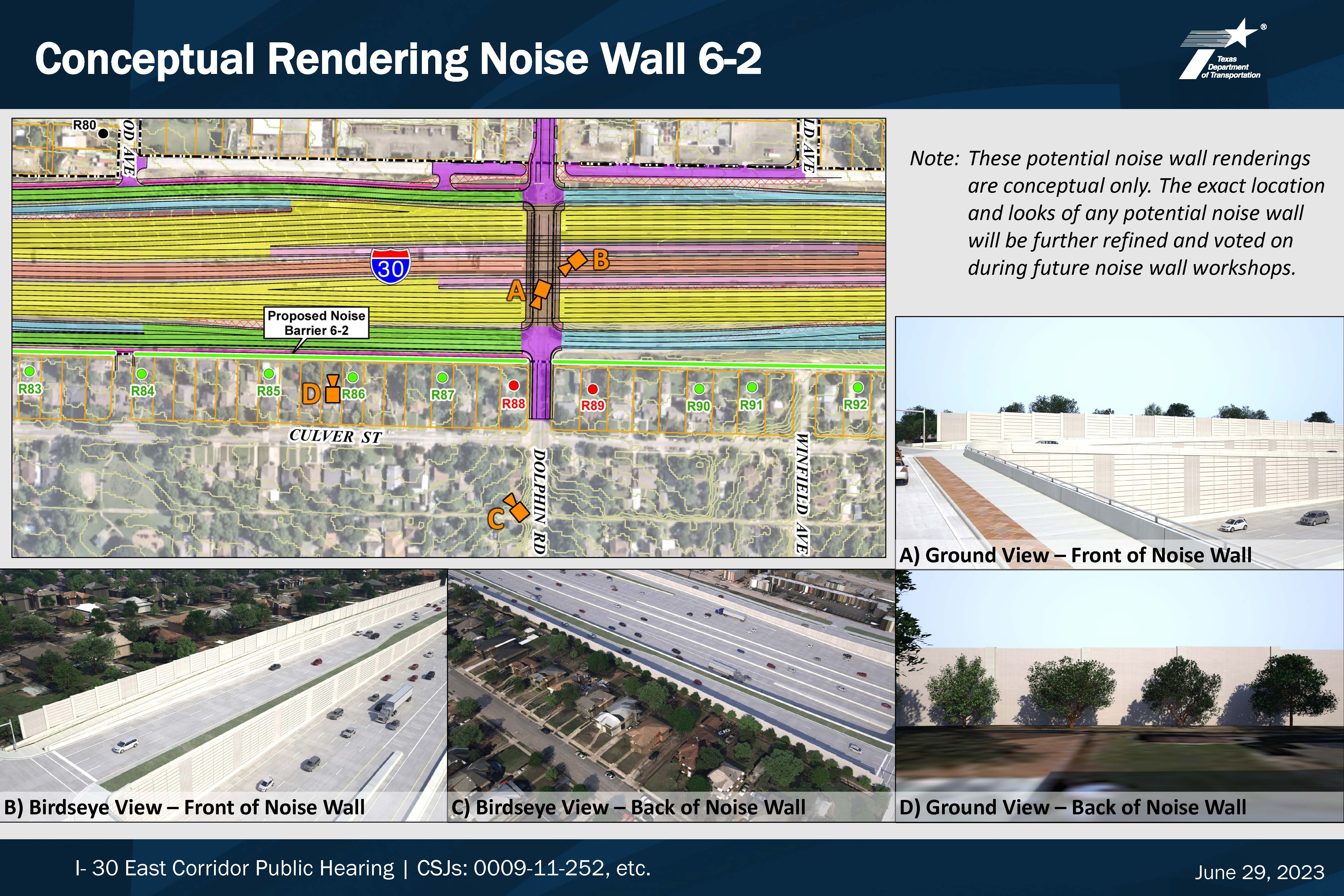
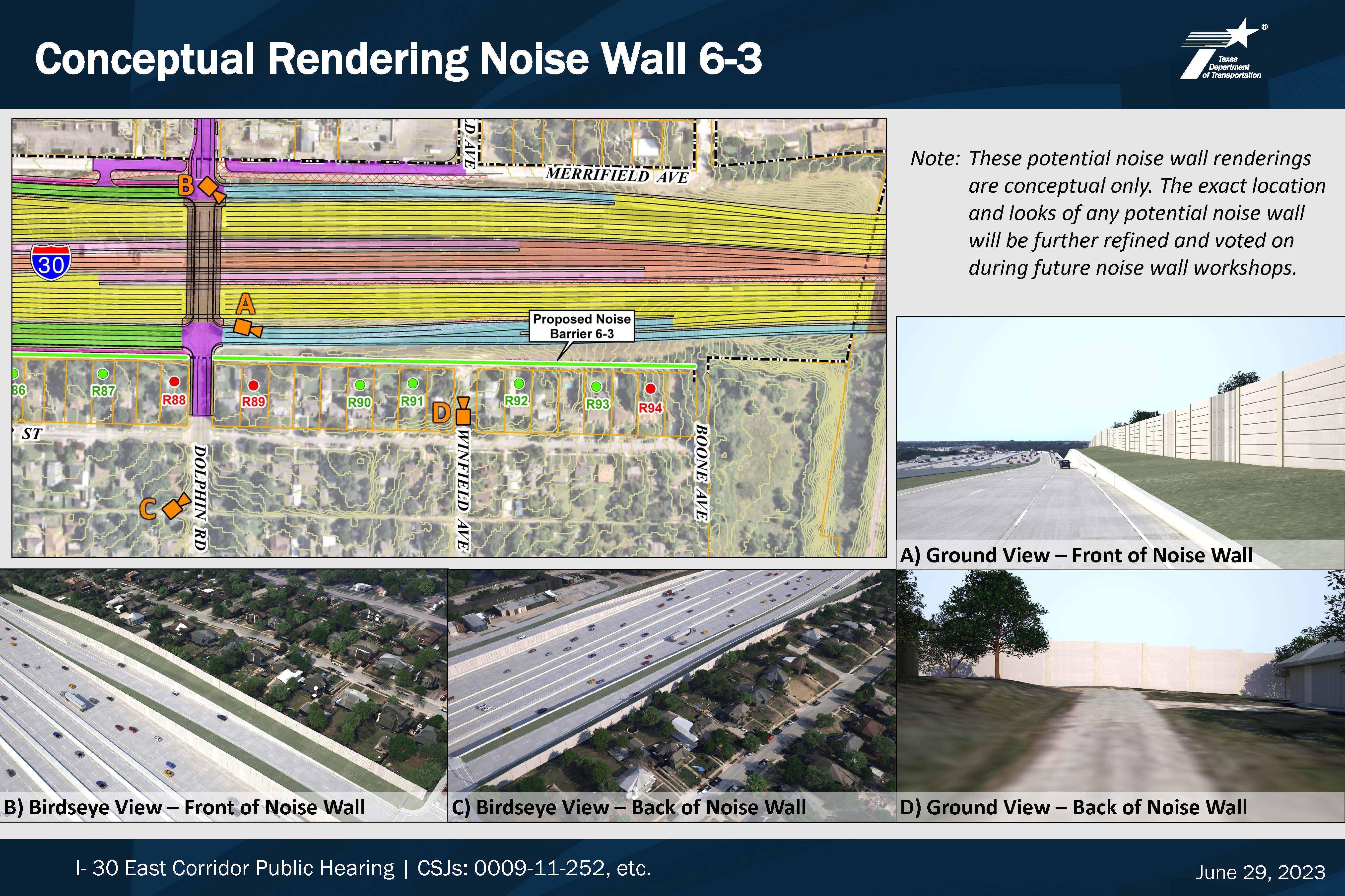
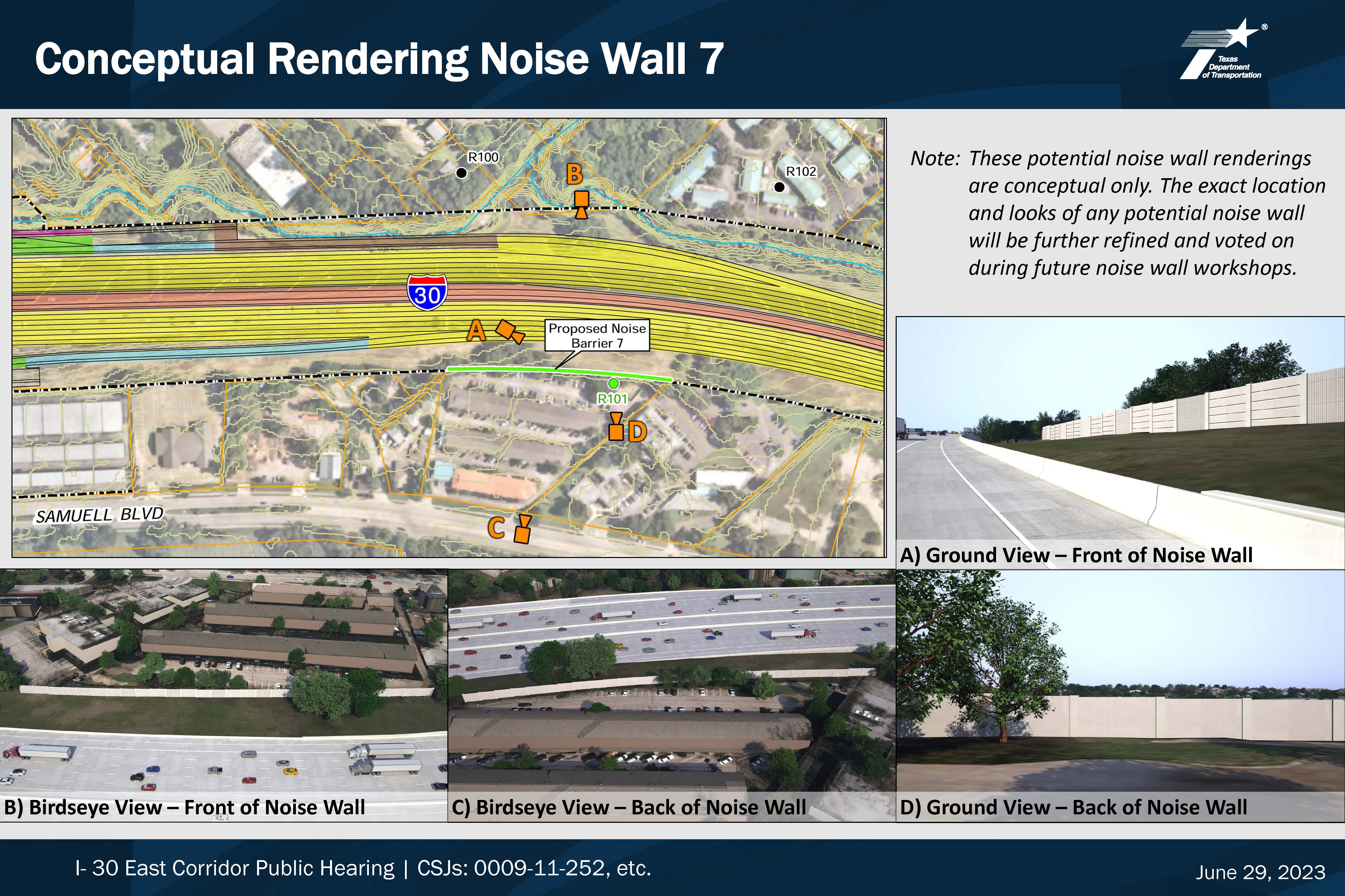
NOISE WALL RENDERINGS
You may click on any of the project exhibits below to view them at full size. Renderings are conceptual only. Location and appearance will be further refined and voted on during future noise wall workshops.
RIGHT OF WAY (ROW) INFORMATION
The proposed improvements would potentially require approximately 11 acres of new ROW and potentially displace five residences, 12 non-residential buildings and 12 billboards.
Information about the process for state purchase of ROW and relocation assistance may be found in the following pamphlets:
Relocation Assistance: English
Relocation Assistance: Spanish
State Purchase of ROW: English
State Purchase of ROW: Spanish
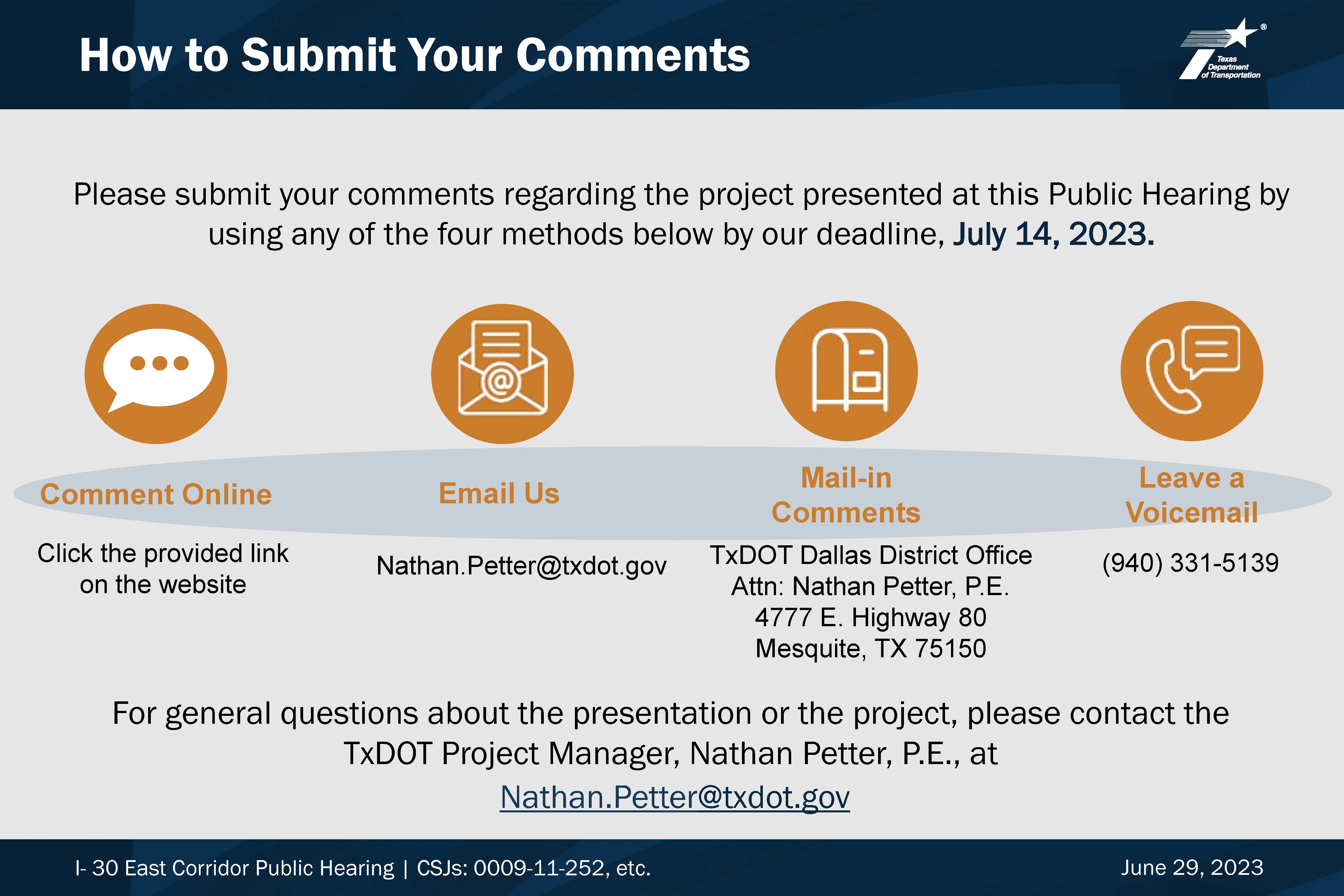
HOW TO PROVIDE COMMENTS
The deadline for providing comments is July 14, 2022.
CLICK HERE TO COMMENT NOW/COMENTARIO AQUI
QUESTIONS?
Contact the TxDOT project manager Nathan Petter, P.E. to ask questions about the project at Nathan.Petter@txdot.gov or (214) 320-6243.
To view the June 2021 public meeting materials, click HERE