Spur 399
To view the DEIS please use the following links:
DRAFT EIS Spur 399 Extension
APPENDIX A - Project Location Map
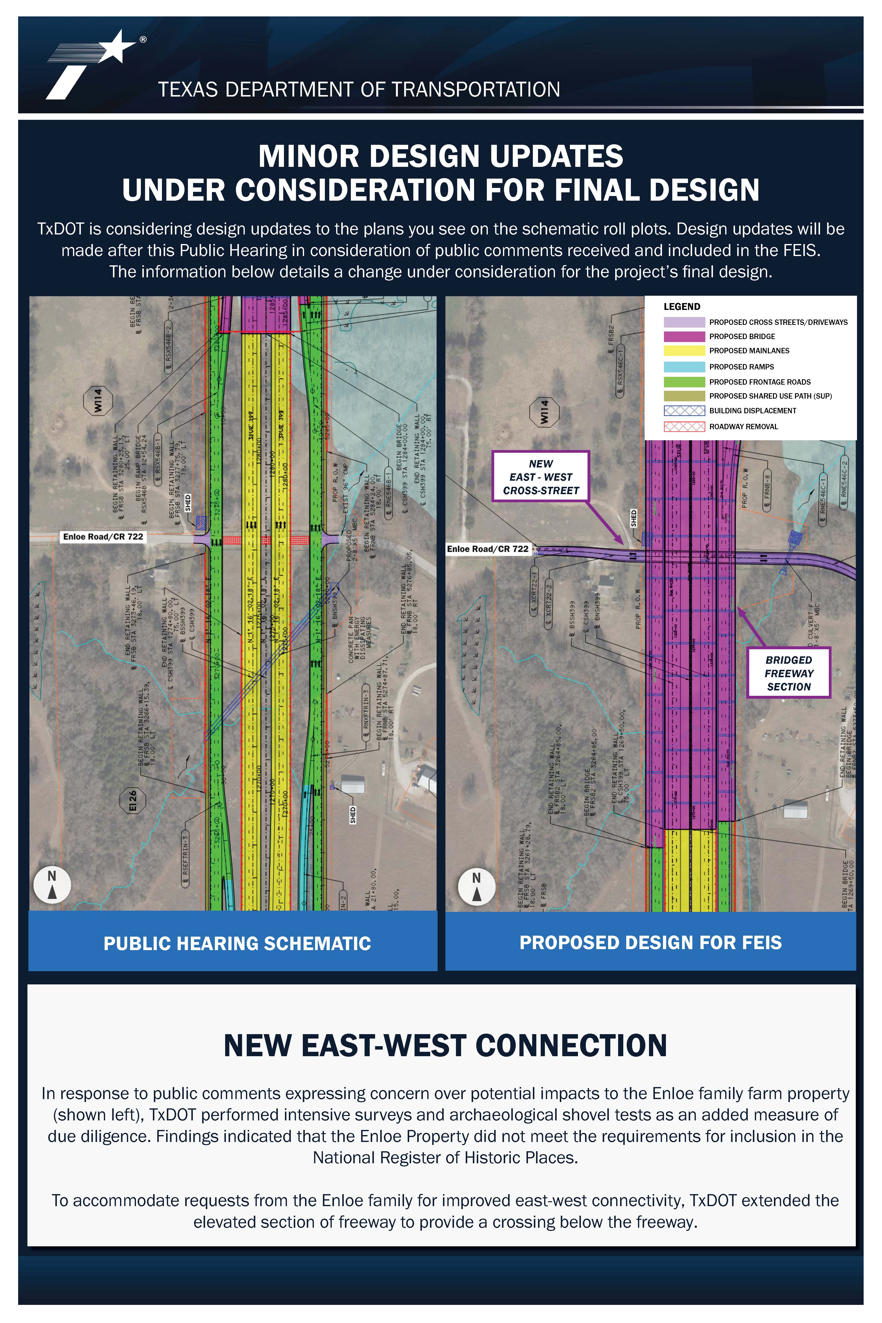
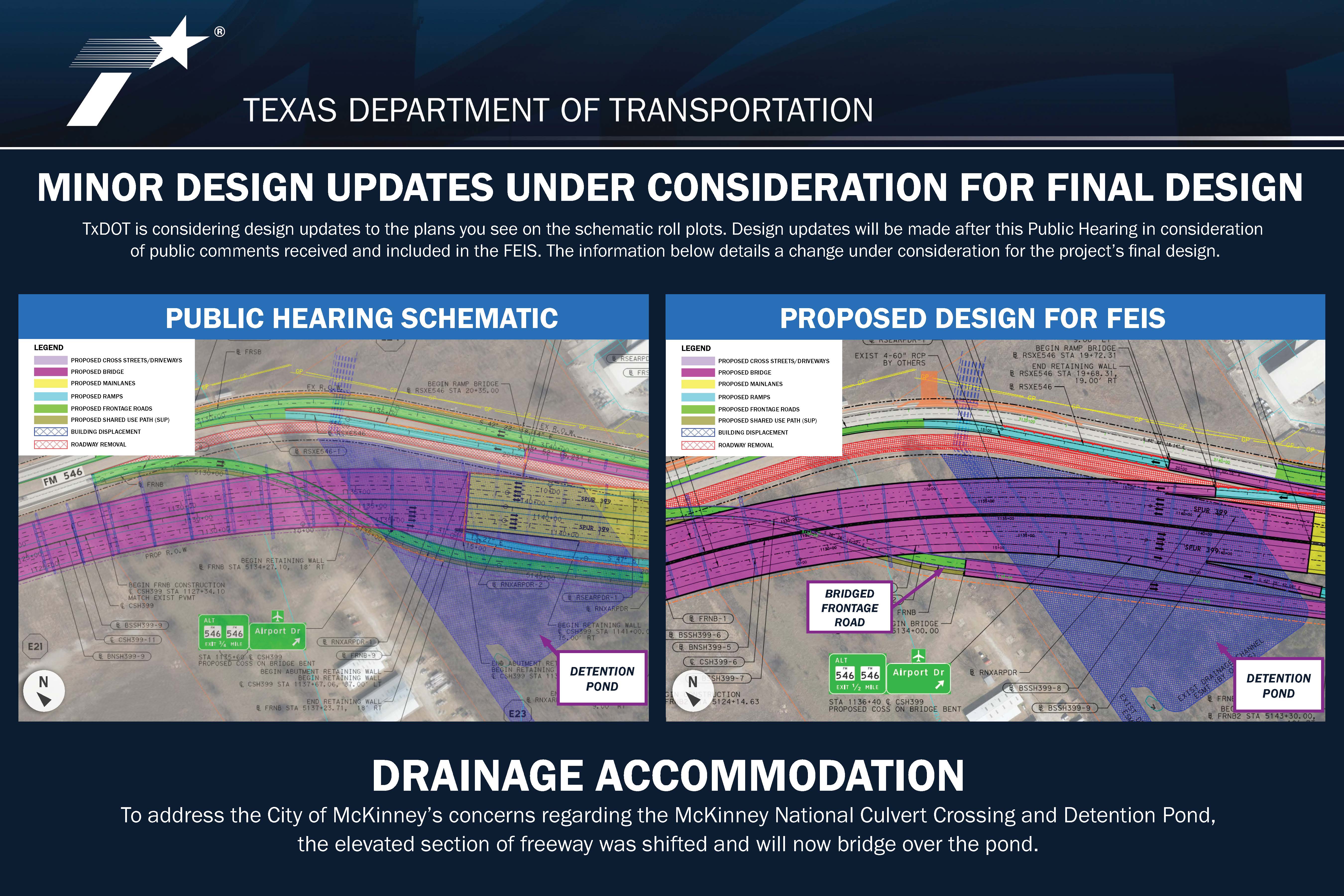
APPENDIX B - Design Schematics
APPENDIX C - Typical Sections
APPENDIX D - Resource-Specific Maps - Purple and Orange Alternatives
APPENDIX E - Agency Coordination
APPENDIX F - Comments Received During Scoping
APPENDIX G - Comments Received from DEIS Public Hearing-NOA - FEIS ONLY
APPENDIX H - Comment-Response Matrix from DEIS Public Hearing-NOA - FEIS ONLY
APPENDIX I - Traffic Data
APPENDIX J - Farmland Protection
APPENDIX K - Community Impacts
APPENDIX L - Cultural Resources
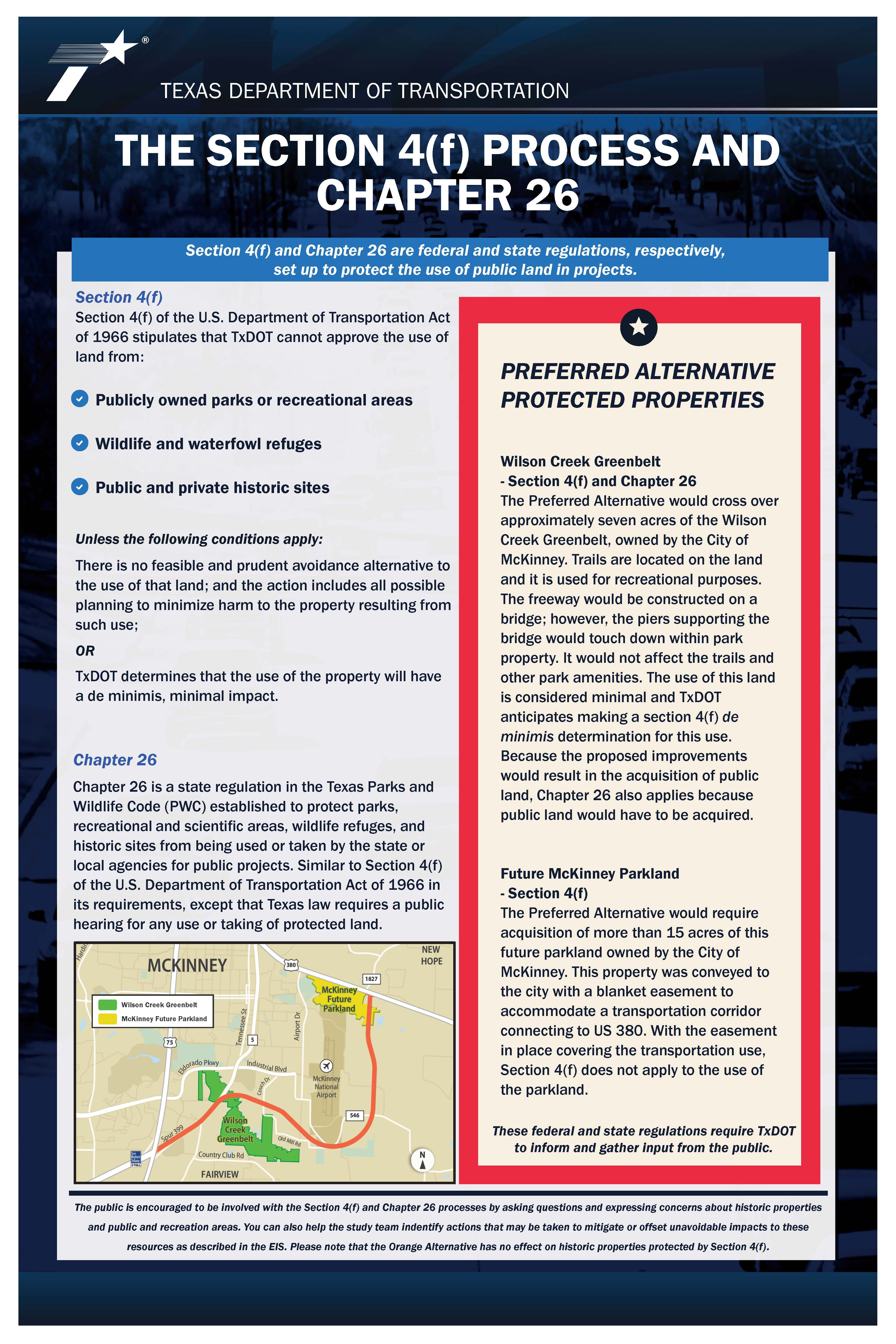
APPENDIX M - Protected Lands
APPENDIX N - Water Resources
APPENDIX O - Biological Resources
APPENDIX P - Air Quality
APPENDIX Q - Hazardous Materials
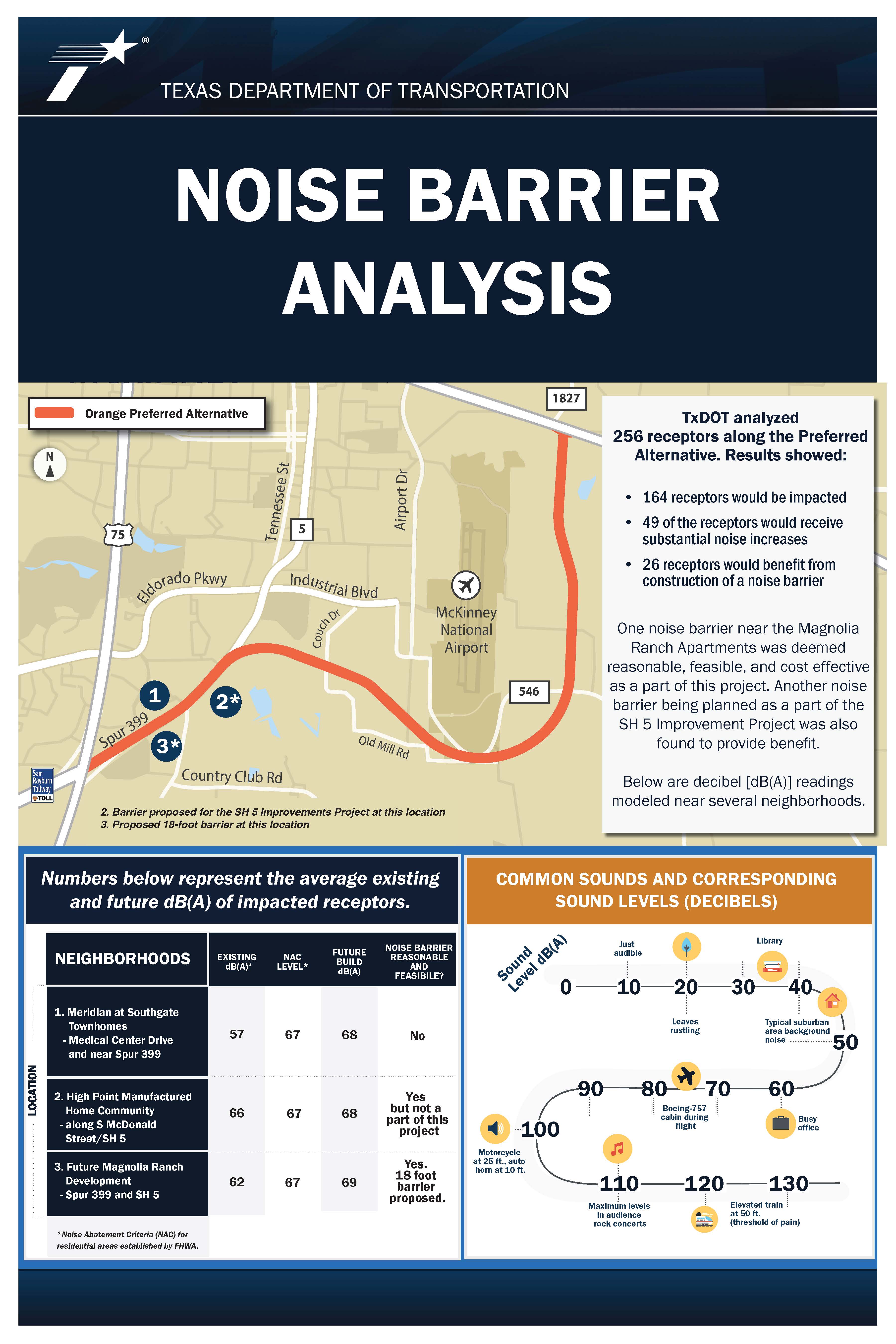
APPENDIX R - Traffic Noise
To view the October 2021 public meeting materials, click HERE
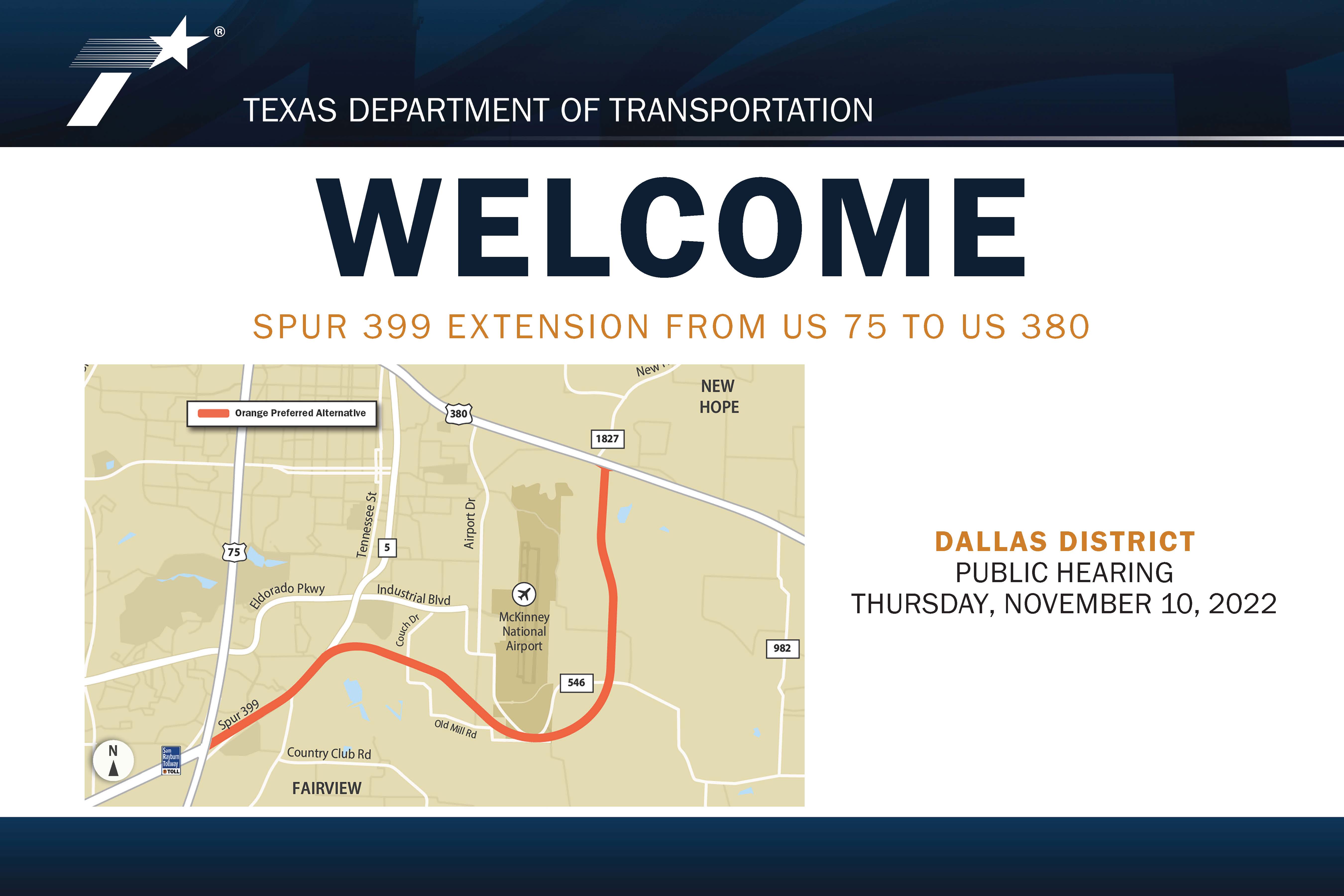
Virtual Public Meeting for Spur 399 Extension
From US Highway (US) 75 to US 380
Collin County
CSJs 0364-04-051, 0047-05-058, 0047-10-002
Thursday, November 10, 2022
The virtual meeting begins on Thursday, November 10, 2022 at 5:30 PM and will remain available online through the comment period deadline of December 10, 2022. During this time, please view the project materials and other information provided on this site to learn about the project and provide your comments.
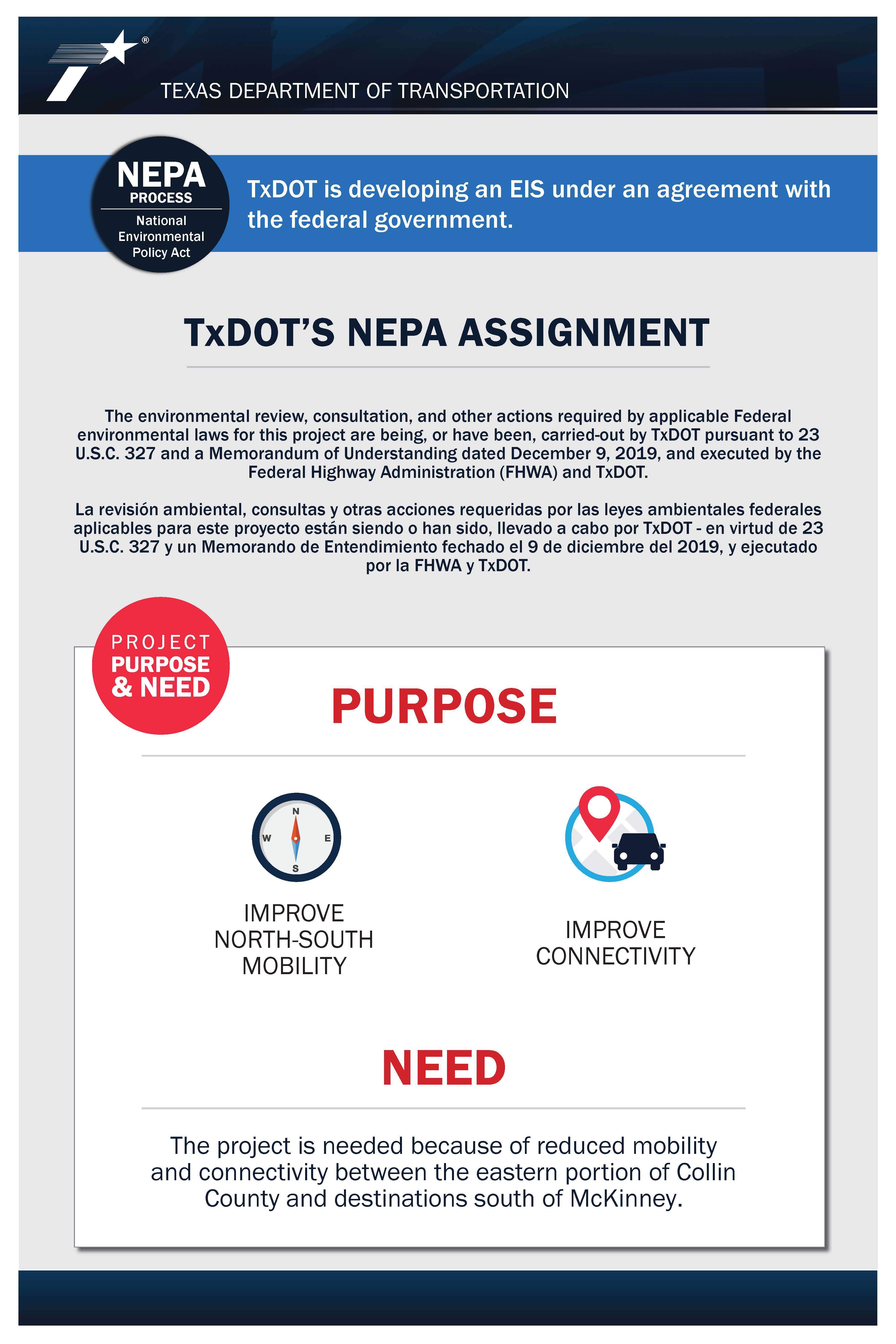
PROJECT DESCRIPTION & SELECTION OF PREFERRED ALTERNATIVE
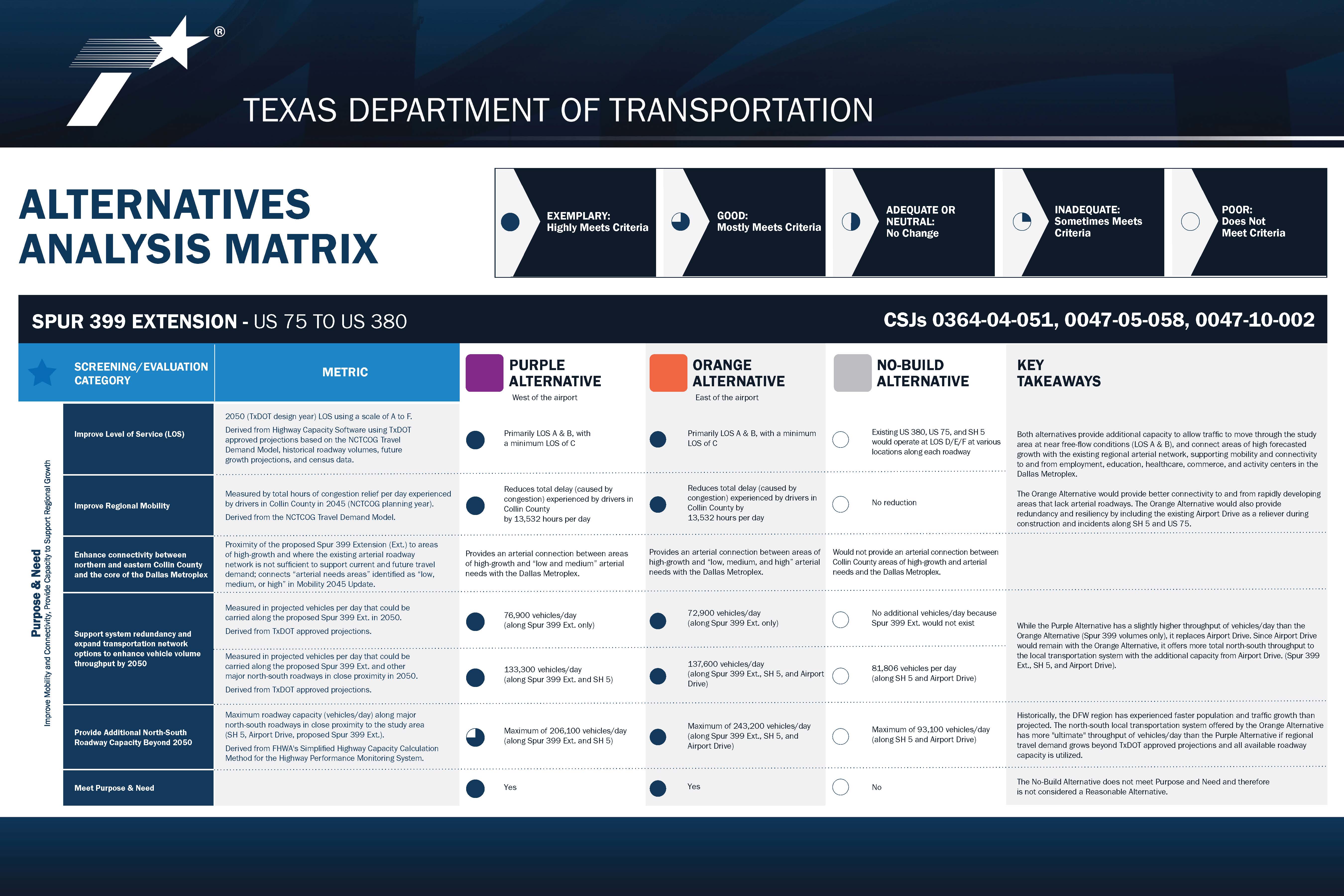
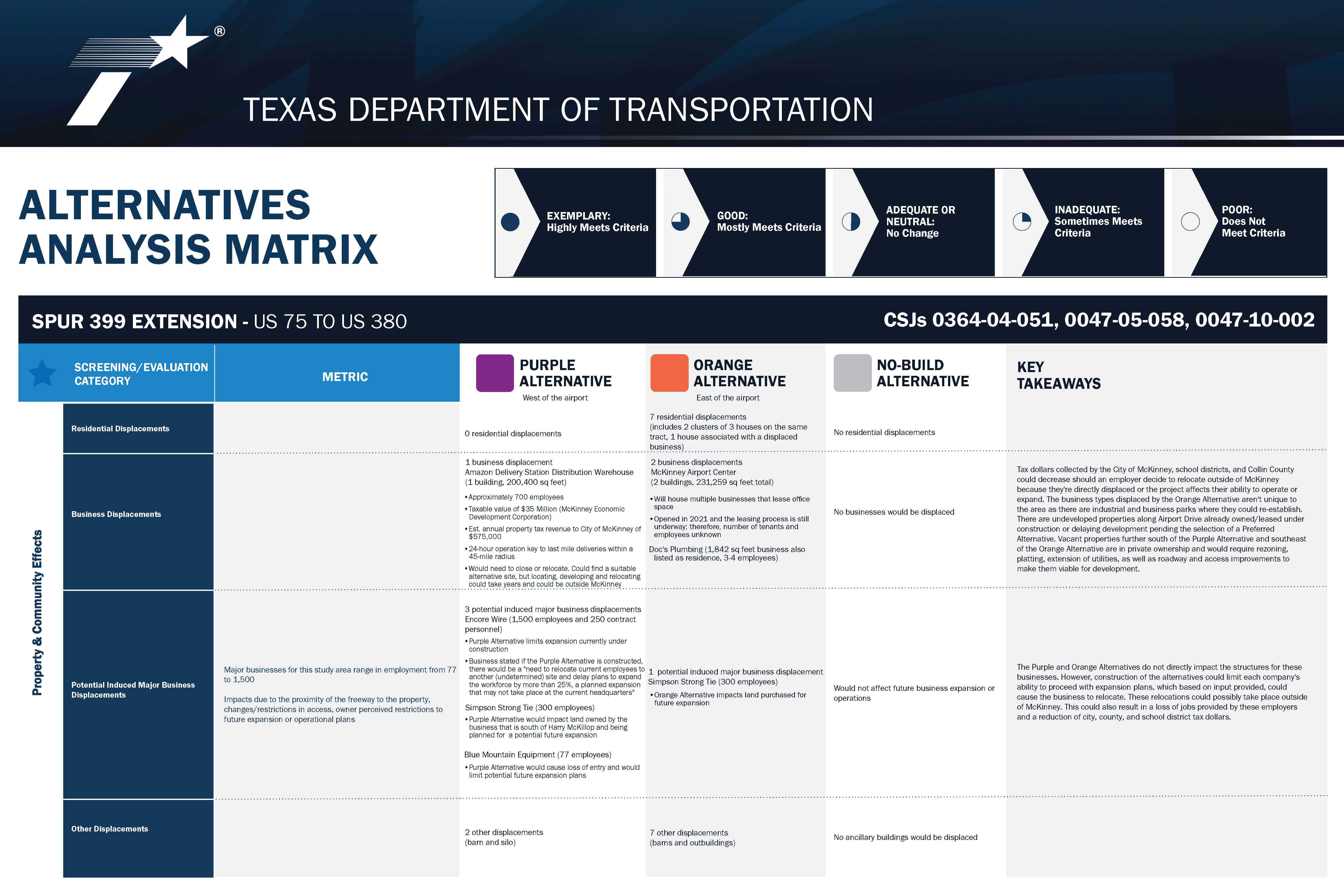
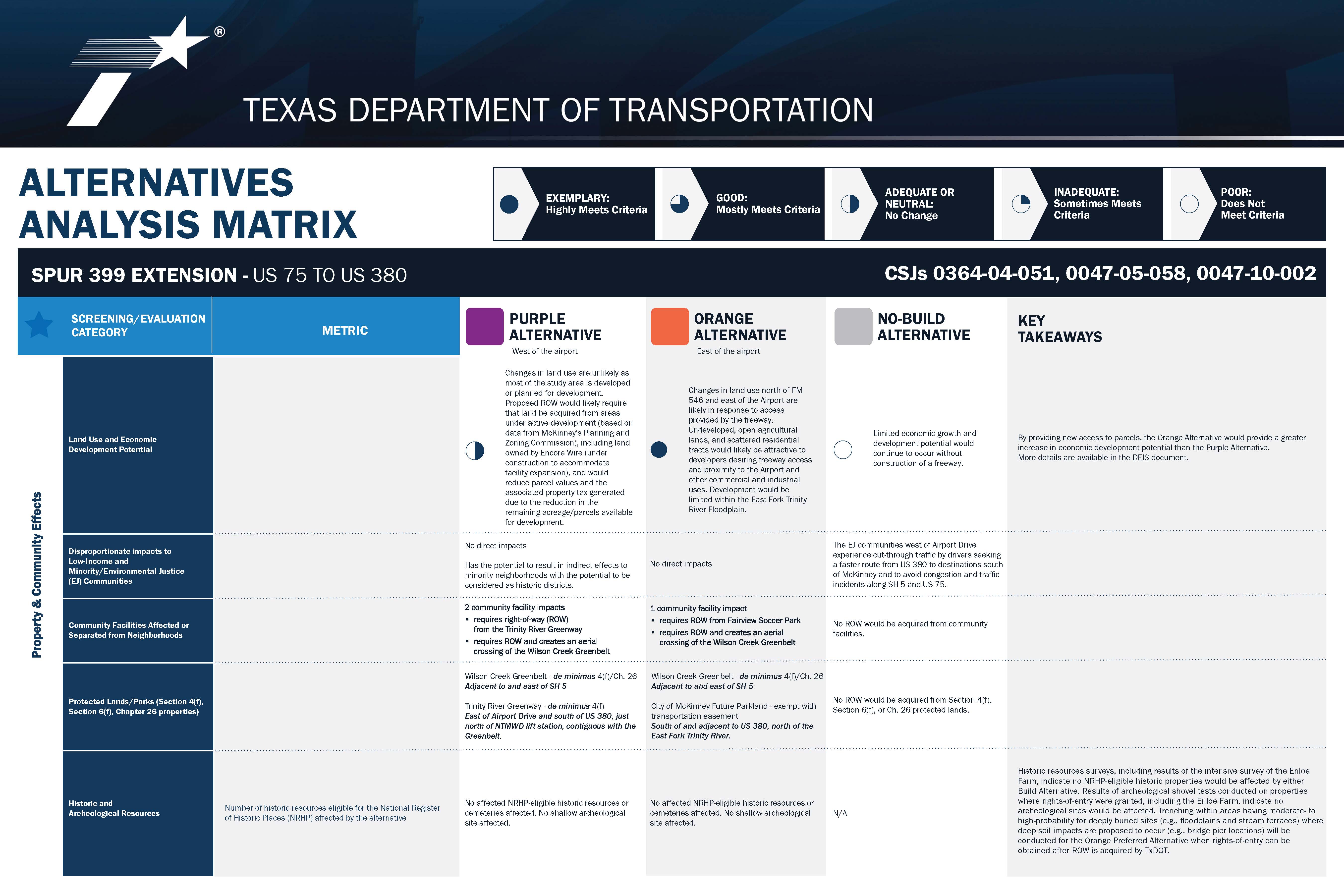
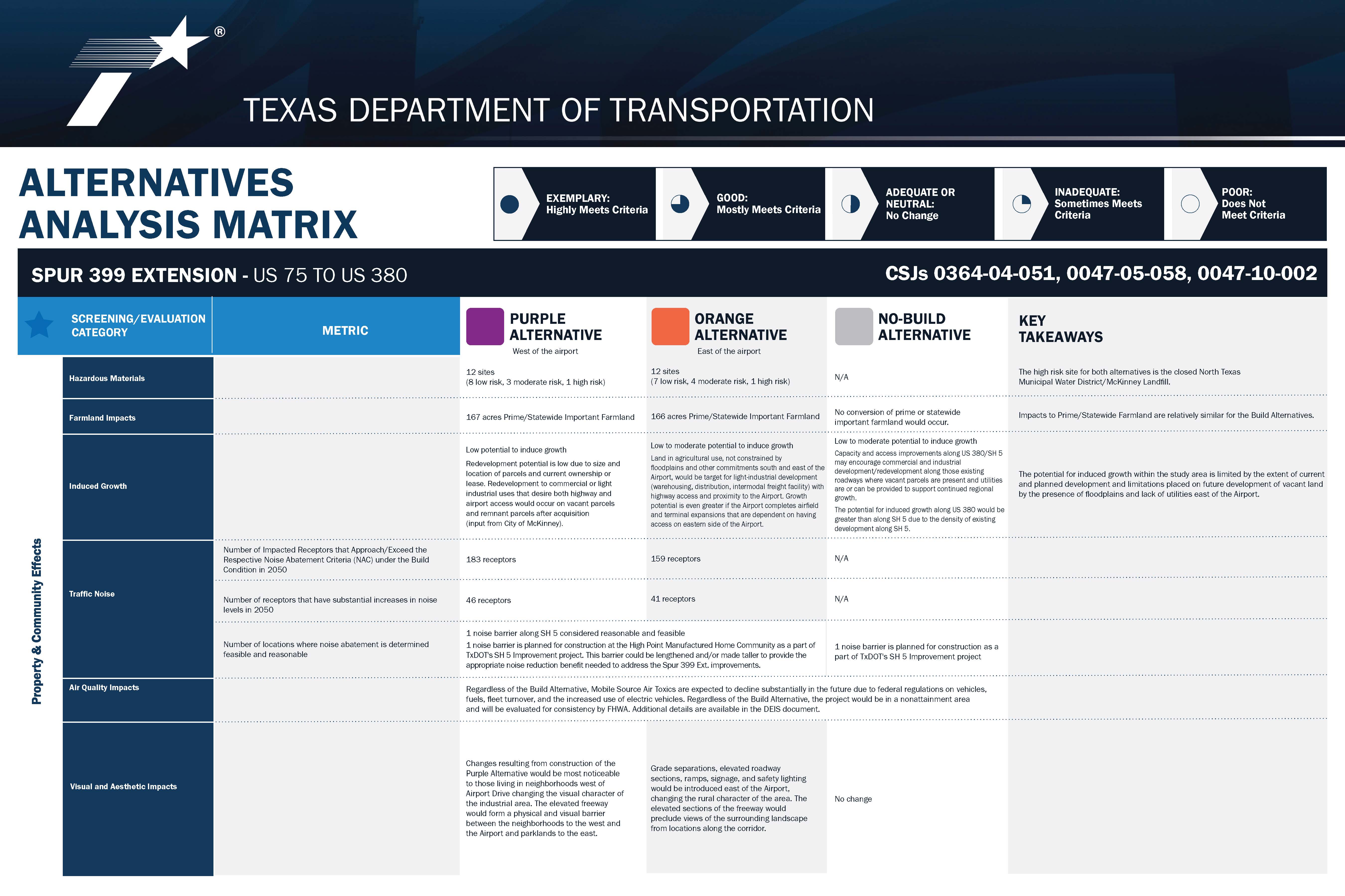
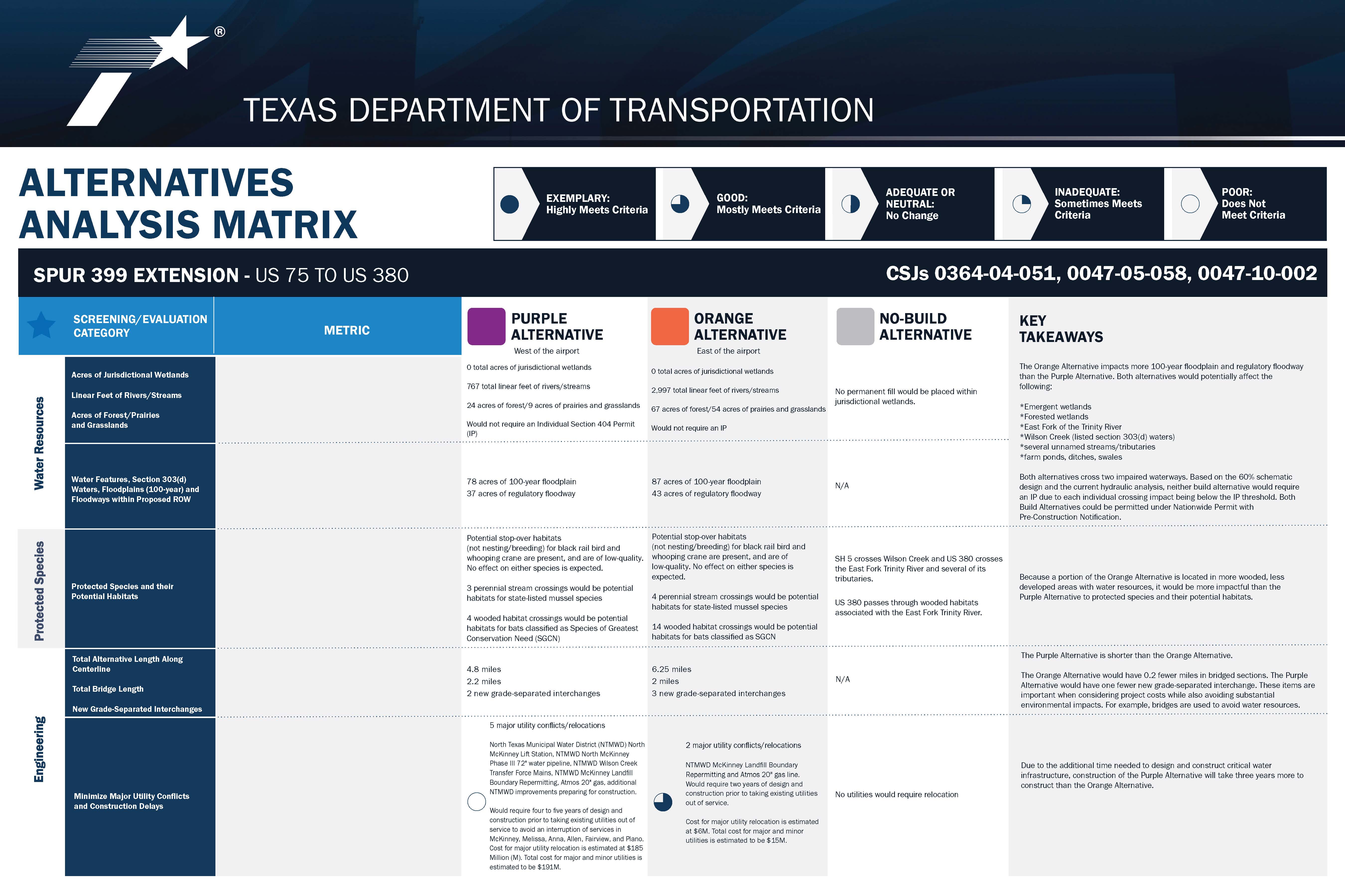
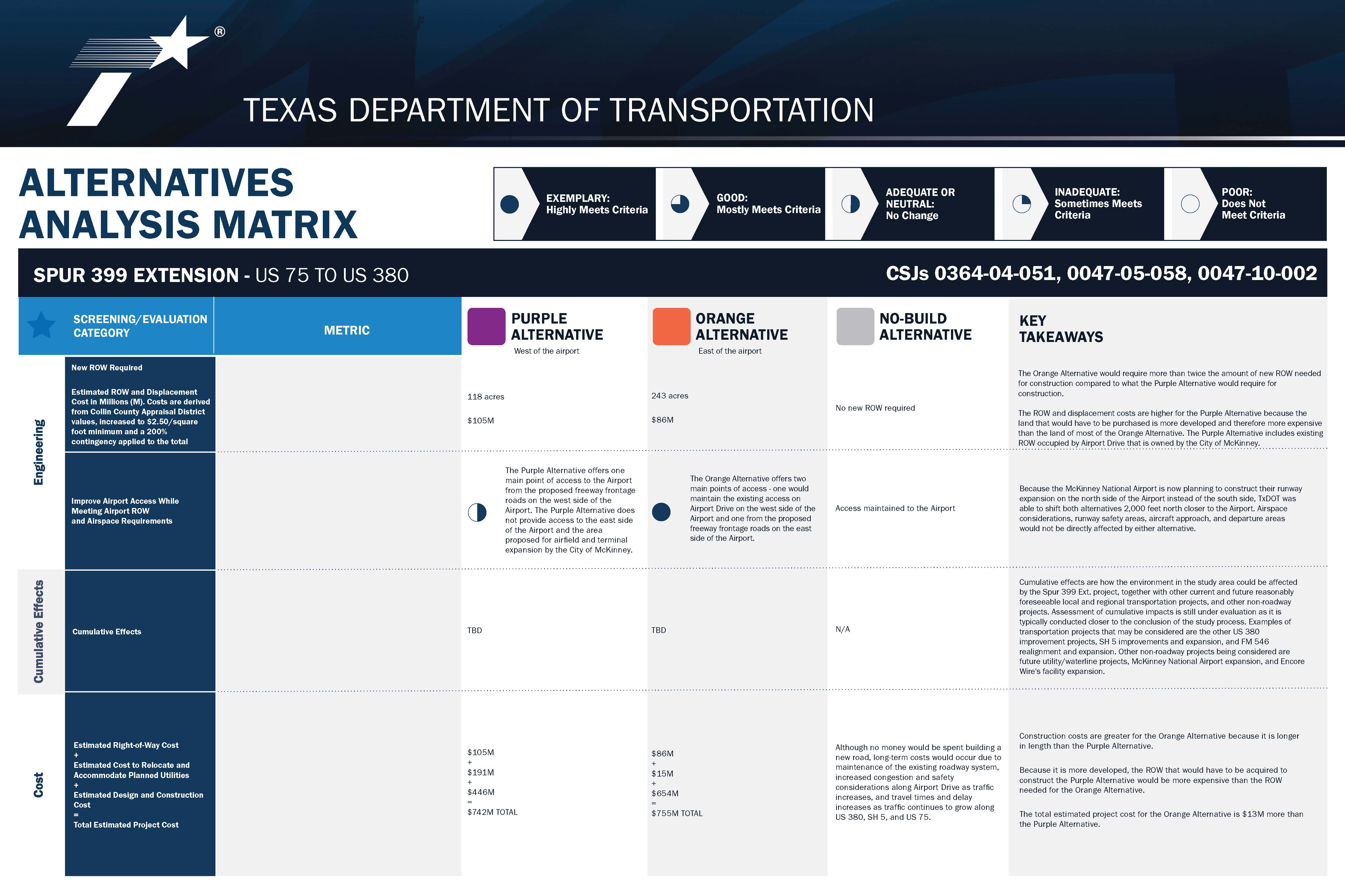
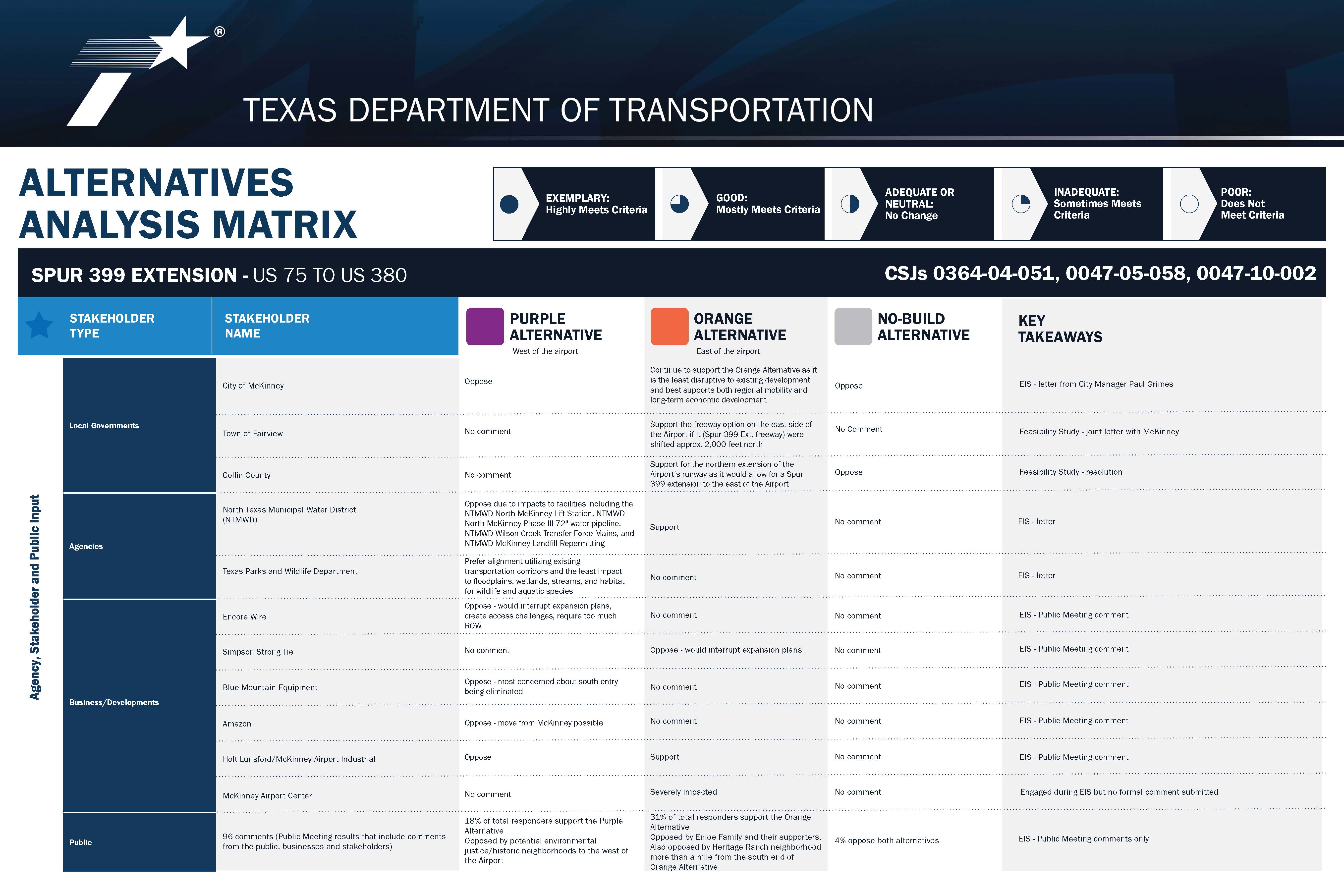
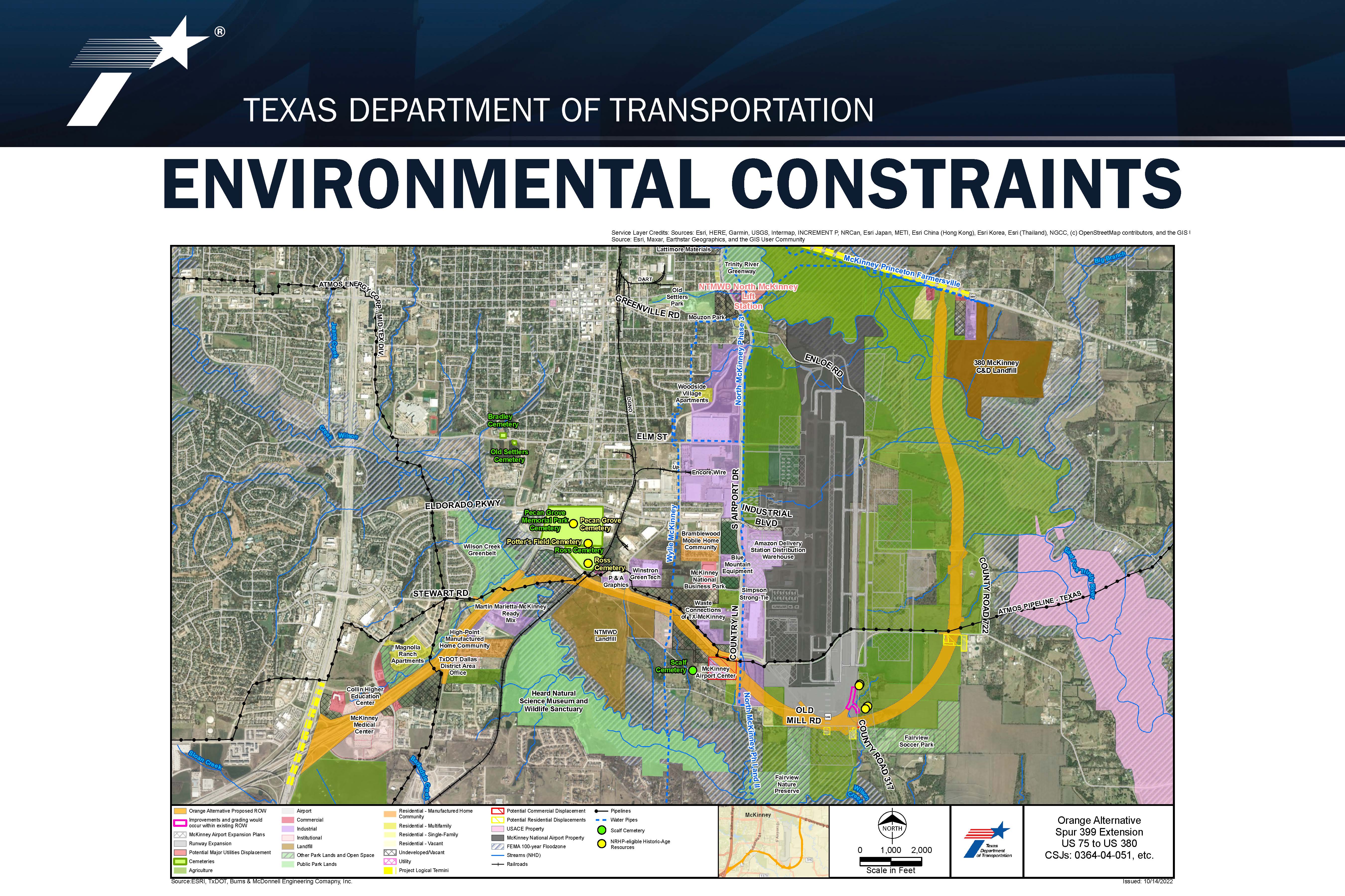
The proposed project would accommodate a six- to eight-lane freeway with frontage roads on each side to improve north-south mobility and improve connectivity between the eastern portion of Collin County and destinations south of McKinney. The proposed project passes through the City of McKinney and Collin County and is near the Town of Fairview. As part of the NEPA process, TxDOT evaluated three alternatives for this project including the No-Build Alternative and two Build Alternatives – The Purple Alternative to the west of McKinney National Airport and the Orange Alternative to the east of the McKinney National Airport. After completing a very detailed evaluation, TxDOT selected the Orange Alternative as its Preferred Alternative for the project.
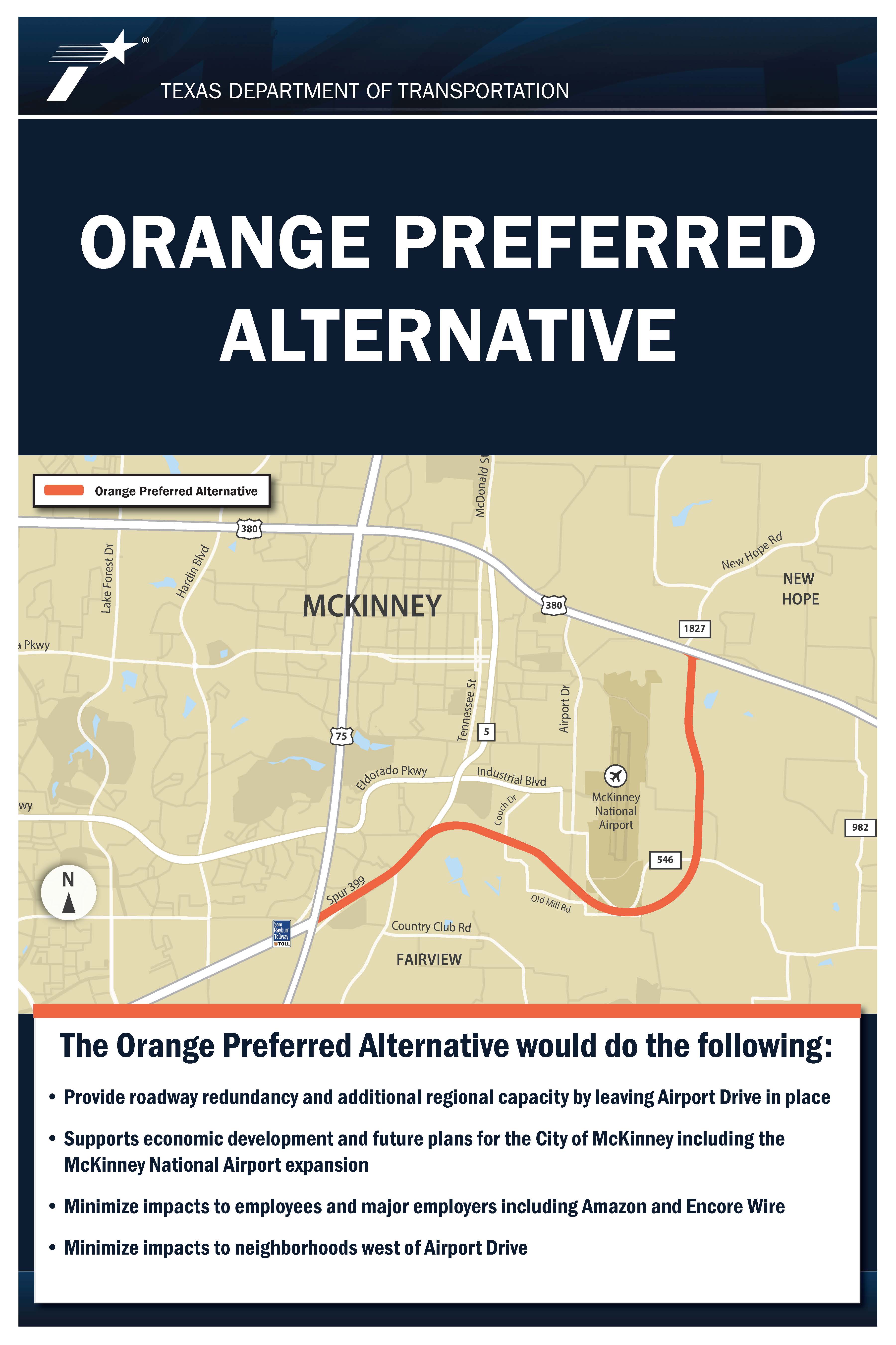
The Orange Alternative supports the project’s purpose and need, and it provides roadway redundancy and additional capacity by leaving Airport Drive in place to function as a reliever or emergency access route. This alternative better supports economic development including future plans for the City of McKinney and the expansion of the McKinney National Airport. It would minimize impacts to major employers including the Amazon Delivery Station and Encore Wire. The Orange Alternative would also minimize impacts to neighborhoods, particularly those west of Airport Drive.
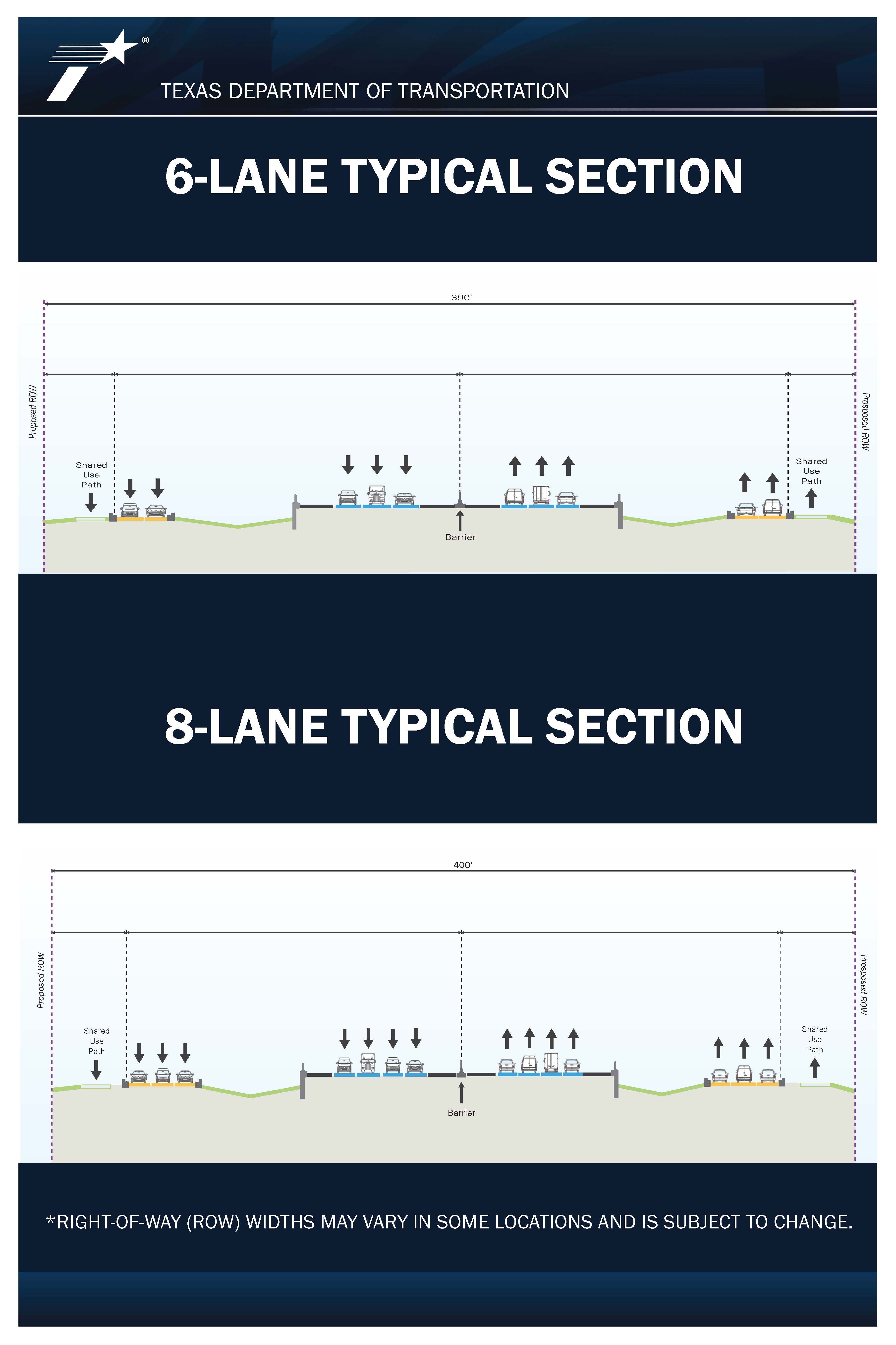
The typical proposed right-of-way would be approximately 400 feet wide, with the minimum and maximum right-of-way width ranging from 165 feet to 696 feet, respectively. Depending on the location, the typical freeway section would consist of four 12-foot-wide travel lanes in each direction with two-lane (each 12 feet wide), one way frontage roads on either side of the mainlanes. Grade-separated interchanges would include ramps with curb and gutter to support drainage. Bridges and overpasses along the mainlanes would have a desired vertical clearance of 18.5 feet, with a vertical clearance over railroads proposed at 23.5 feet. Shared-use paths built along the frontage roads would provide bicycle and pedestrian accommodations and support multi-modal access. The total proposed right-of-way acreage is estimated at 366.1 acres.
PRESENTATION
HELPFUL INFORMATION
EXHIBITS
You may click on any of the project exhibits below to view them at full size

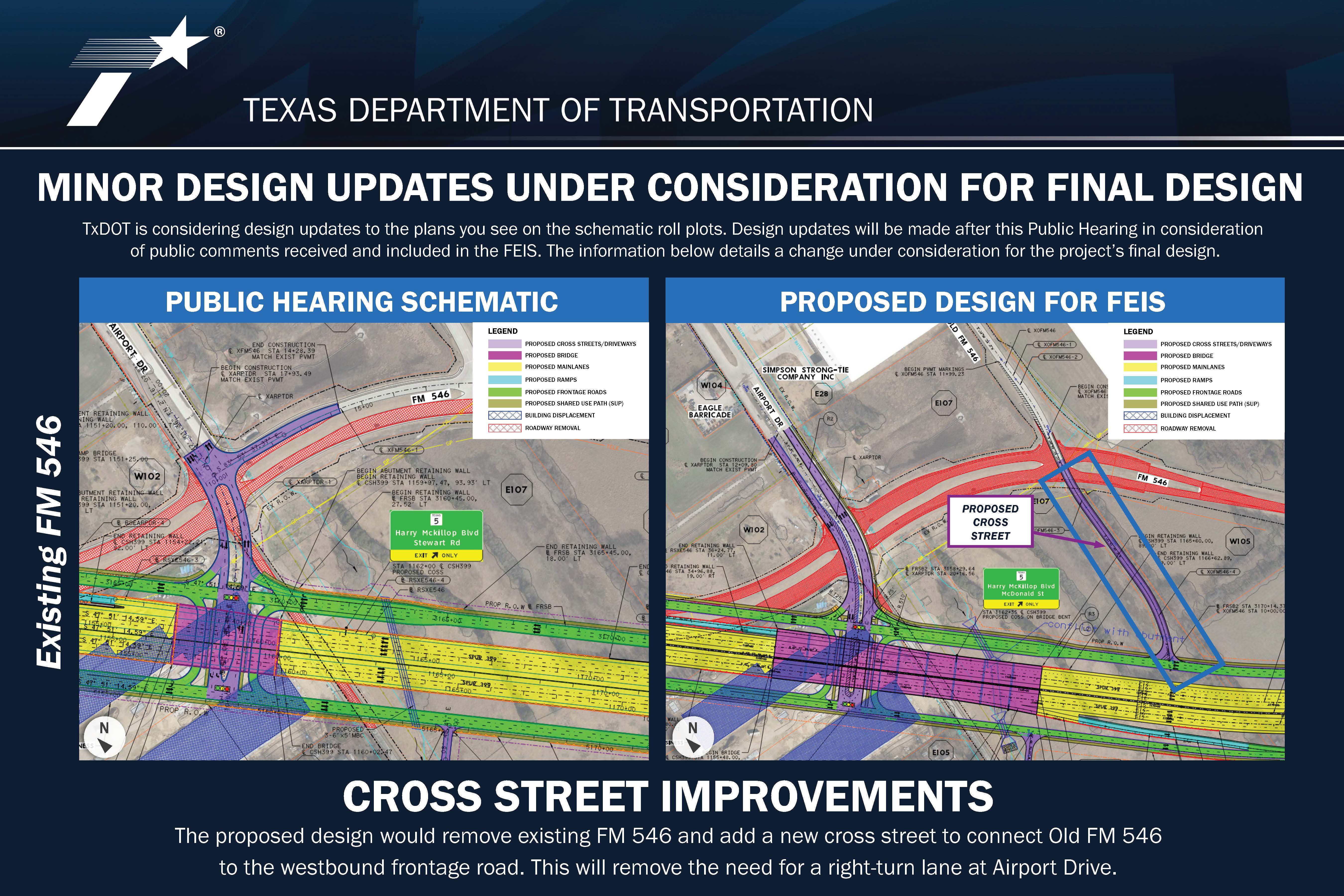
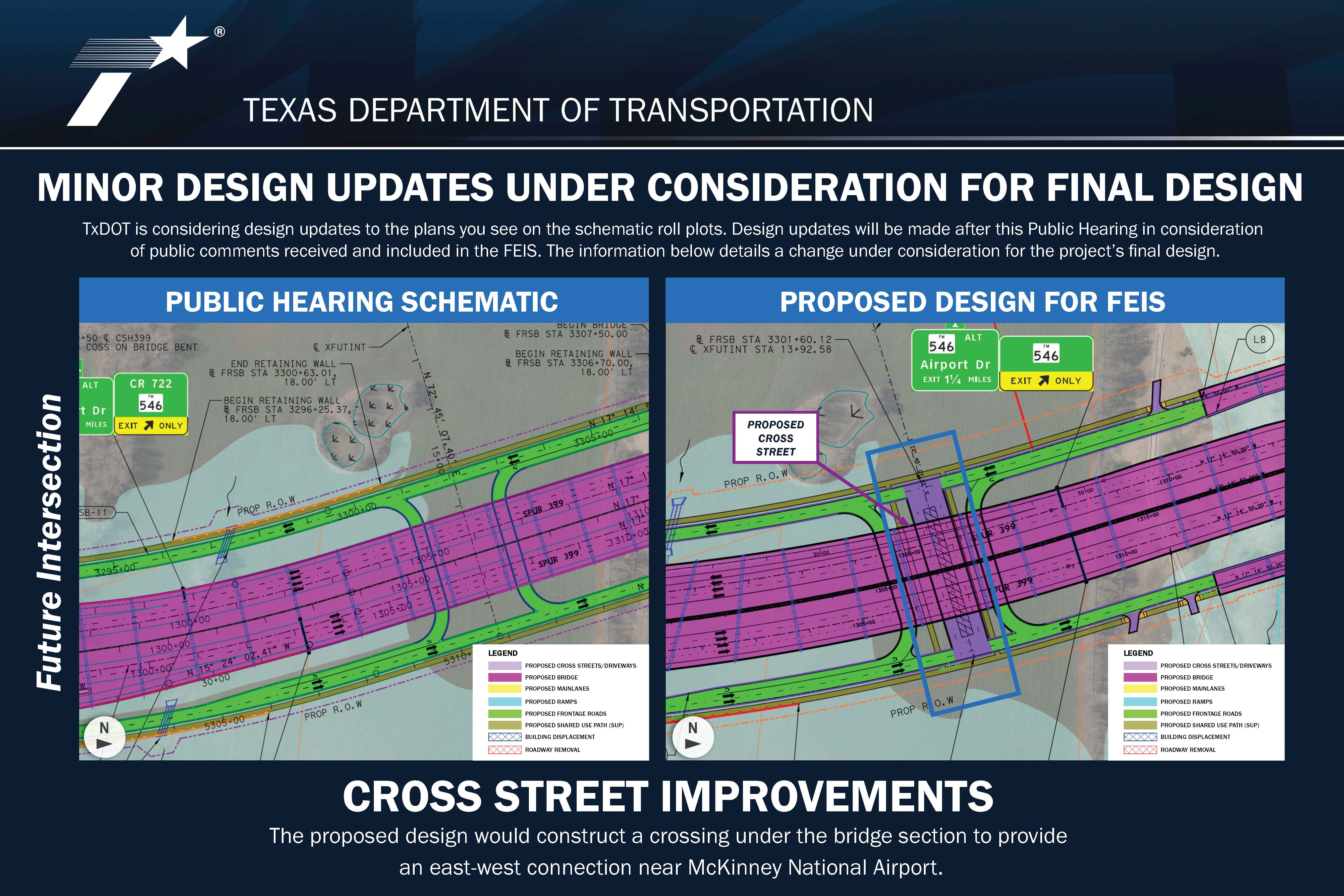
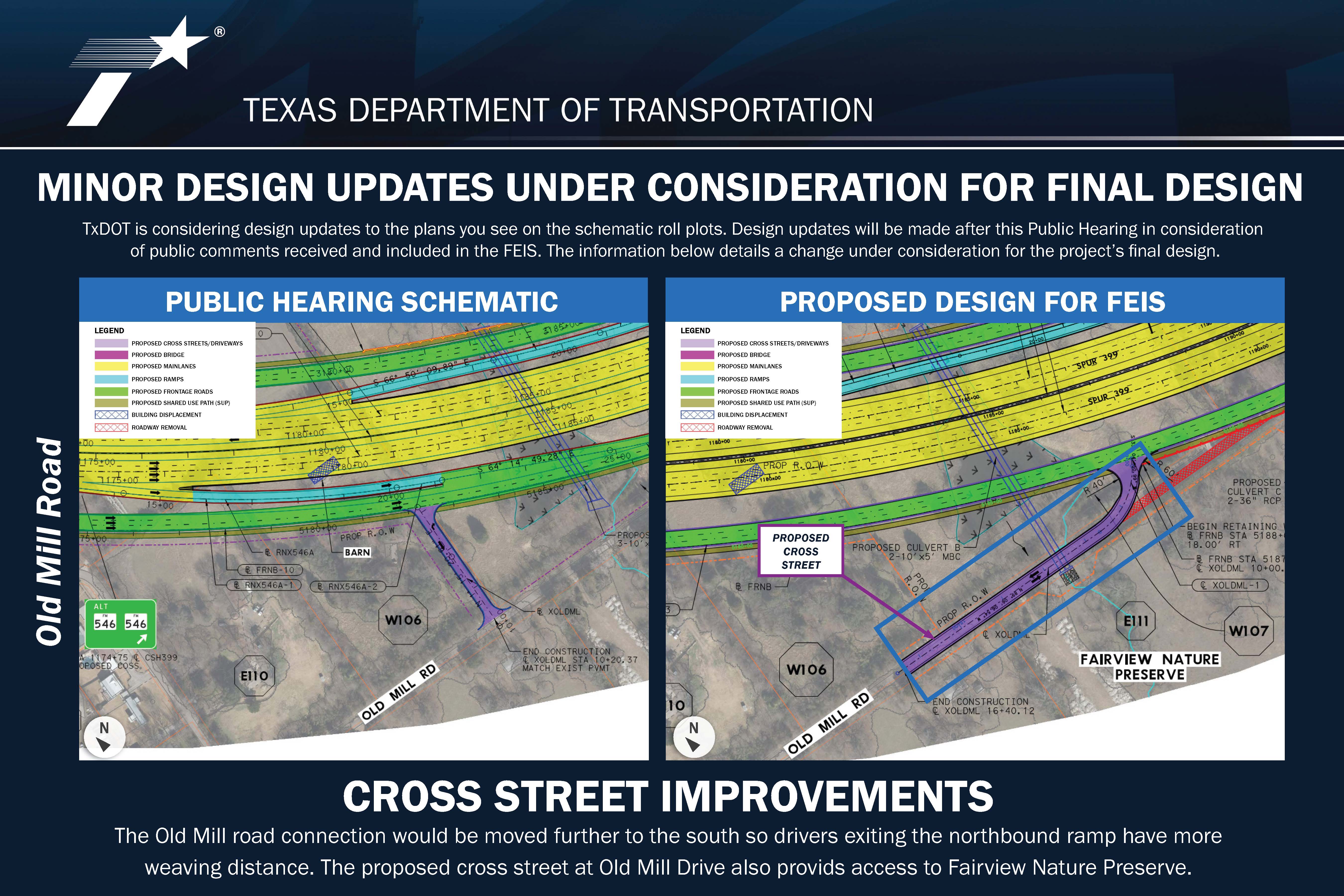
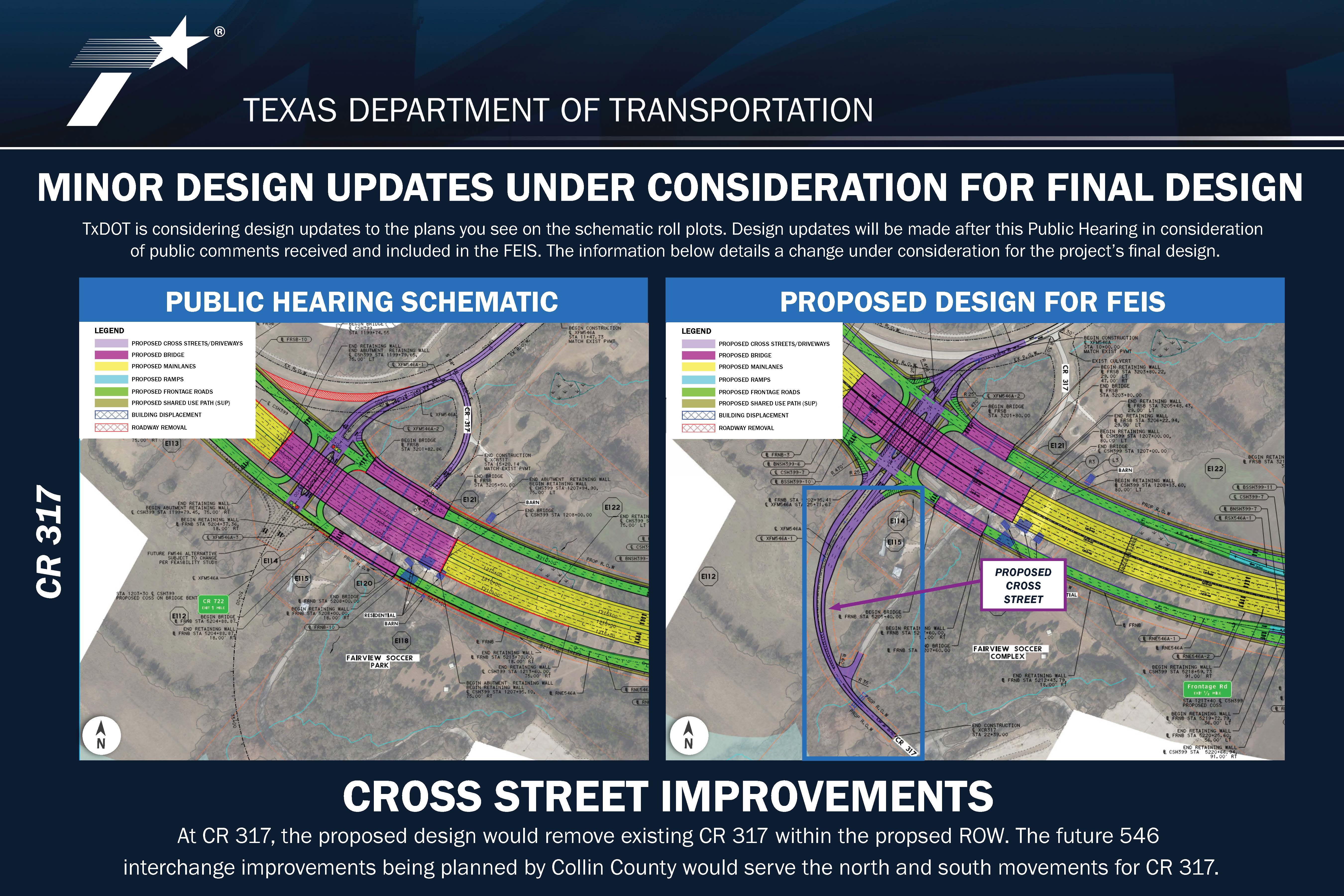
SCHEMATICS
Plan View Roll 1 – from US 75 to FM 546
Plan View Roll 2 – from FM 546 to Old Mill Road
Plan View Roll 3 – from CR 317 to CR 722
Plan View Roll 4 – from CR 722 to US 380
Profile Roll 1
Profile Roll 2
Profile Roll 3
Profile Roll 4
Property Owners List
INTERACTIVE MAP
FLYTHROUGH VIDEO
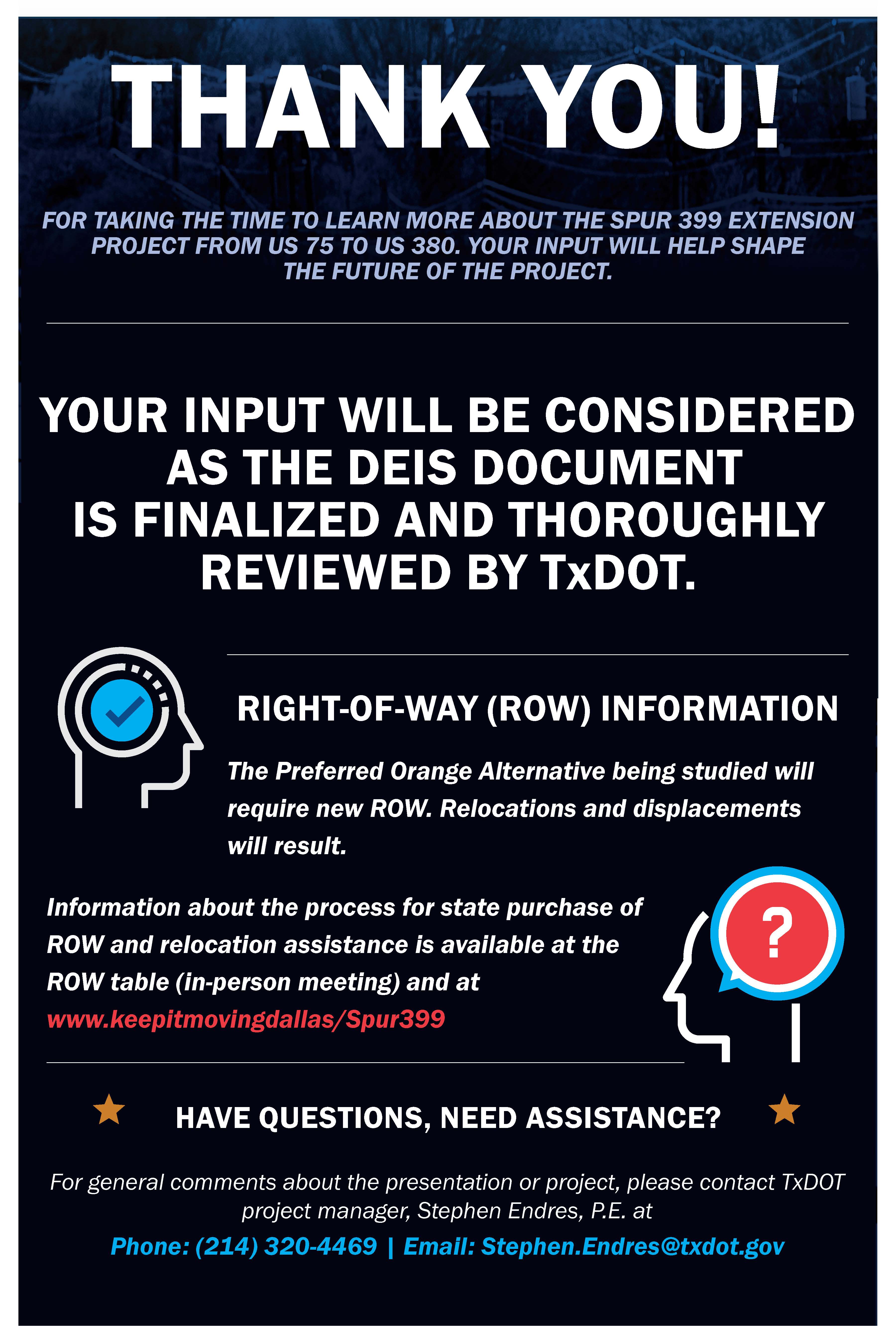
RIGHT OF WAY (ROW) INFORMATION
The total proposed ROW acreage is estimated at 366.1 acres. Information about the process for state purchase of ROW and relocation assistance may be found in the following pamphlets:
Relocation Assistance: English
Relocation Assistance: Spanish
State Purchase of ROW: English
State Purchase of ROW: Spanish
HOW TO PROVIDE COMMENTS
The deadline for providing comments is December 10, 2022.
To leave a verbal comment call (833) 933-0443
If you prefer to print a comment form, you can do so using the following links:
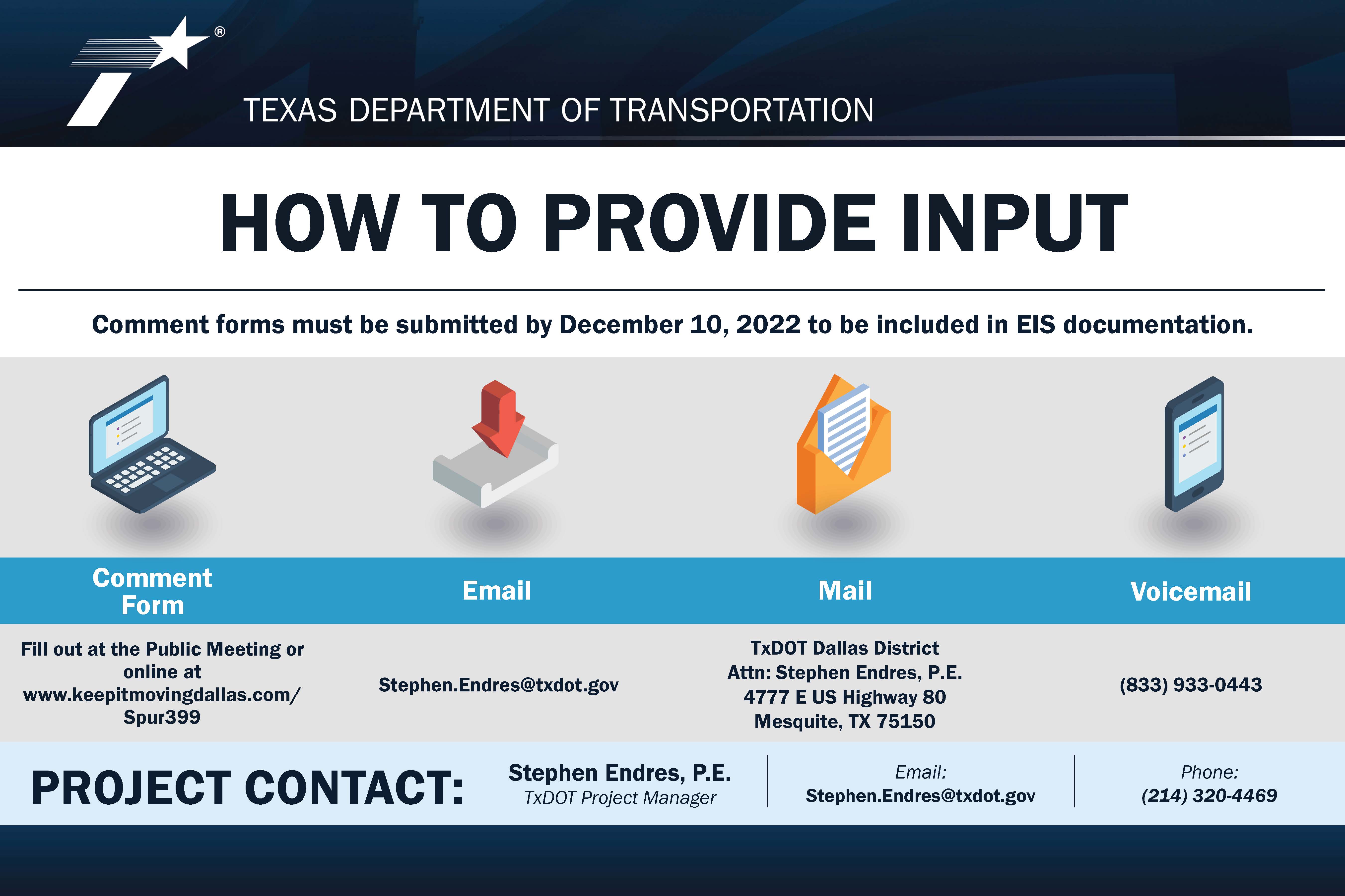
QUESTIONS?
Contact the TxDOT project manager Stephen Endres, P.E. to ask questions about the project at Stephen.Endres@txdot.gov or (214) 320-4469.