US380EIS
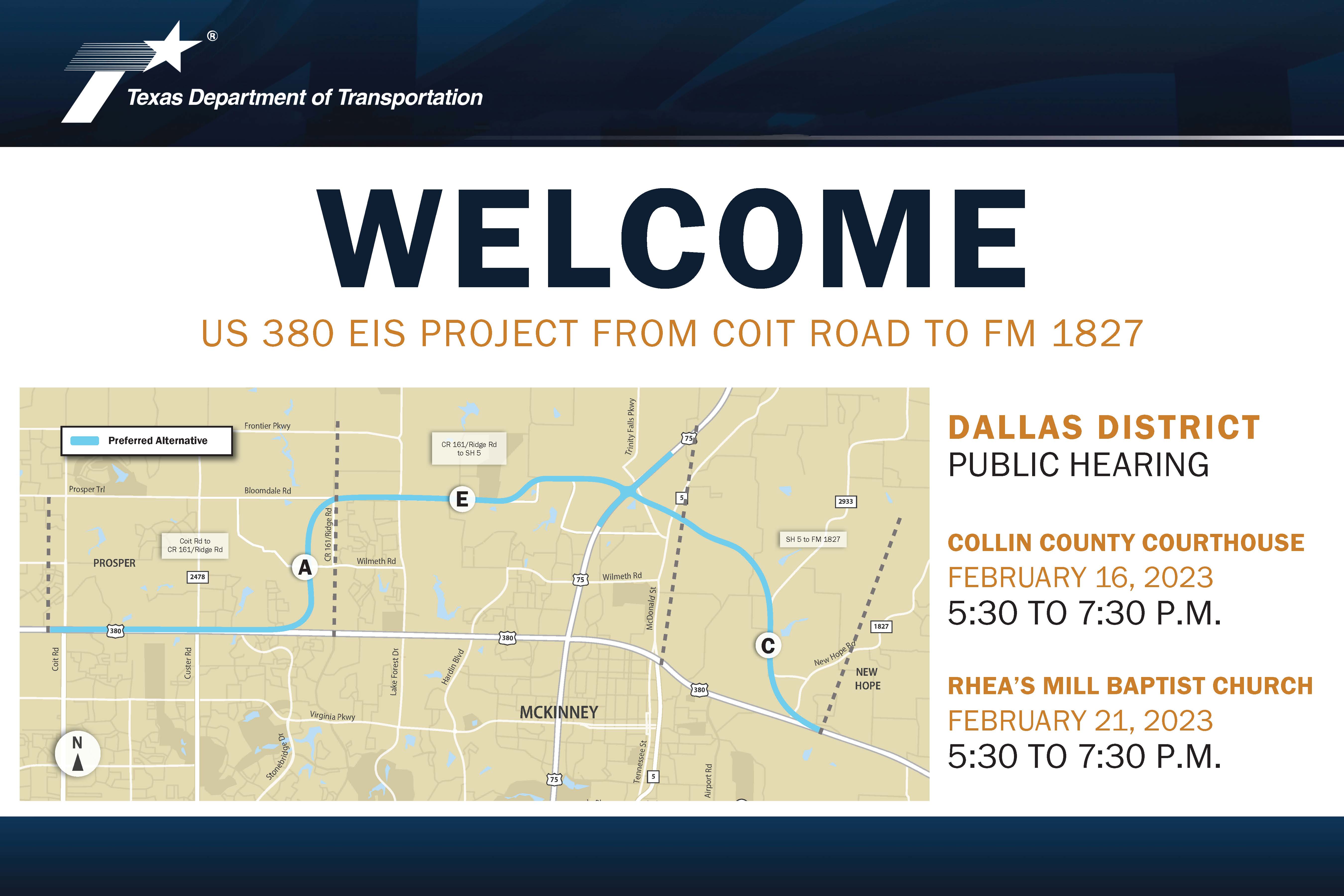
Virtual Public Hearing for US 380 McKinney Improvements
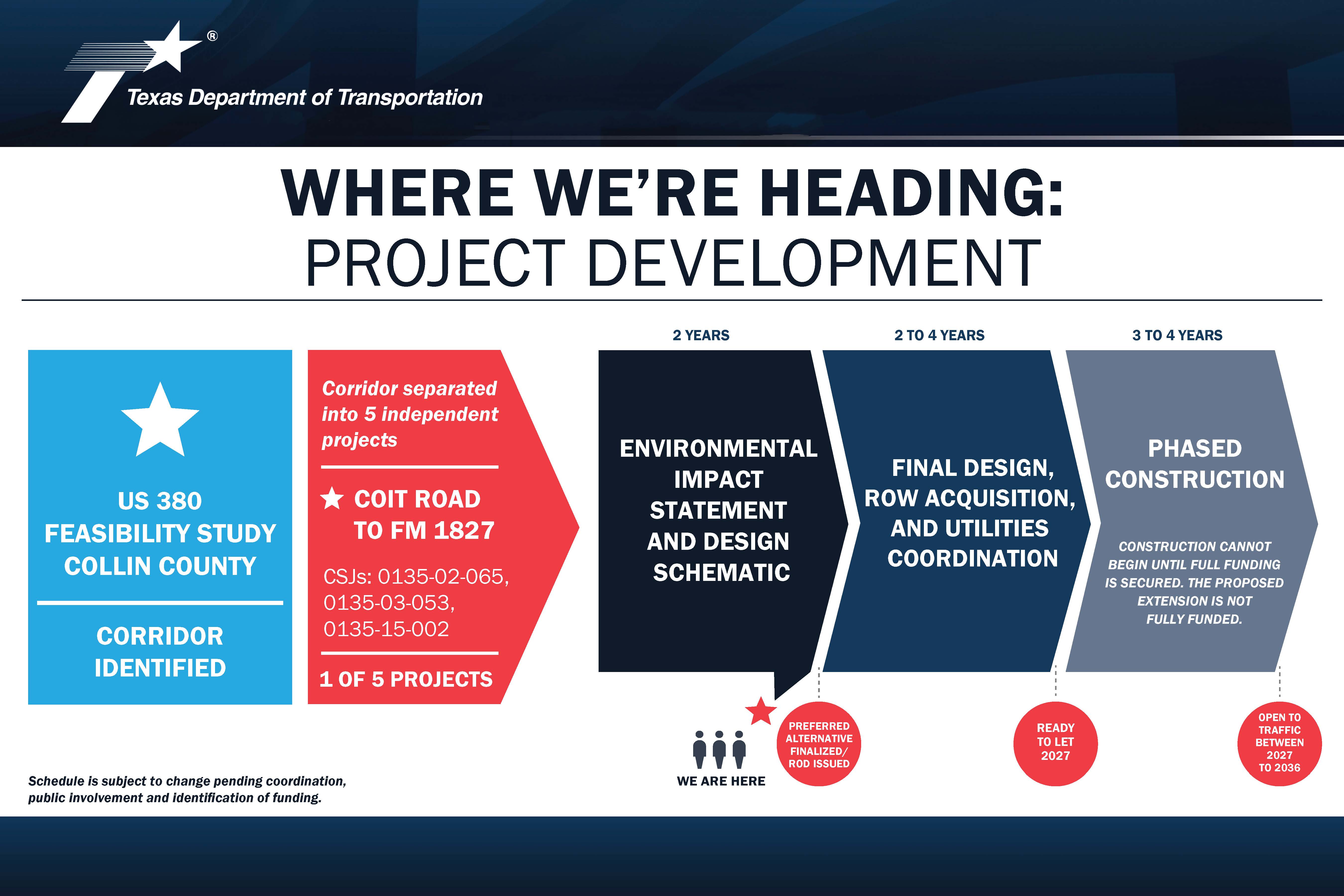
From Coit Road to FM 1827
Collin County
CSJs 0135-02-065, 0135-03-053, 0135-15-002
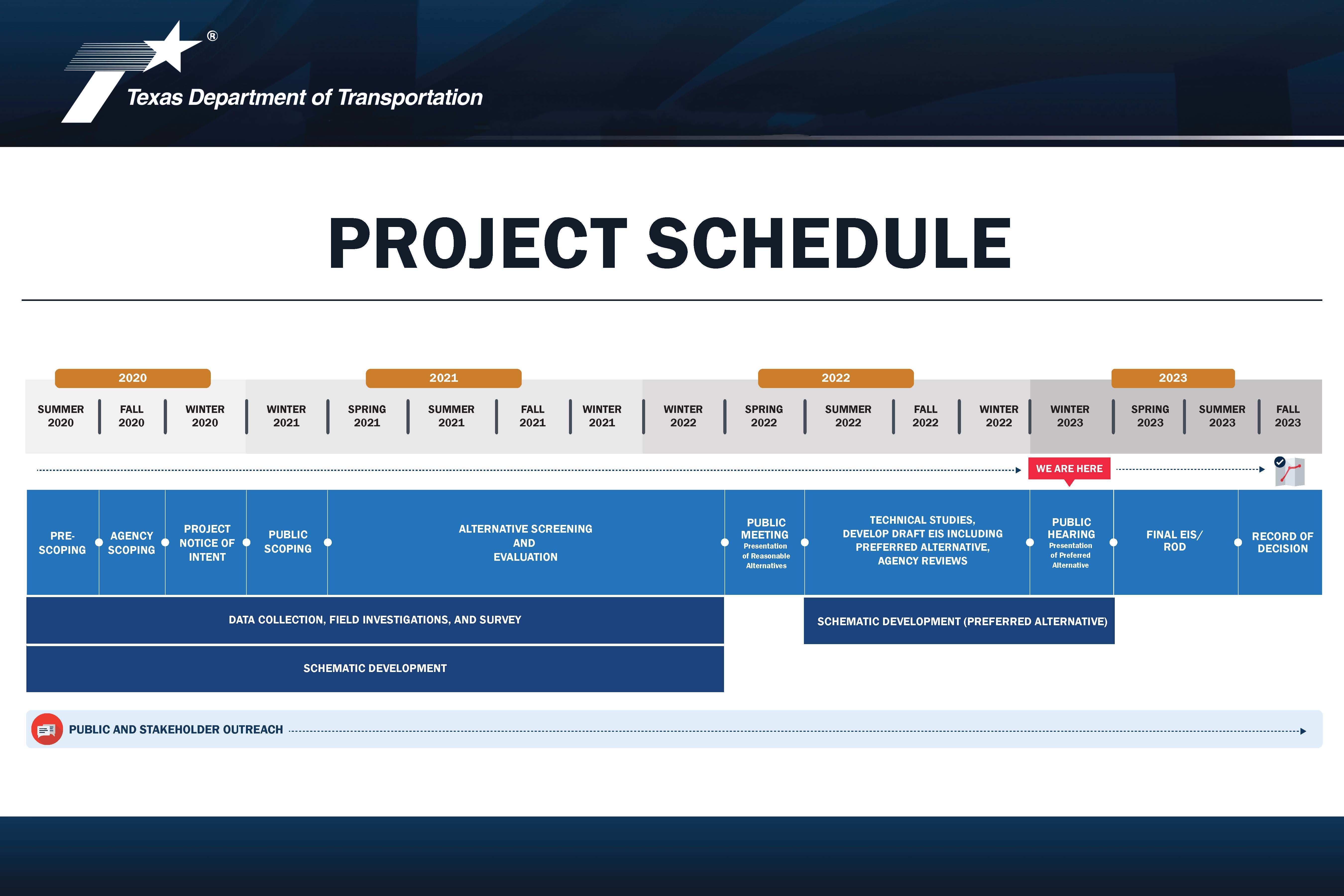
The comment period for this project has been extended to April 20, 2023.
The virtual hearing begins on Thursday, February 16, 2023 at 5:30 PM and will remain available online through the comment period deadline of March 21, 2023. During this time, please view the project materials and other information provided on this site to learn about the project and provide your comments.
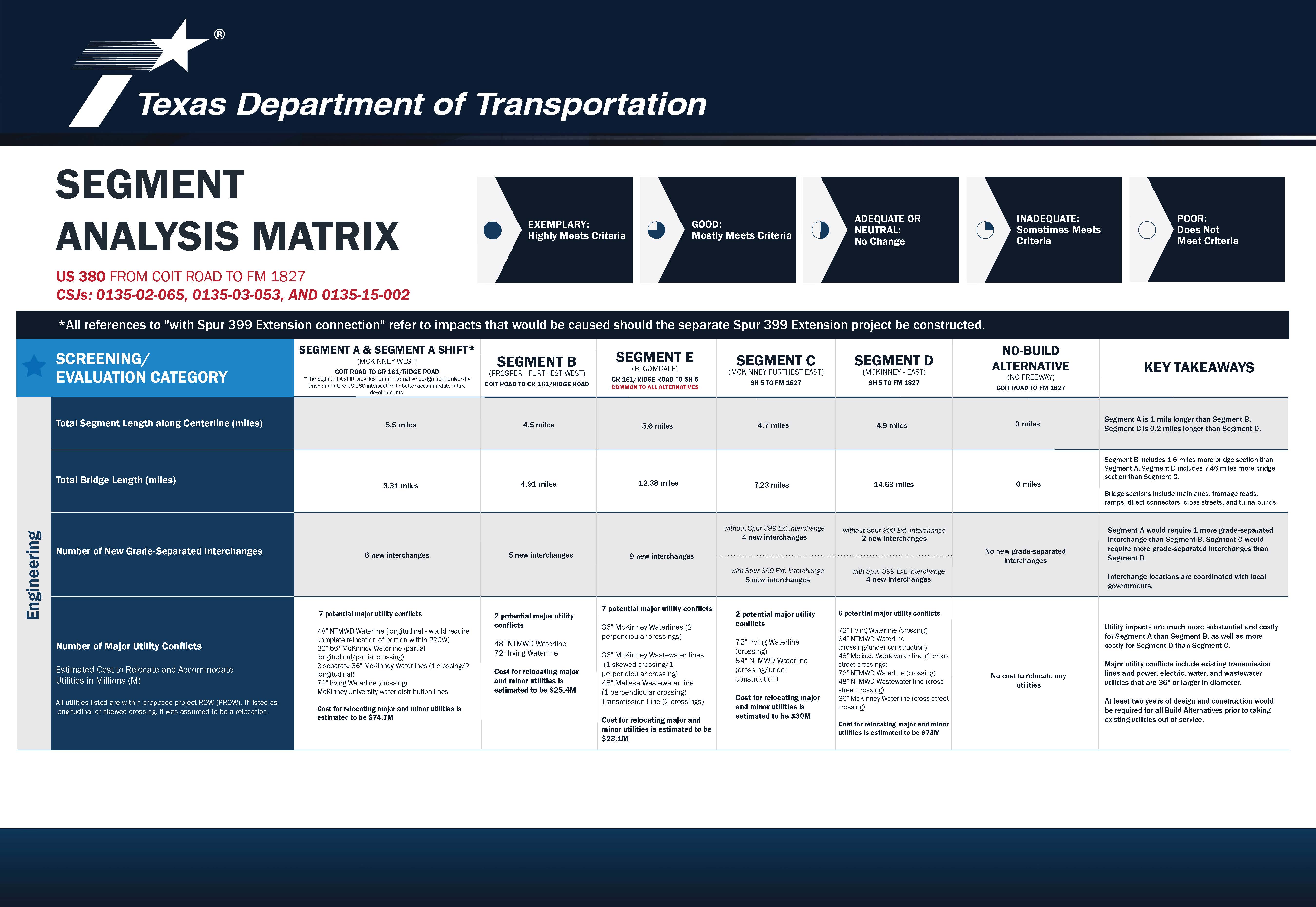
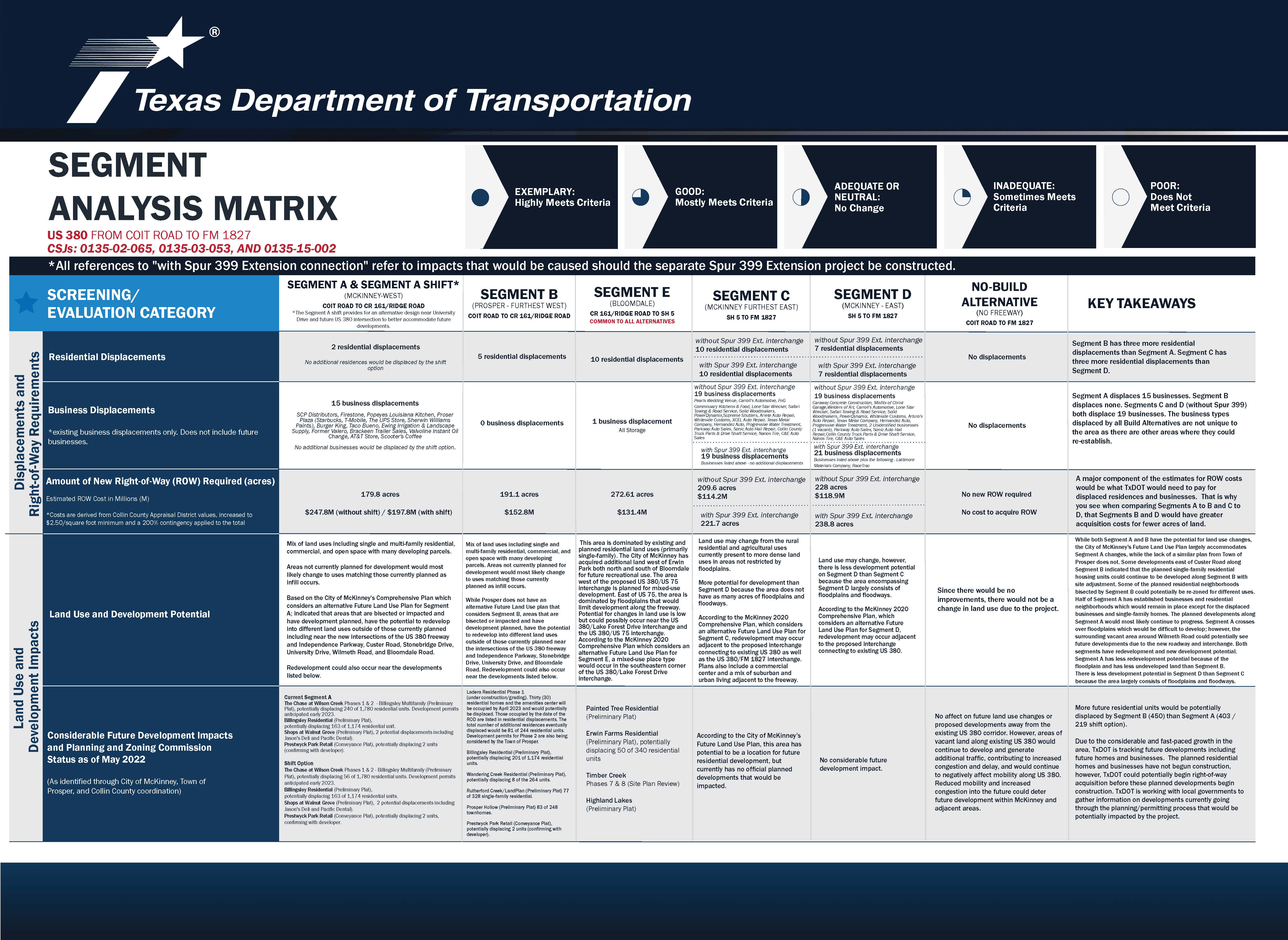
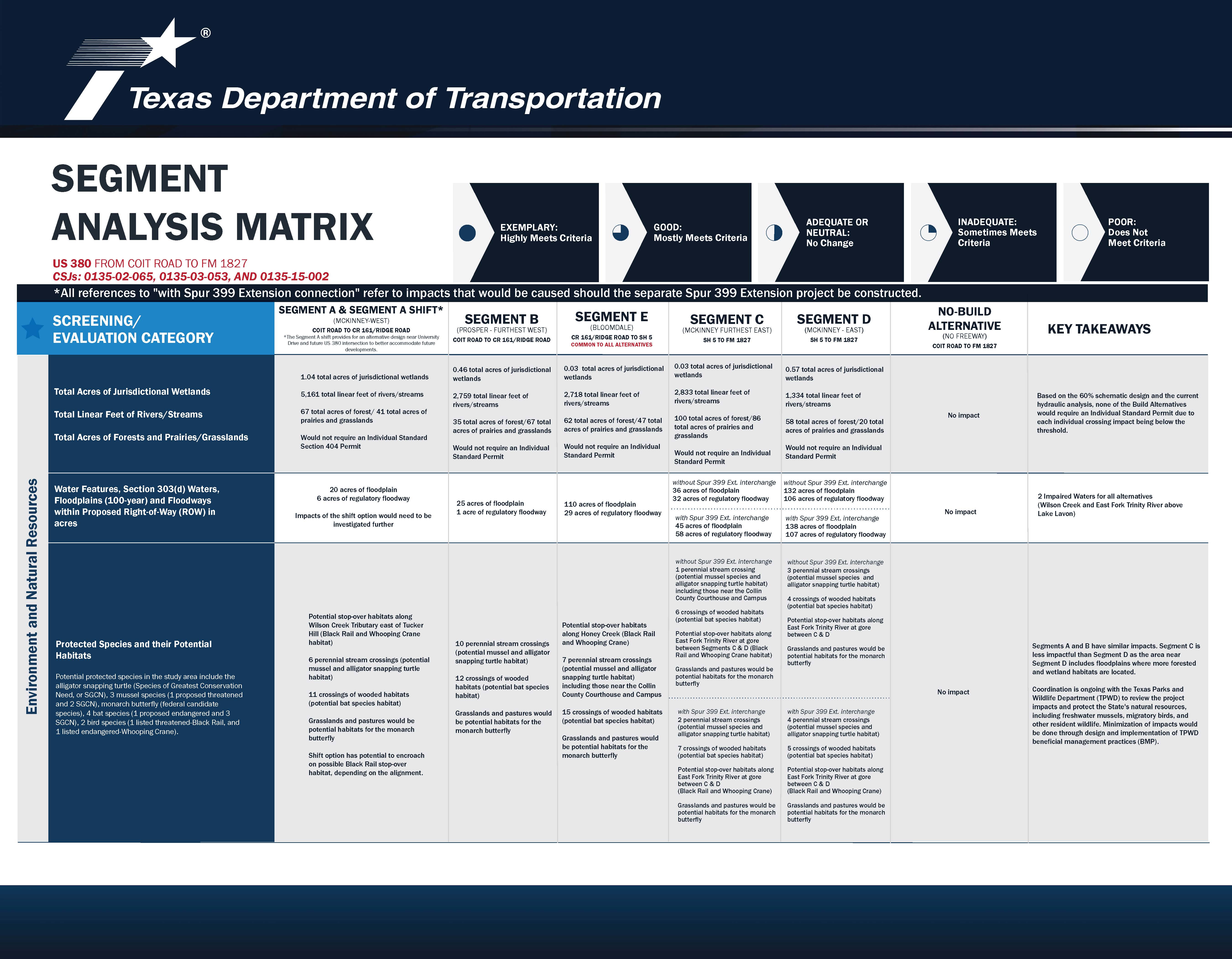
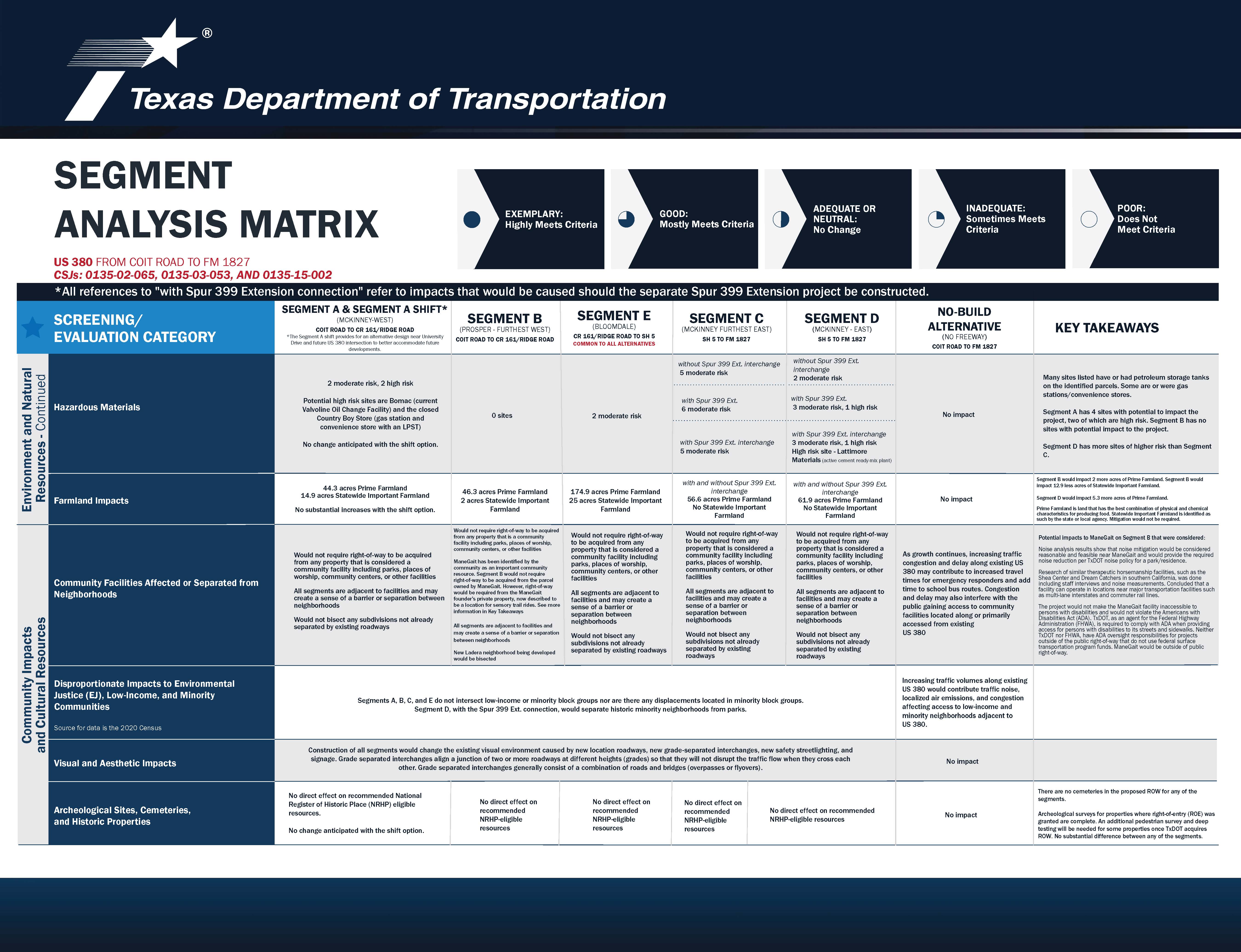
PROJECT DESCRIPTION & SELECTION OF PREFERRED ALTERNATIVE
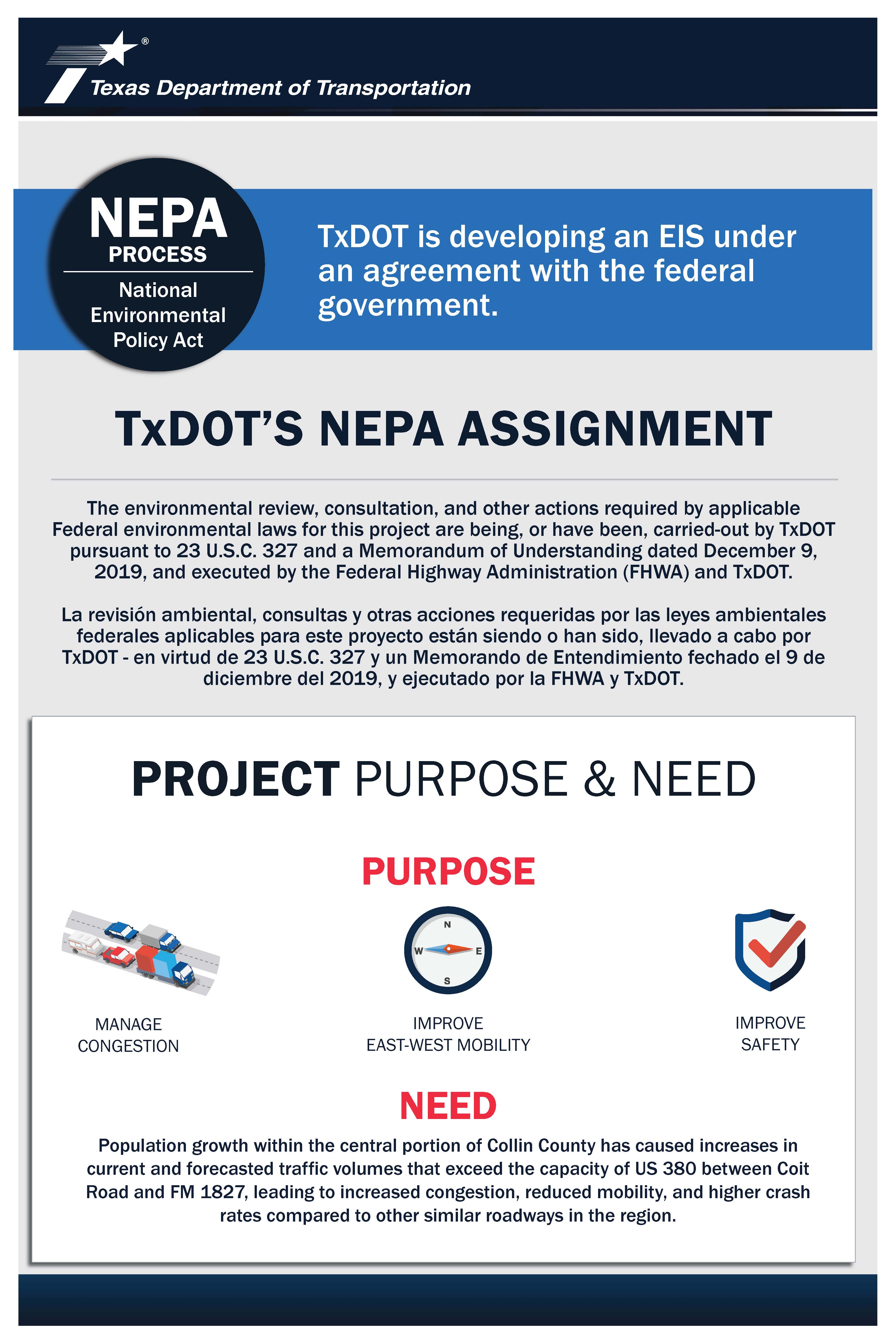
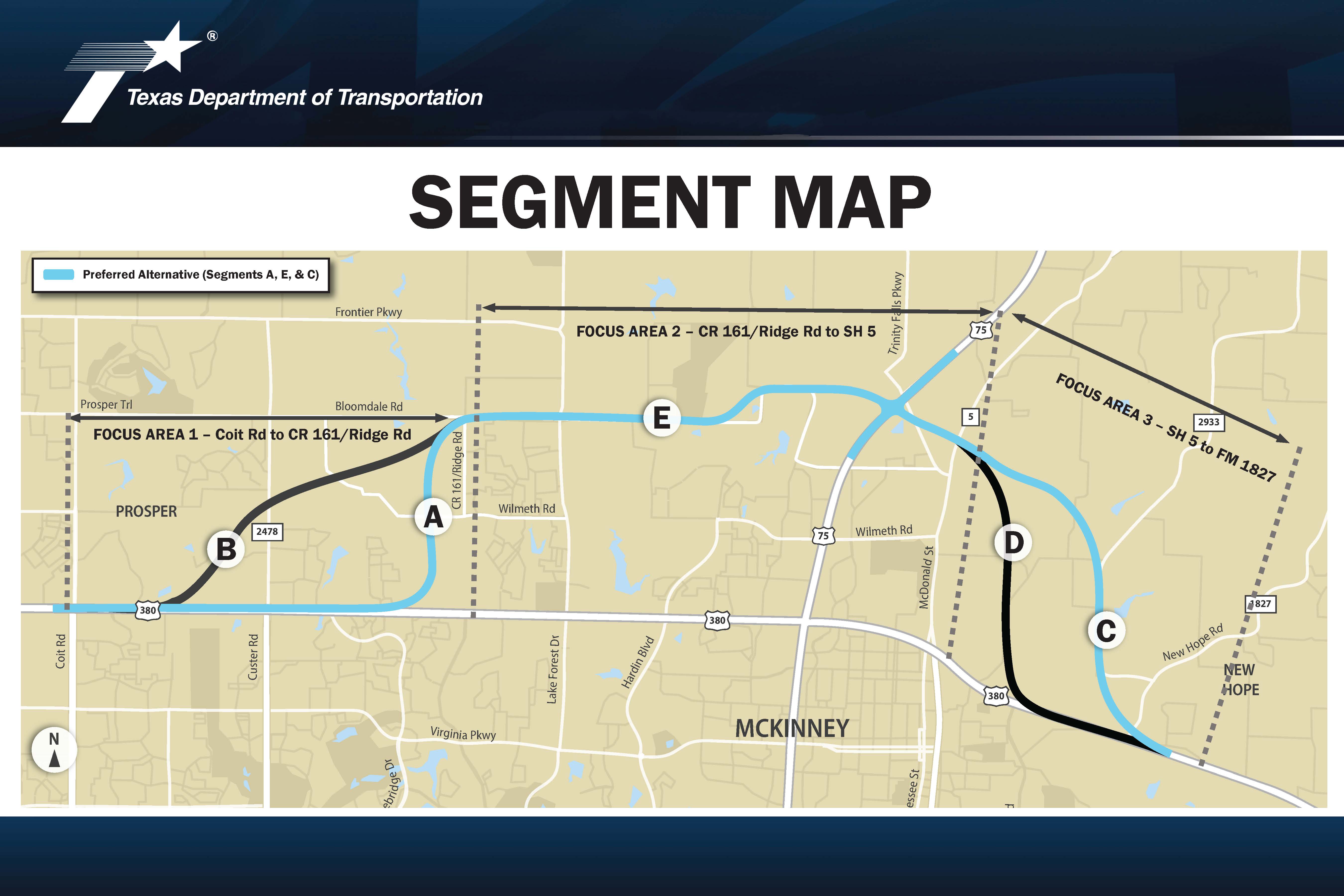
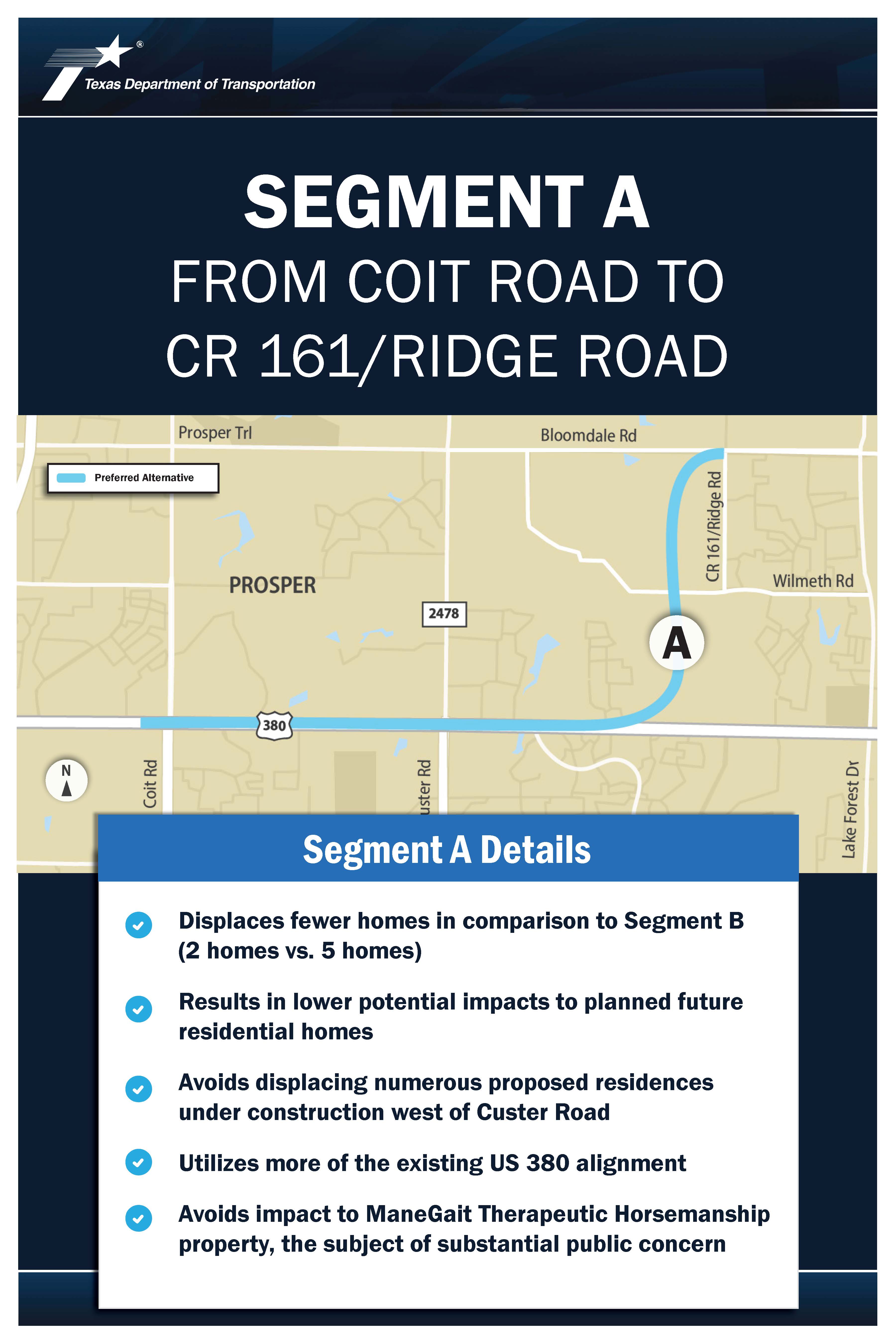
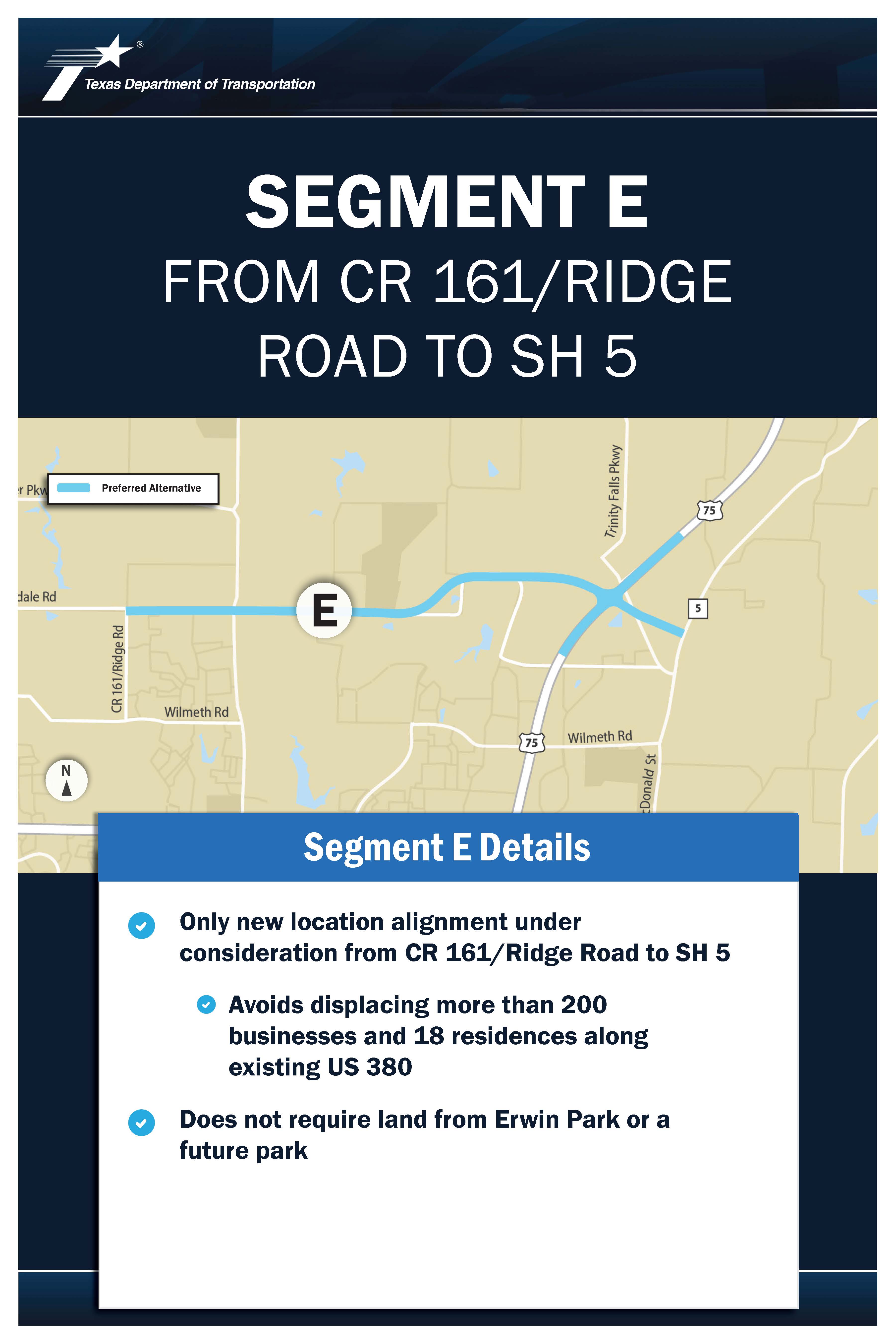
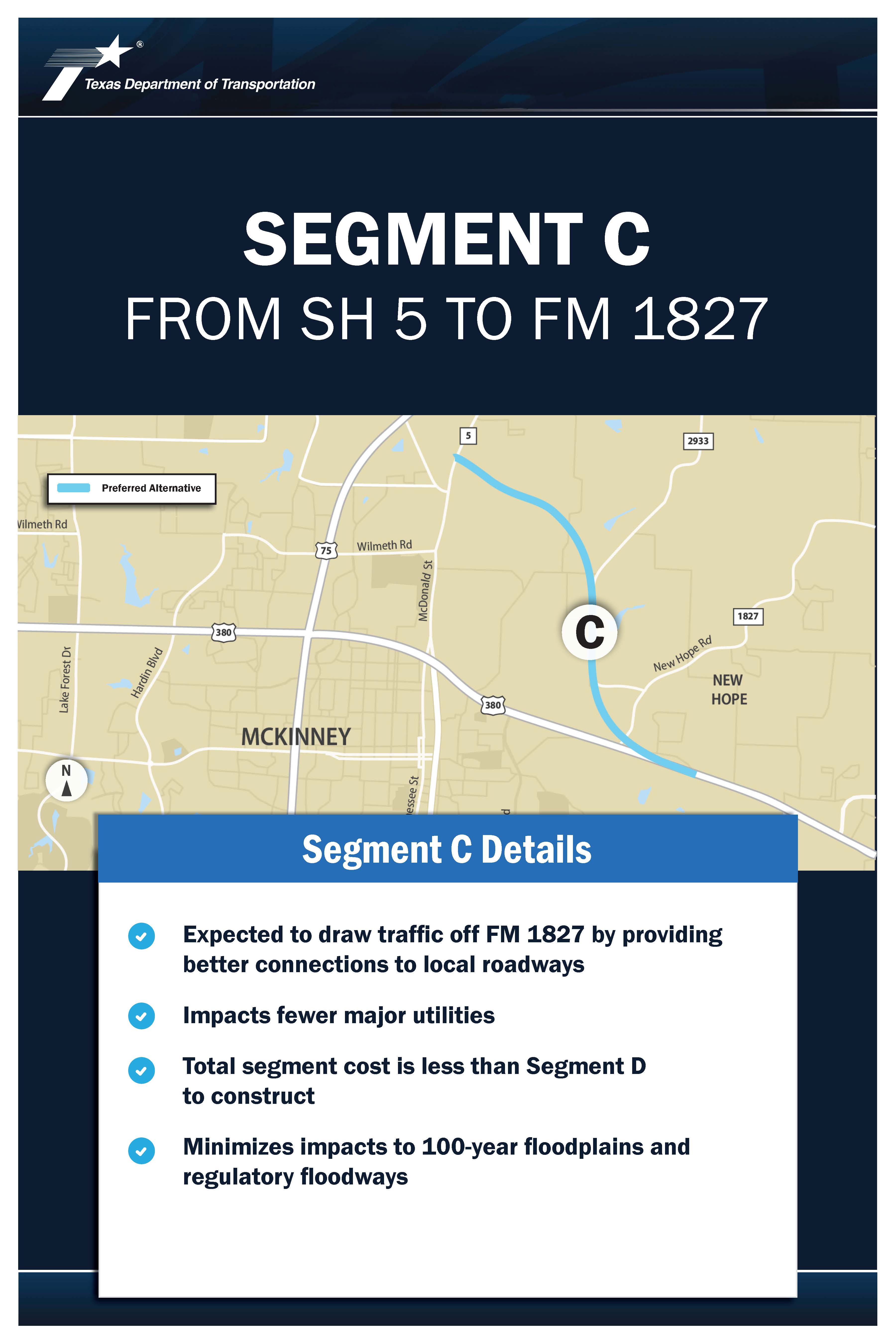
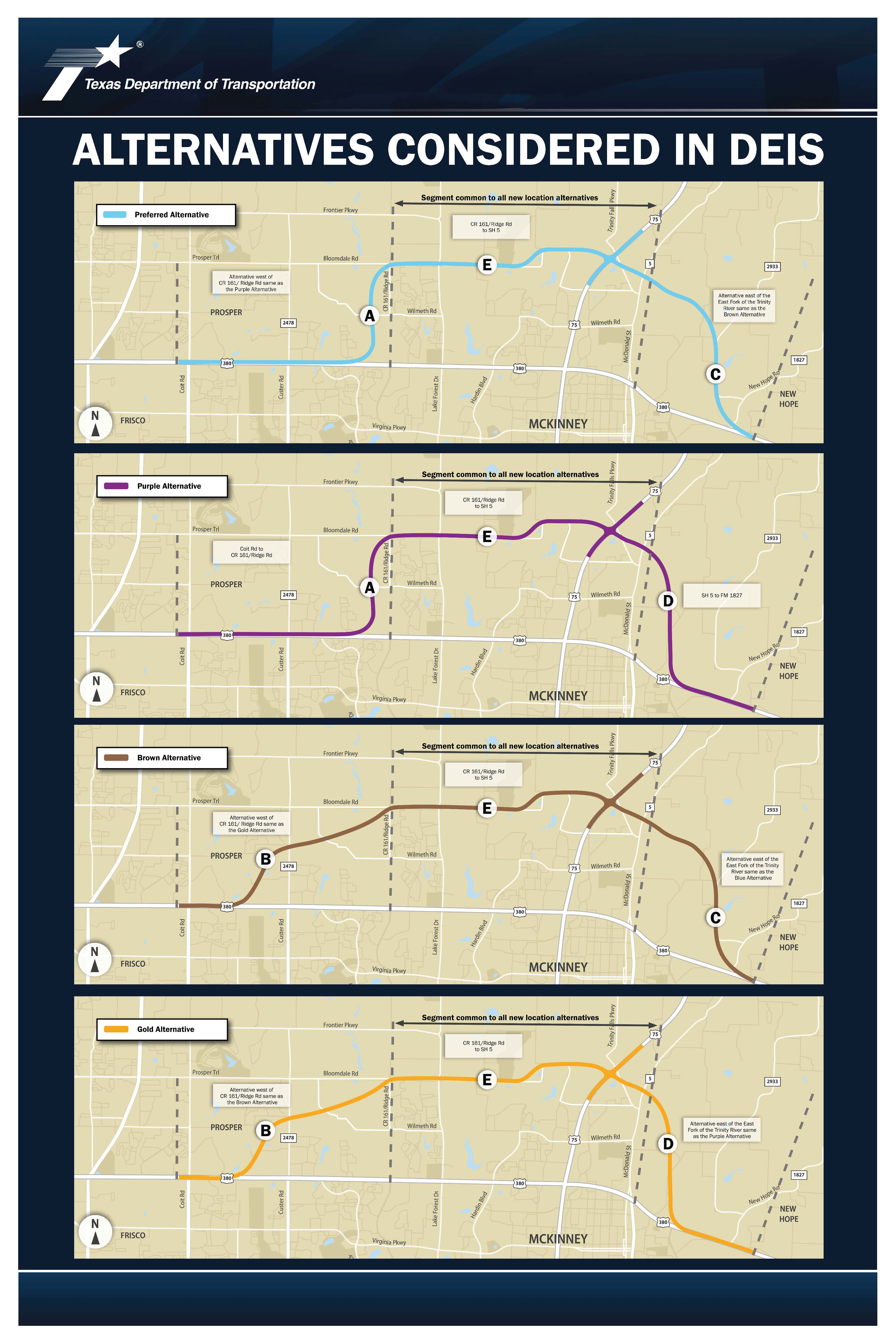
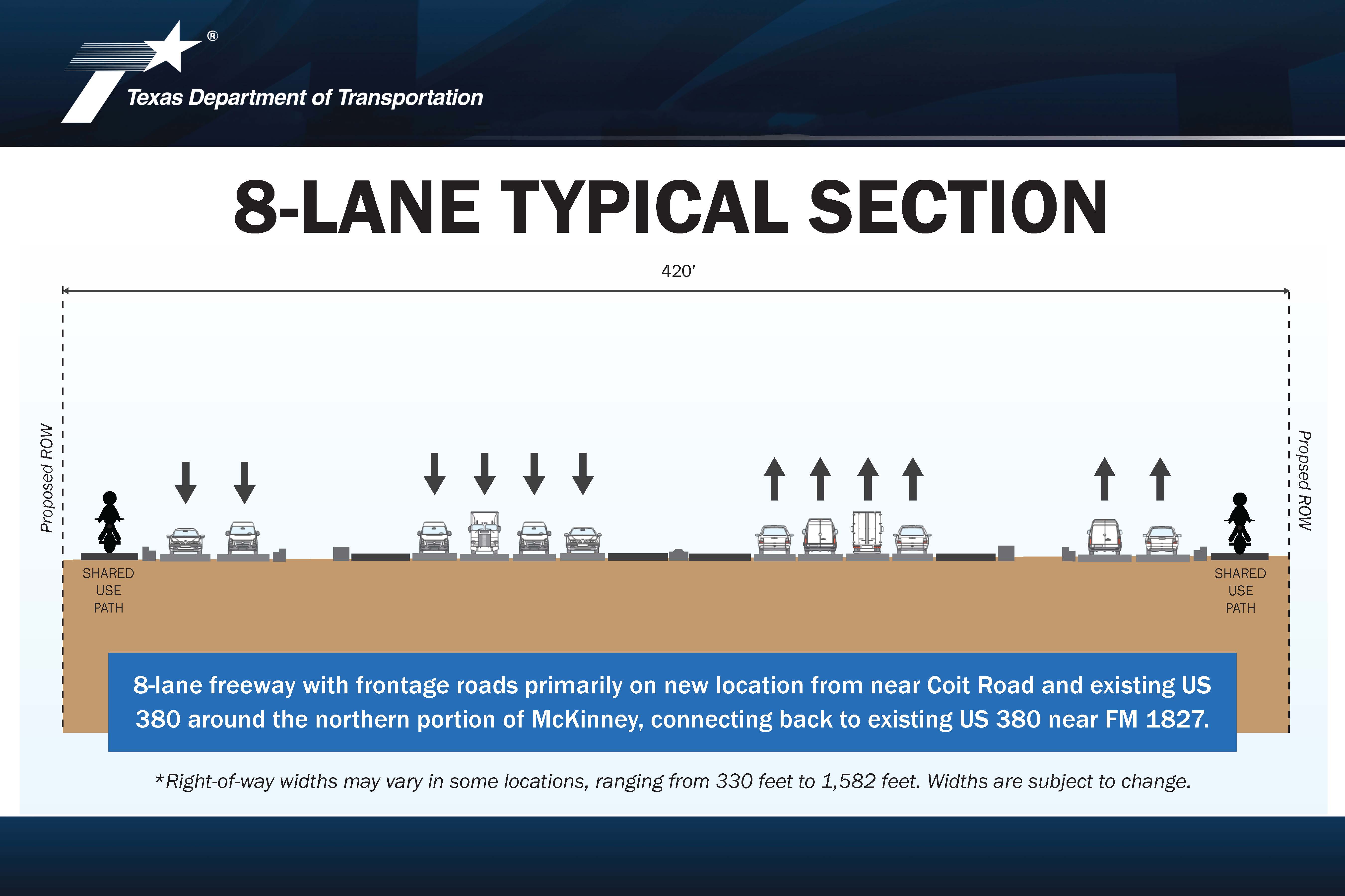
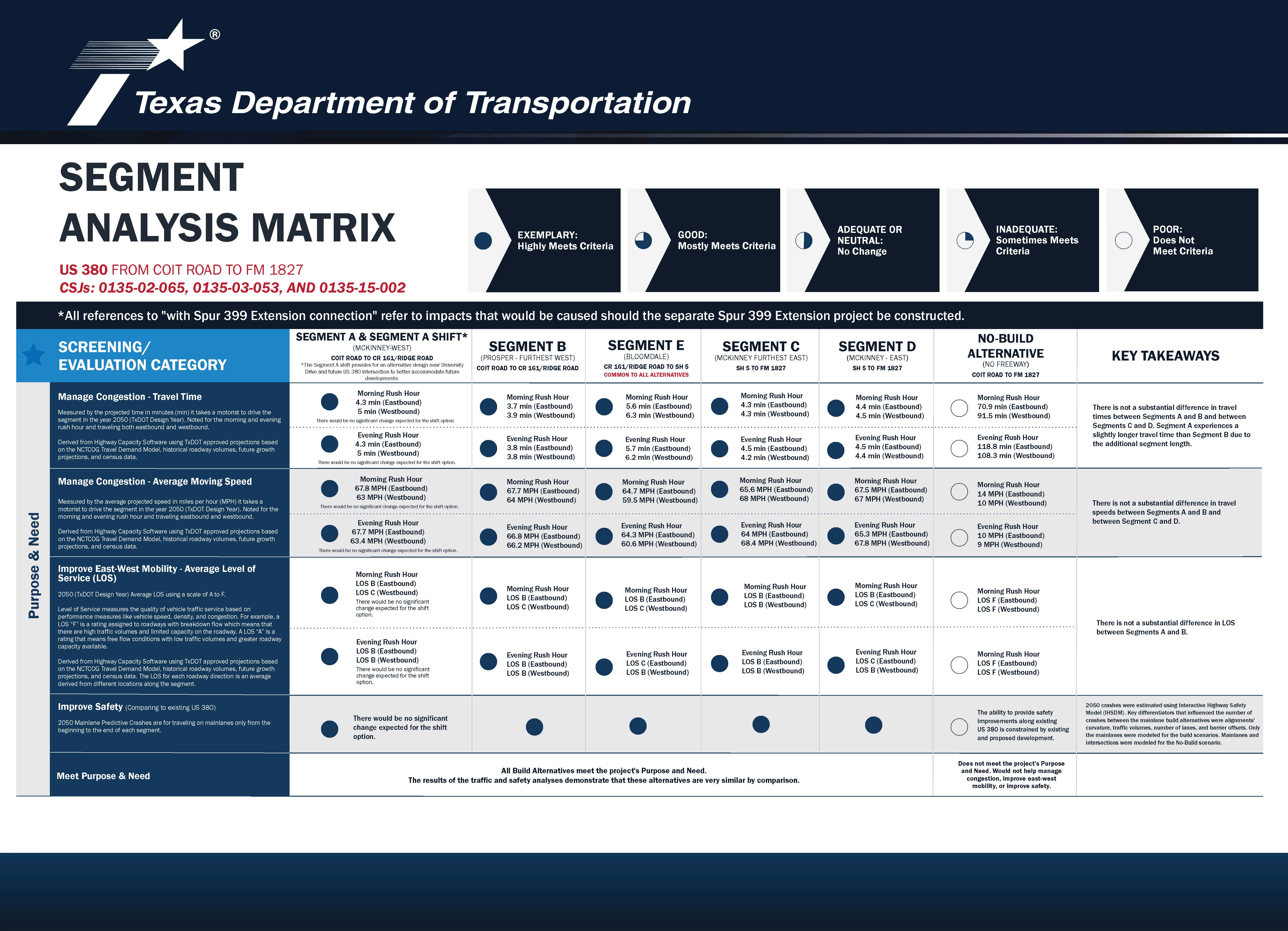
The proposed project would provide a new location, eight-lane, controlled-access freeway with two-lane, one-way frontage roads on each side from Coit Road and existing US 380 to the eastern terminus at existing US 380 and FM 1827 in Collin County. The proposed project passes through the City of McKinney, Town of Prosper, and Collin County and is near the Town of New Hope. As part of the NEPA process, TxDOT evaluated five end-to-end alternatives for this project including the No-Build Alternative and four Build Alternatives comprised of Segments A, B, C, D, and E. After completing a very detailed evaluation, TxDOT selected the Blue Alternative as its Preferred Alternative for the project.
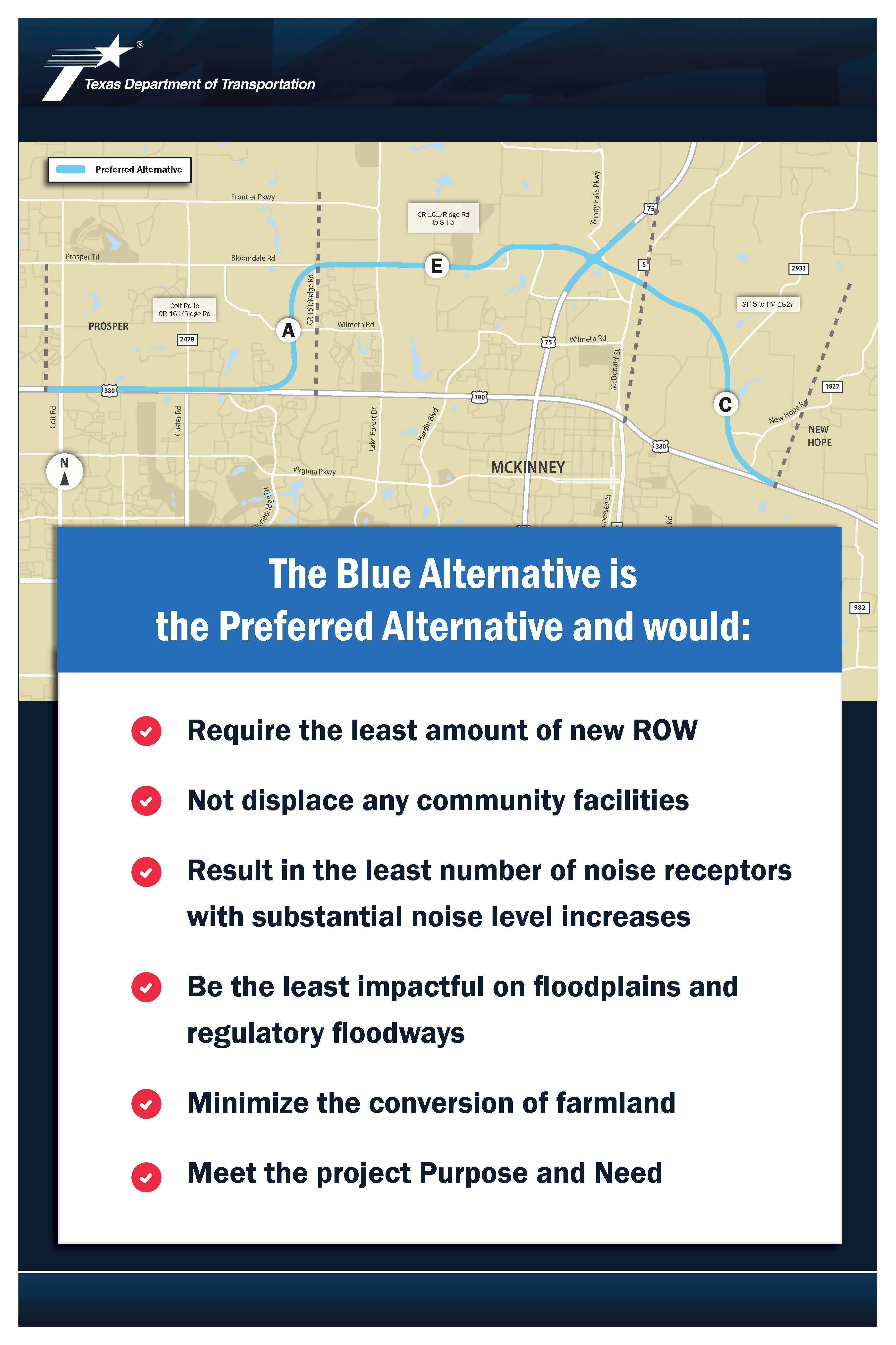
The Blue Alternative supports the project’s purpose and need.
The typical proposed right-of-way would be approximately 420 feet wide, with the minimum and maximum right-of-way width ranging from 330 feet to 1,582 feet, respectively. Depending on the location, the typical freeway section would consist of four 12-foot-wide travel lanes in each direction with two-lane (each 12 feet wide), one- way frontage roads on either side of the mainlanes. Shared-use paths built along the frontage roads would provide bicycle and pedestrian accommodations and support multi-modal access. The total proposed right-of-way acreage is estimated at 662 acres.
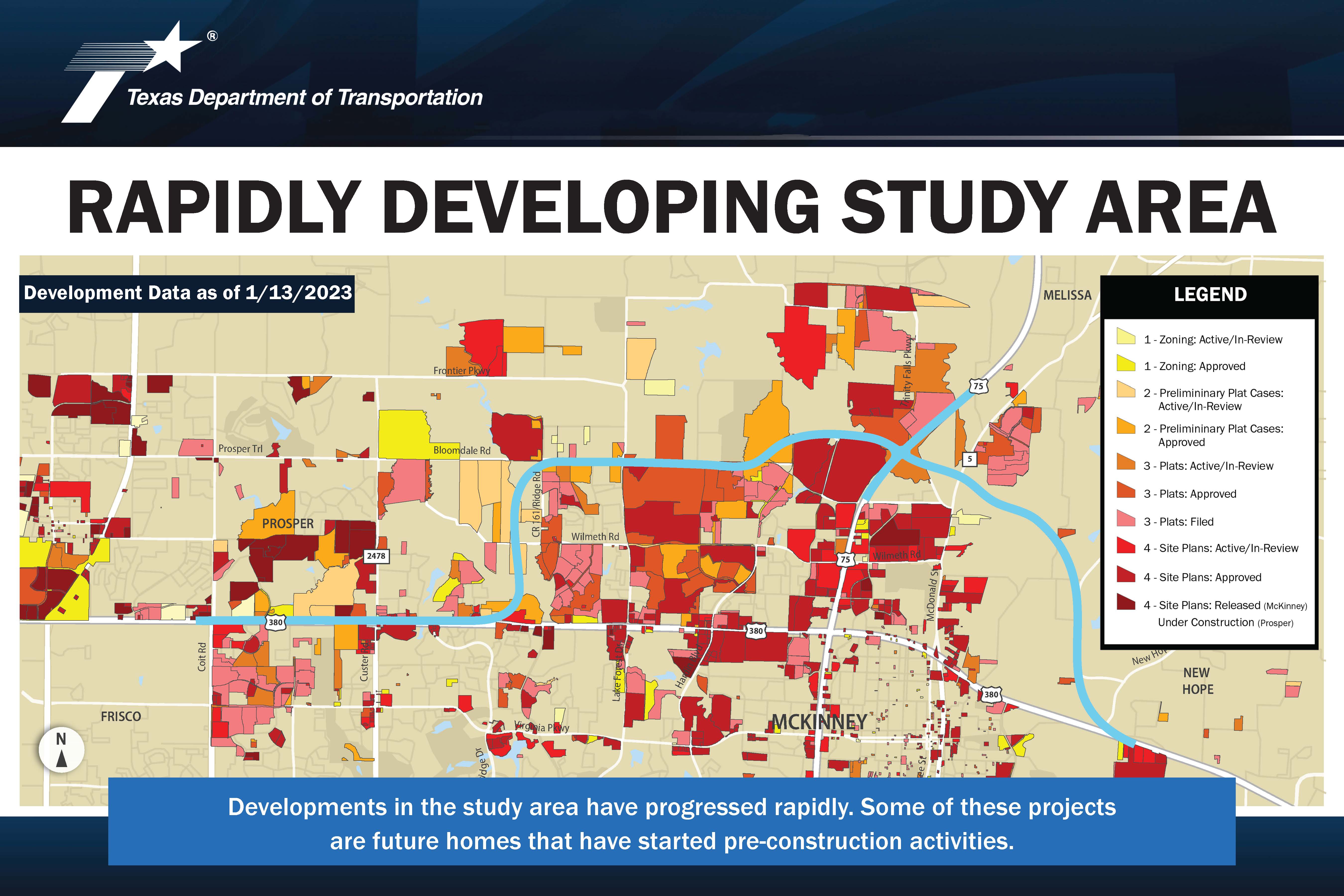
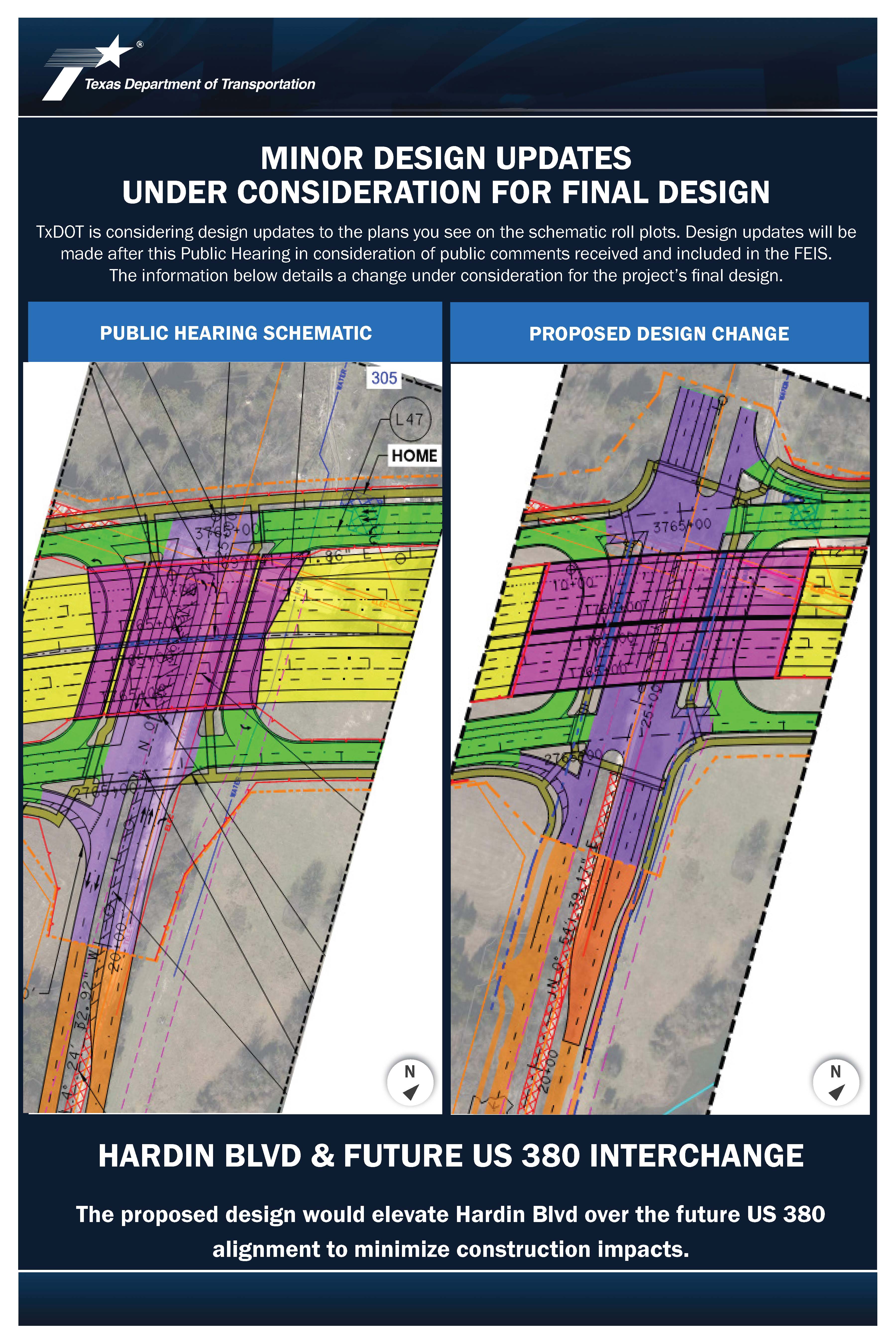
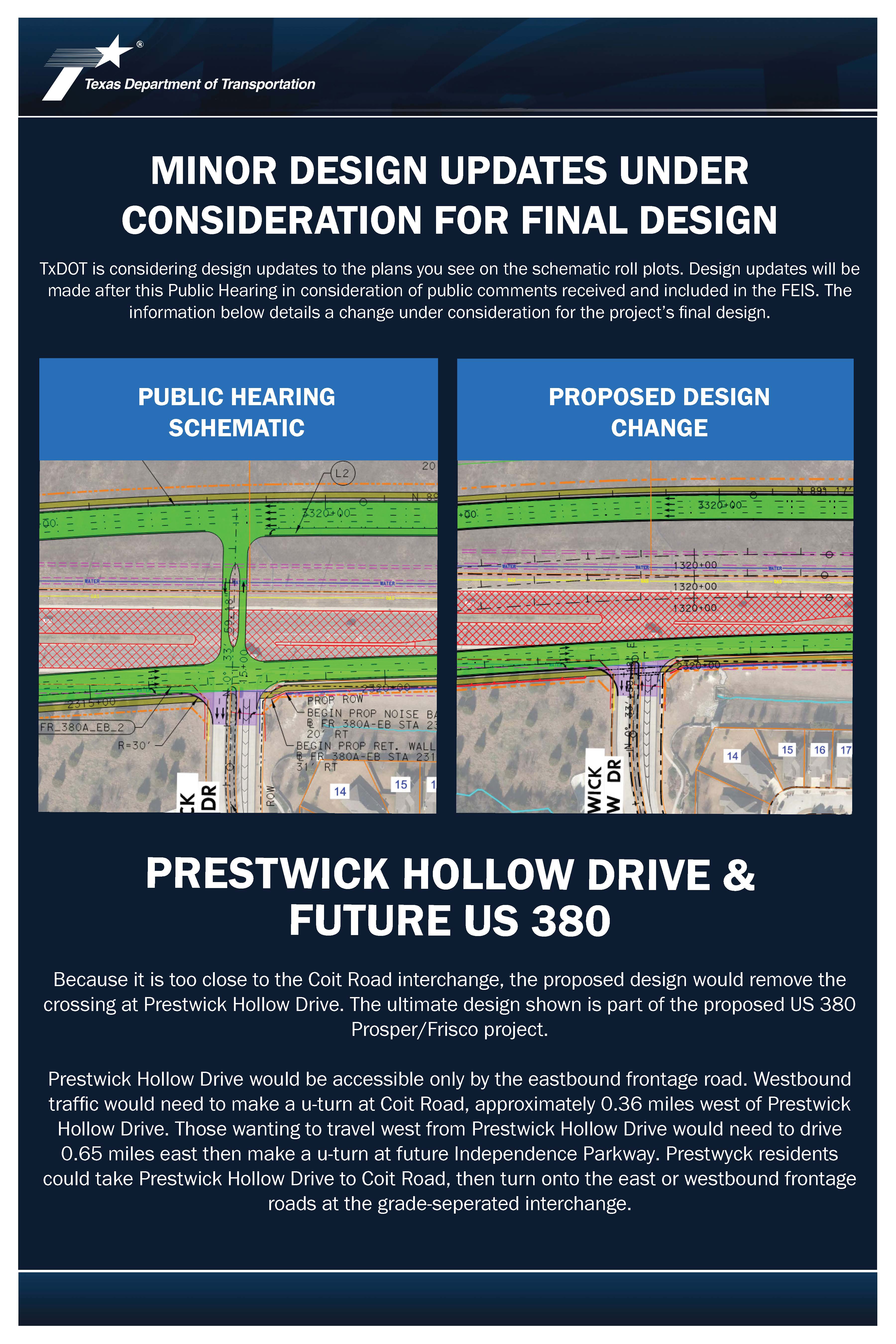
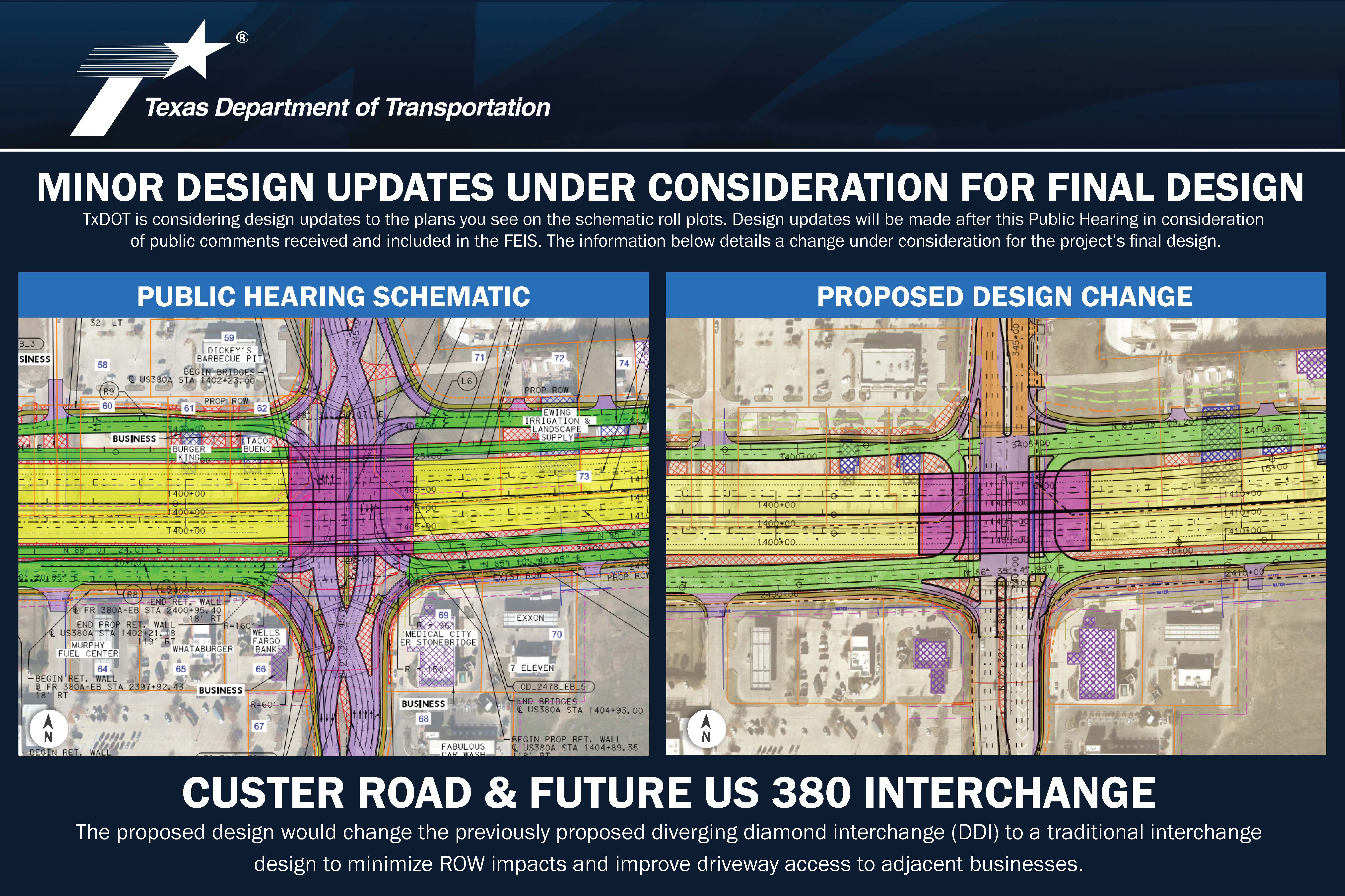
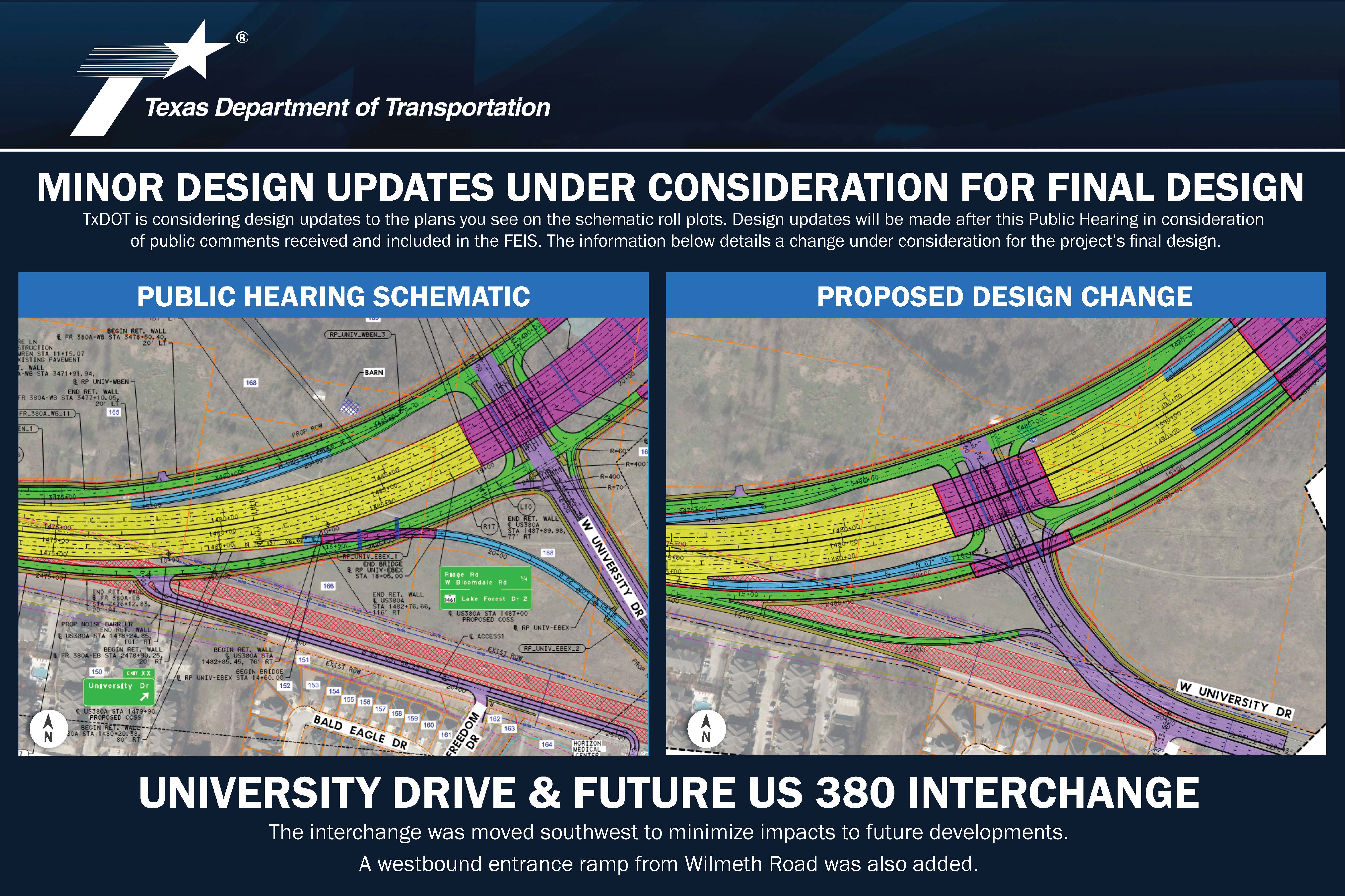
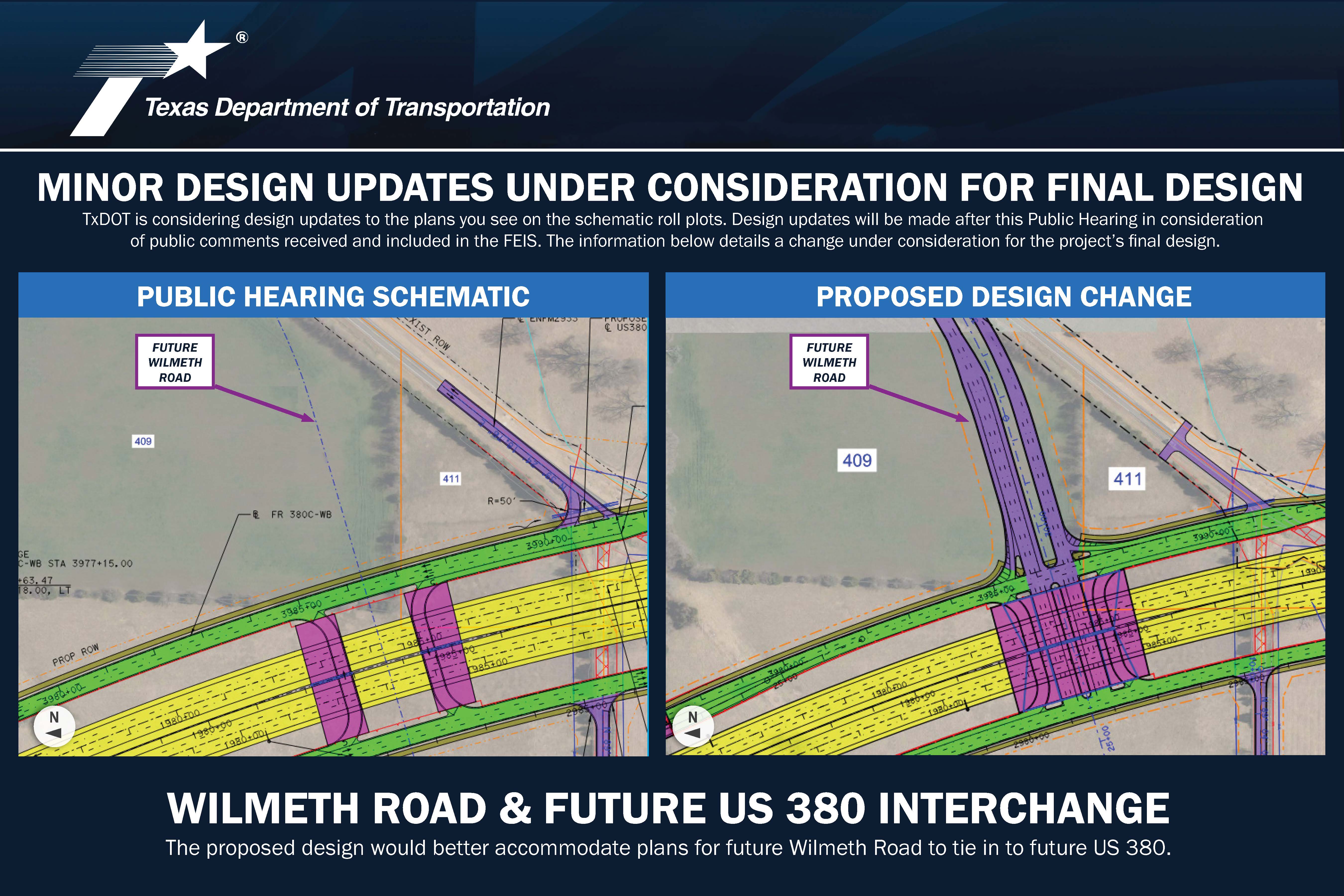
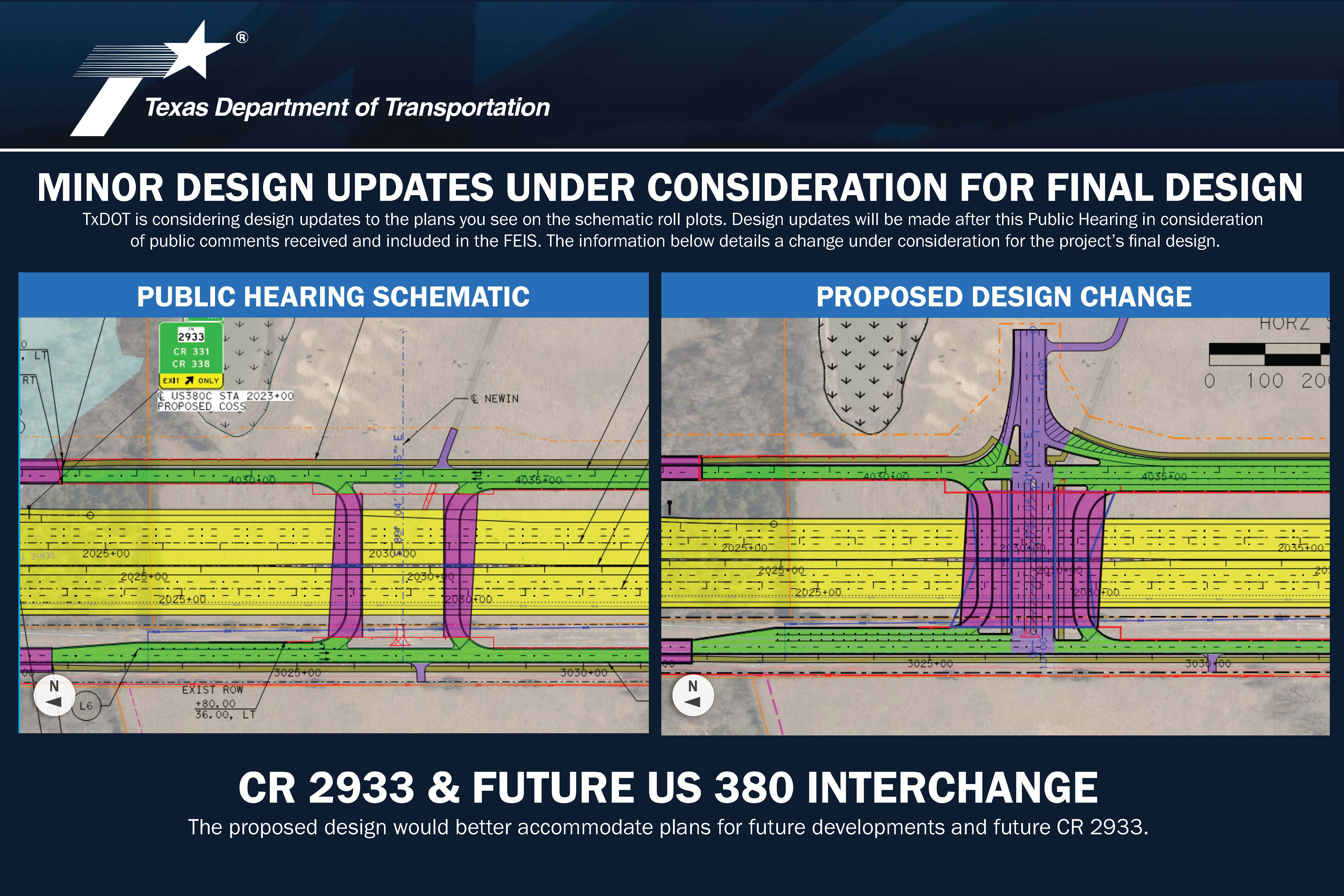
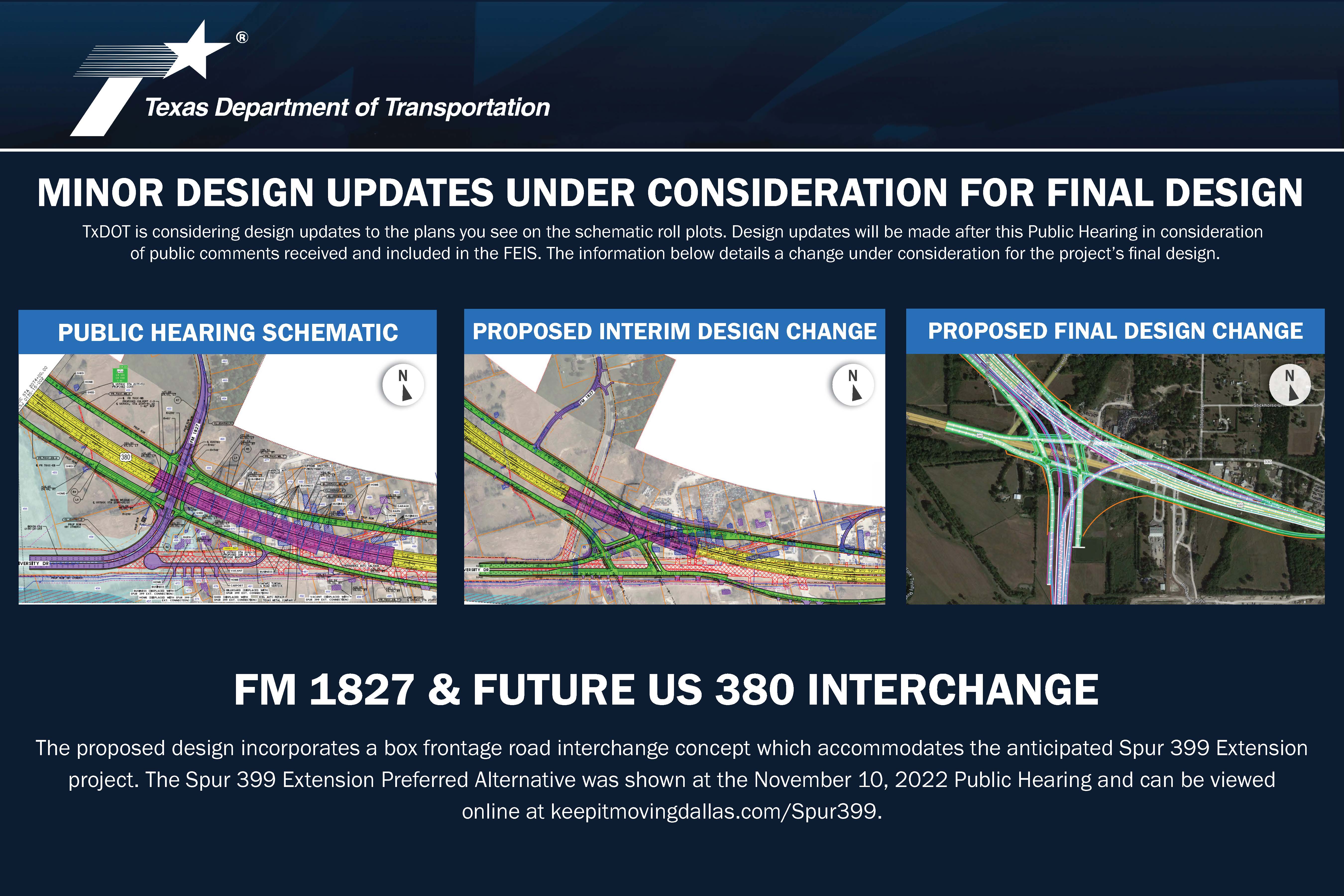
TxDOT continues to develop minor updates to the schematic design. Those updates and why they are being considered are shown on the exhibit boards provided in the Exhibits section below. The schematic design roll plots include insets for each of the considered changes.
PRESENTATION
HELPFUL INFORMATION
Glossary
Schematic Viewing Guide
Frequently Asked Questions
EXHIBITS
You may click on any of the project exhibits below to view them at full size


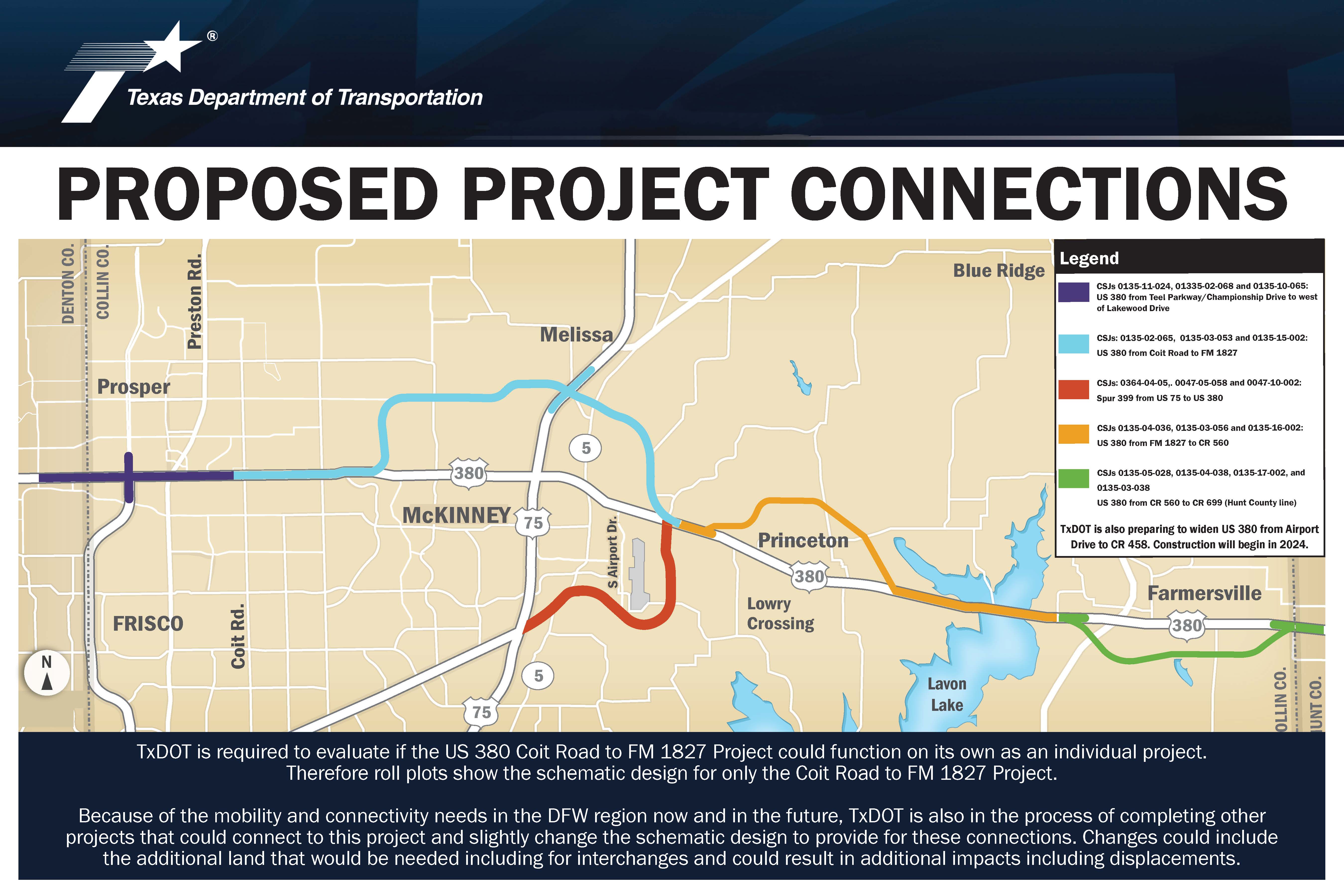
SCHEMATICS
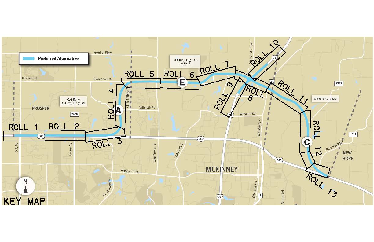
Schematic Plan View Roll 1 – from Coit Road to Lakewood Drive
Schematic Plan View Roll 2 – from Red Bud Drive to N Custer Road
Schematic Plan View Roll 3 – from Stonebridge Drive to W University Drive
Schematic Plan View Roll 4 – from W University Drive to Lake Forest Drive
Schematic Plan View Roll 5 – from CR 161 to Lake Forest Drive
Schematic Plan View Roll 6 – CR 164
Schematic Plan View Roll 7 – from Limousine Pkwy to Community Ave
Schematic Plan View Roll 8 – from Community Ave to SH 5
Schematic Plan View Roll 9 – from Justice Street to Laud Howell Pkwy
Schematic Plan View Roll 10 – from Laud Howell Pkwy to Bucees Blvd
Schematic Plan View Roll 11 – from SH 5 to CR 338
Schematic Plan View Roll 12 – from CR 338 to CR 332
Schematic Plan View Roll 13 – from FM 1933 to CR 330
INTERACTIVE MAP
https://experience.arcgis.com/experience/c5e891374ca34985aa3a2aa3fdb6b455/
FLYTHROUGH VIDEO
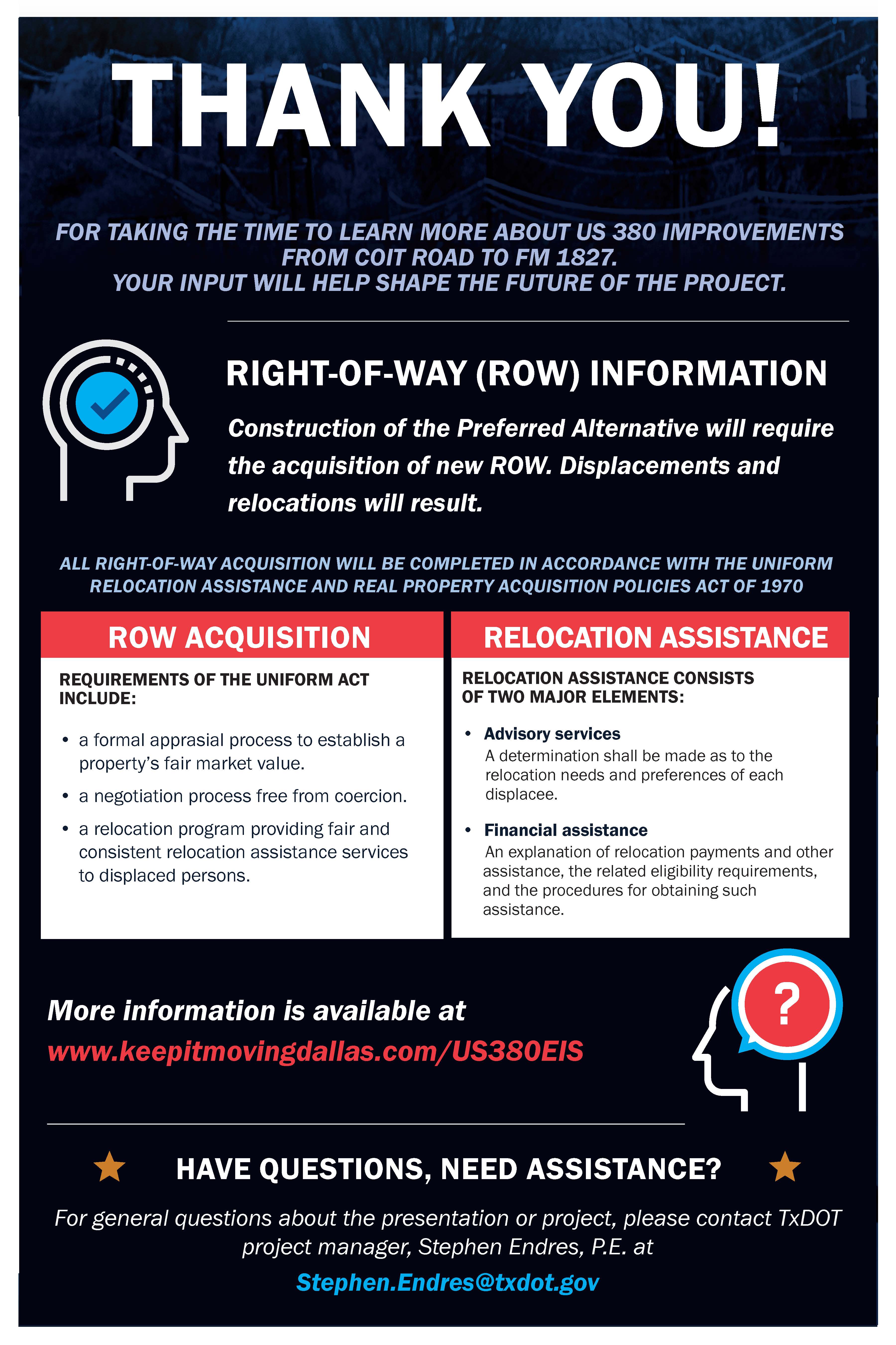
RIGHT OF WAY (ROW) INFORMATION
The total proposed ROW acreage is estimated at 662 acres. Information about the process for state purchase of ROW and relocation assistance may be found in the following pamphlets:
Relocation Assistance: English
Relocation Assistance: Spanish
State Purchase of ROW: English
State Purchase of ROW: Spanish
HOW TO PROVIDE COMMENTS
The deadline for providing comments is March 21, 2023.

To leave a verbal comment call (833) 933-0443
If you prefer to print a comment form, you can do so using the following links:
QUESTIONS?
Contact the TxDOT project manager Stephen Endres, P.E. to ask questions about the project at Stephen.Endres@txdot.gov or (214) 320-4469.